Author: leftenright
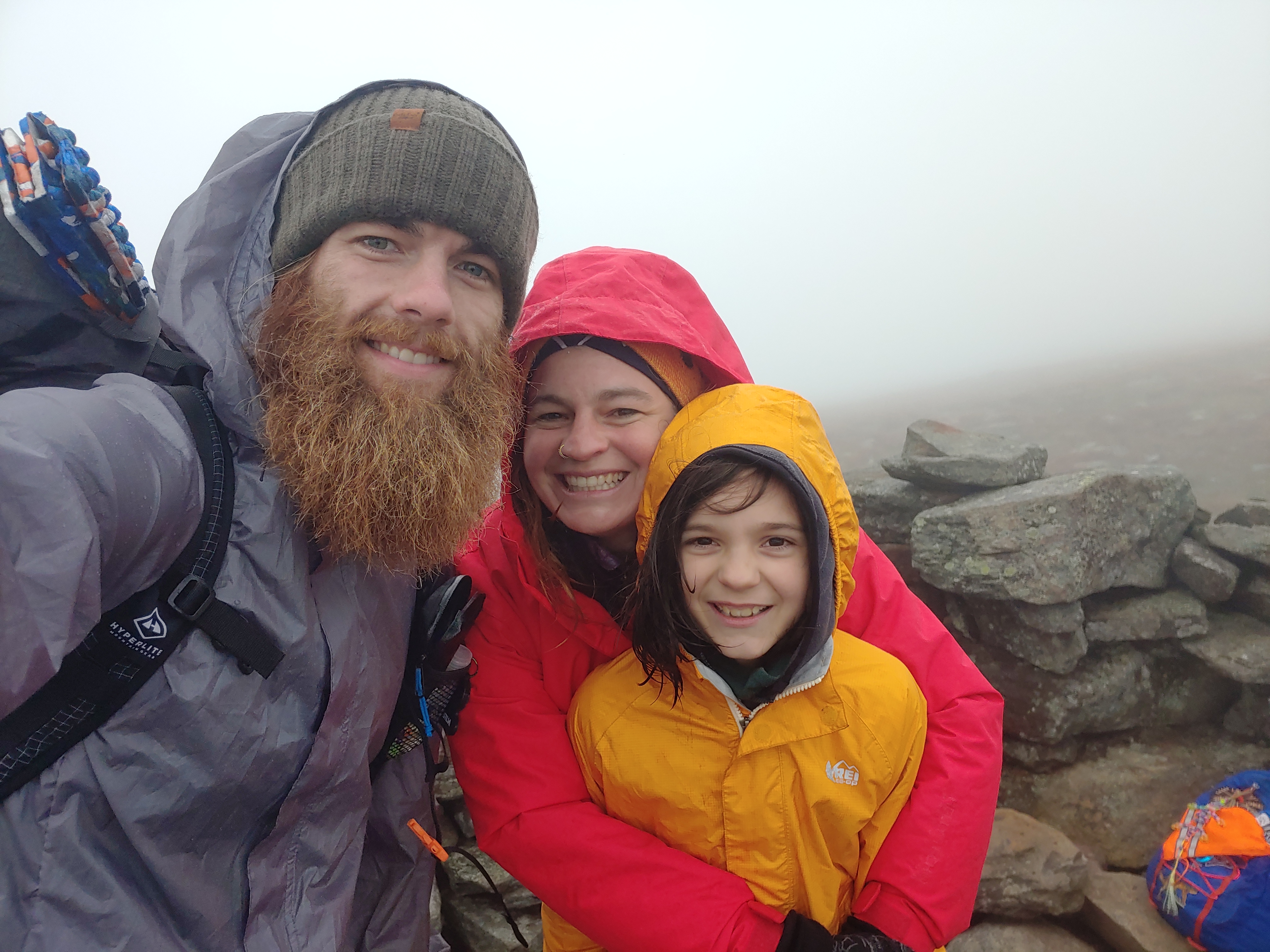
Colorado Trail: Day 1-3

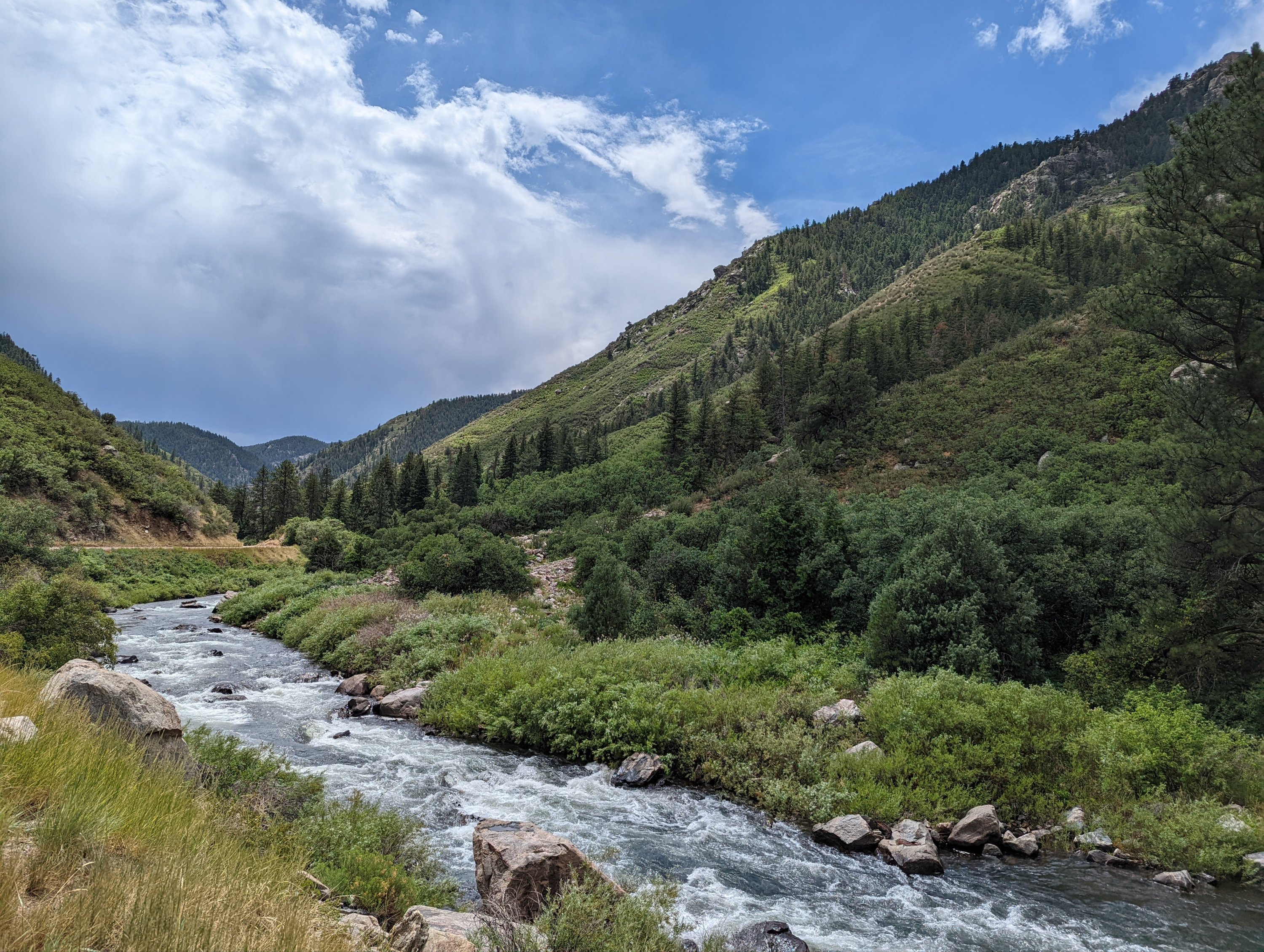
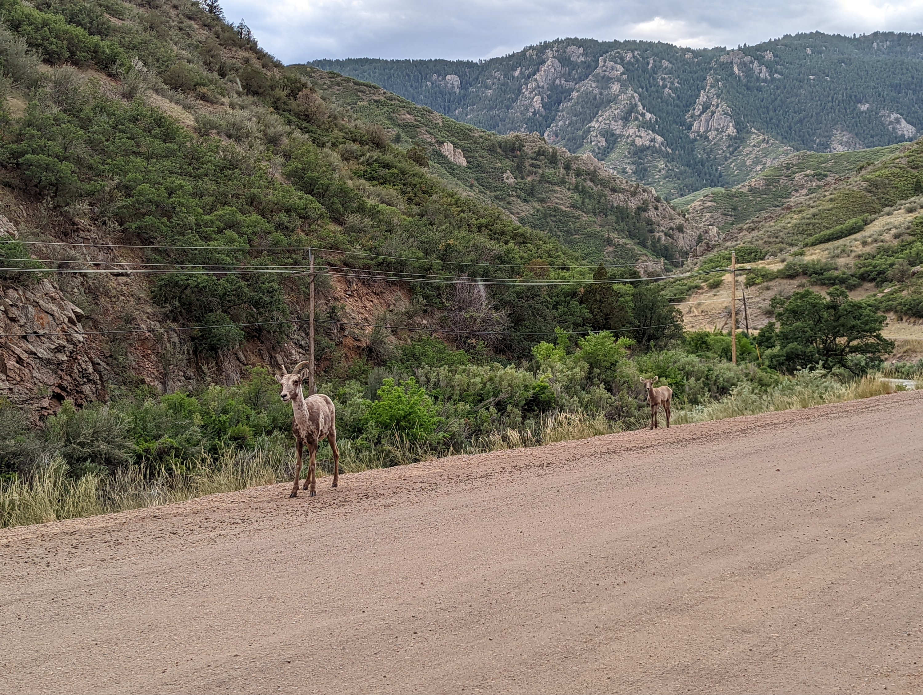
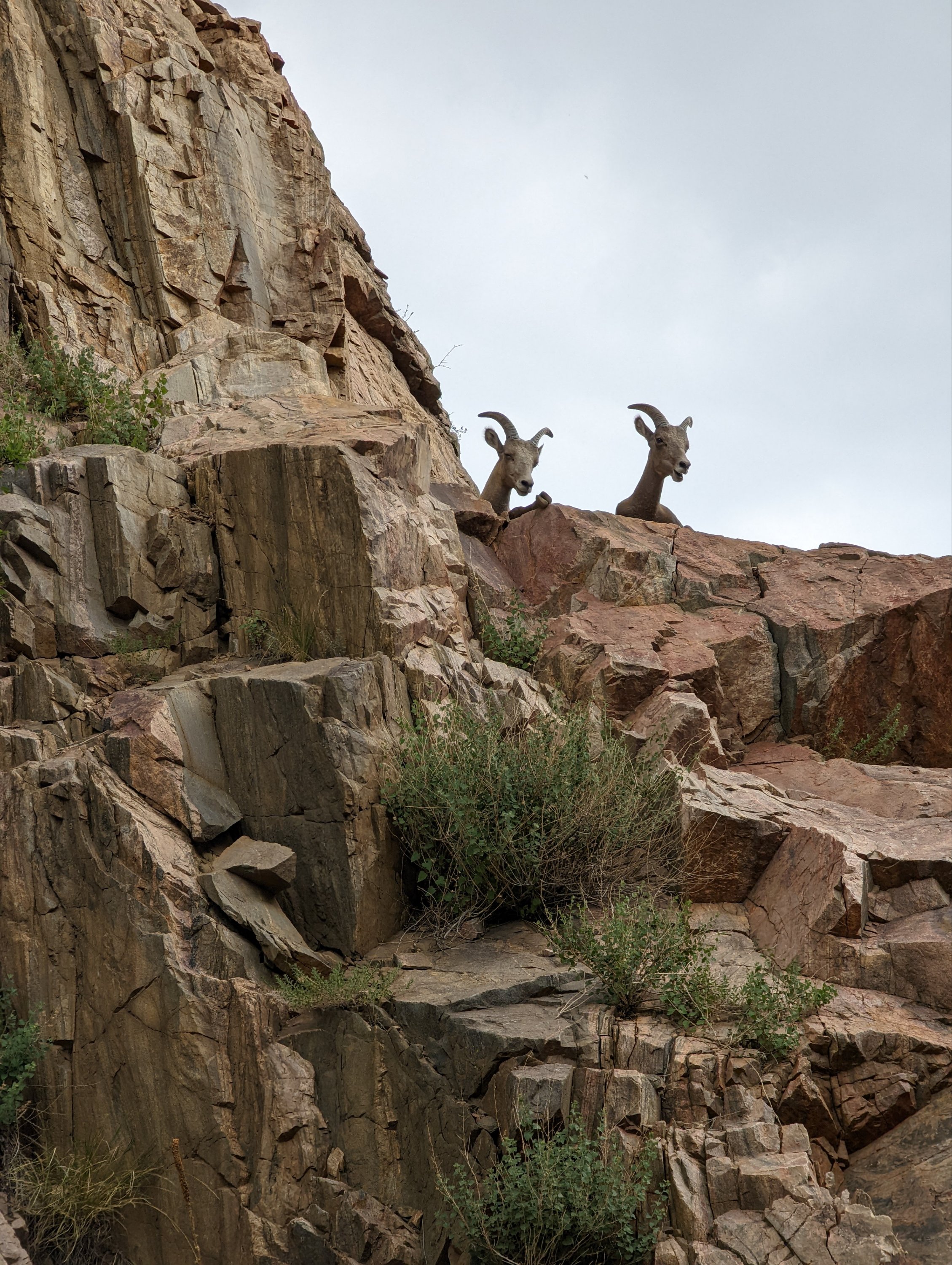
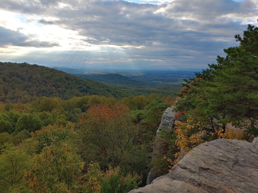
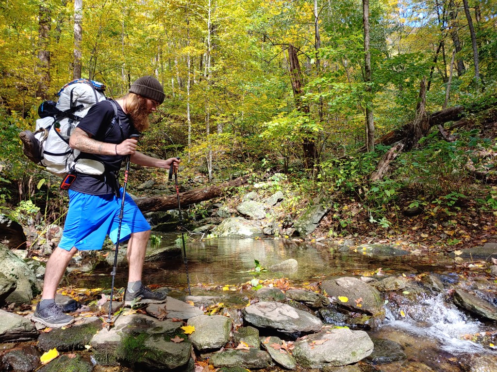
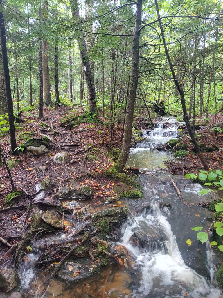
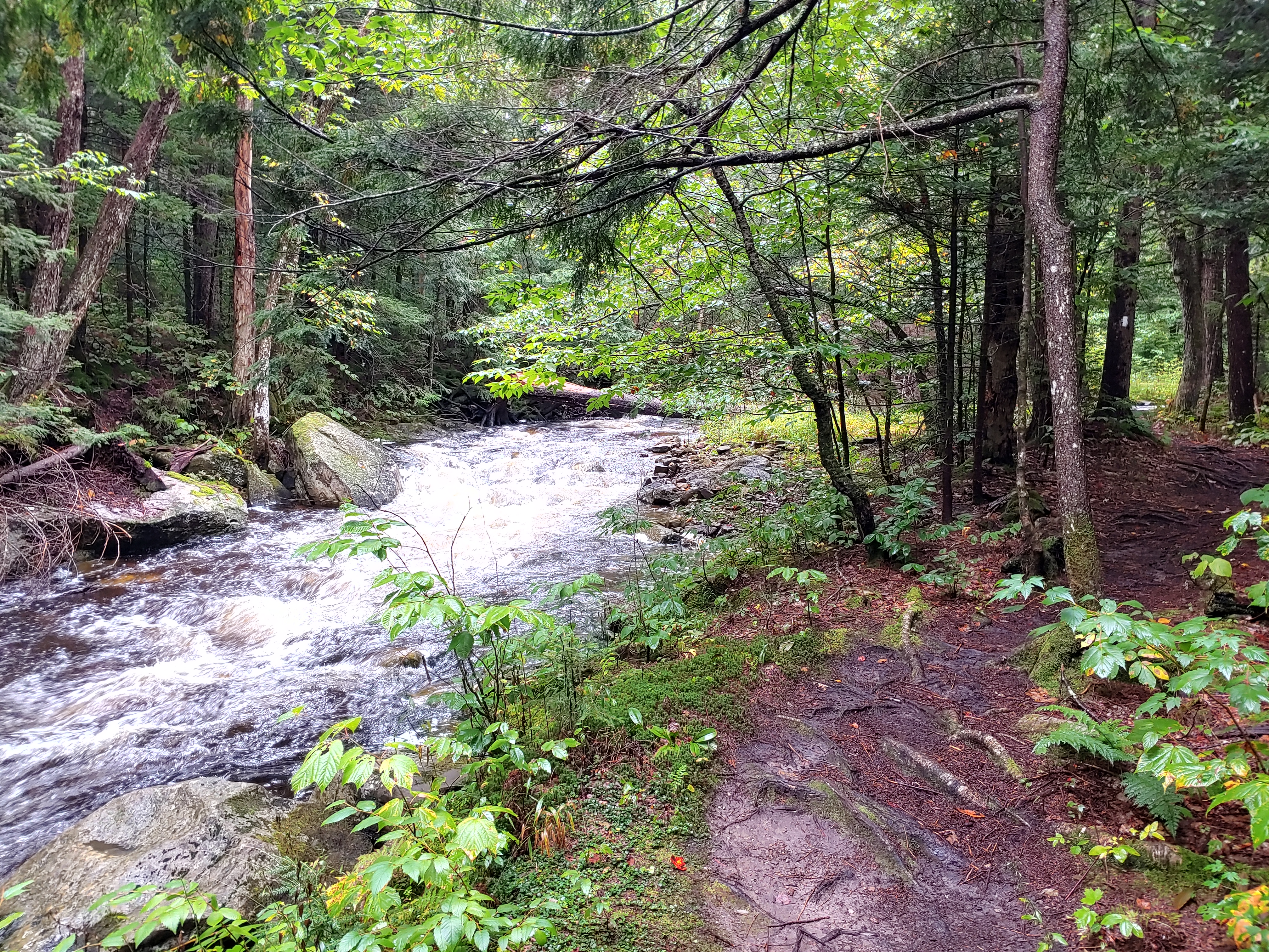
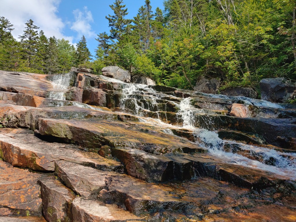
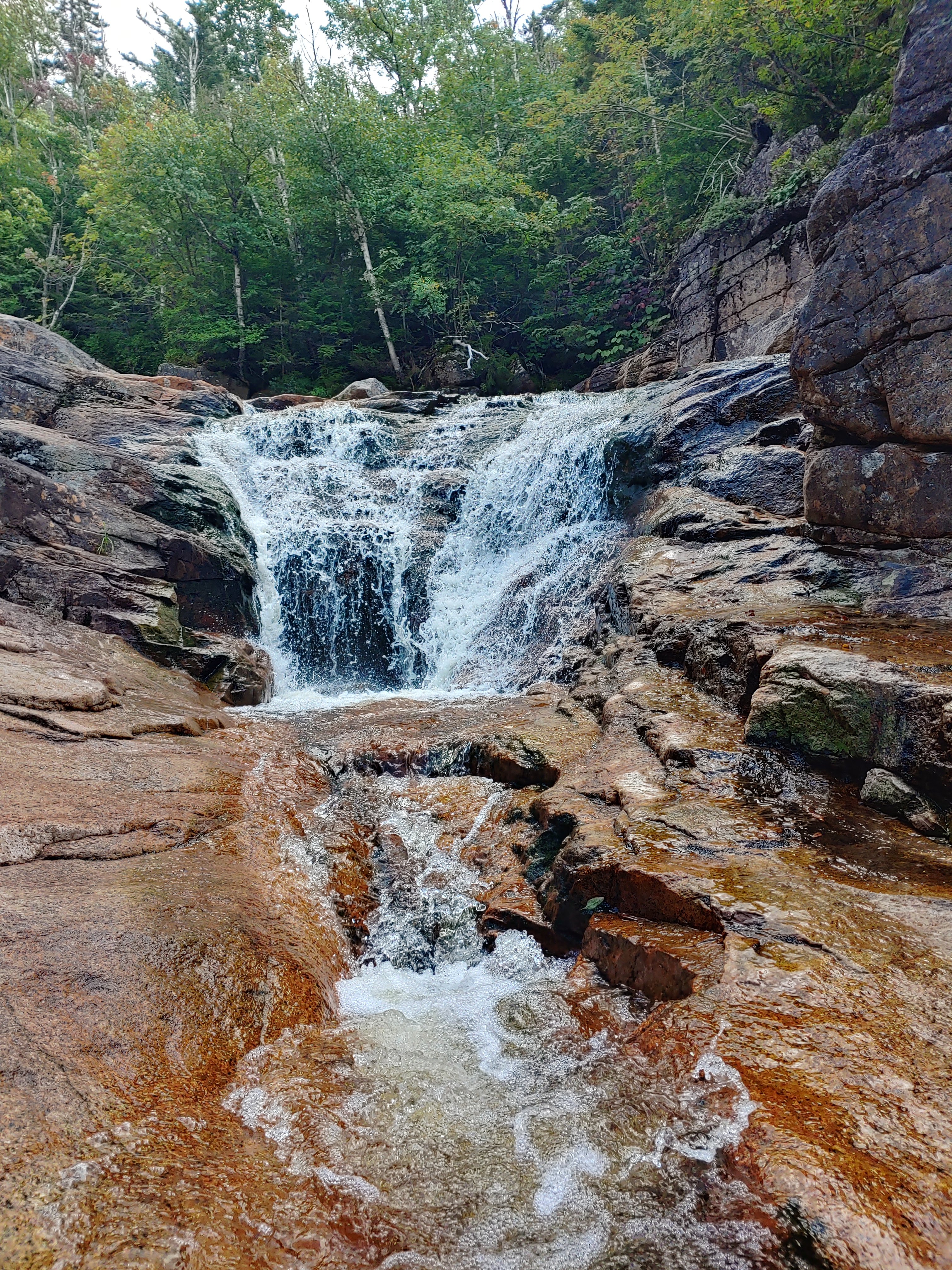
In 90° weather, I hit the trail with ambitions high and a smile shining bright as the sun. The walk through Waterton Canyon was pretty smooth and steady which made all the dramatic views so much easier to take in. I even spotted some of the notorious bighorn sheep which was quite a sight to see.
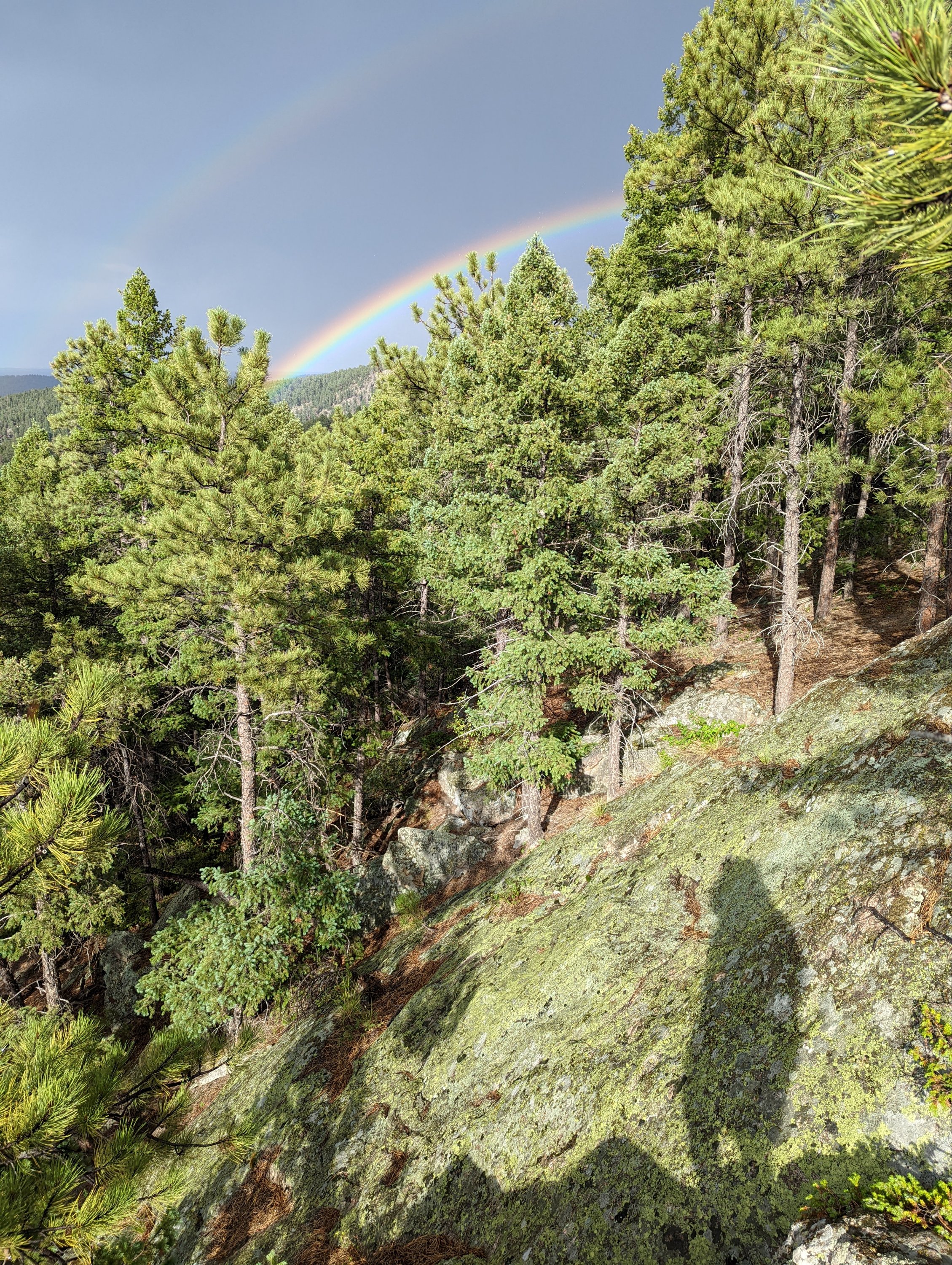
Stopping on a rocky outcrop to camp for the night, a brief storm rolled through and left behind a glorious double rainbow.


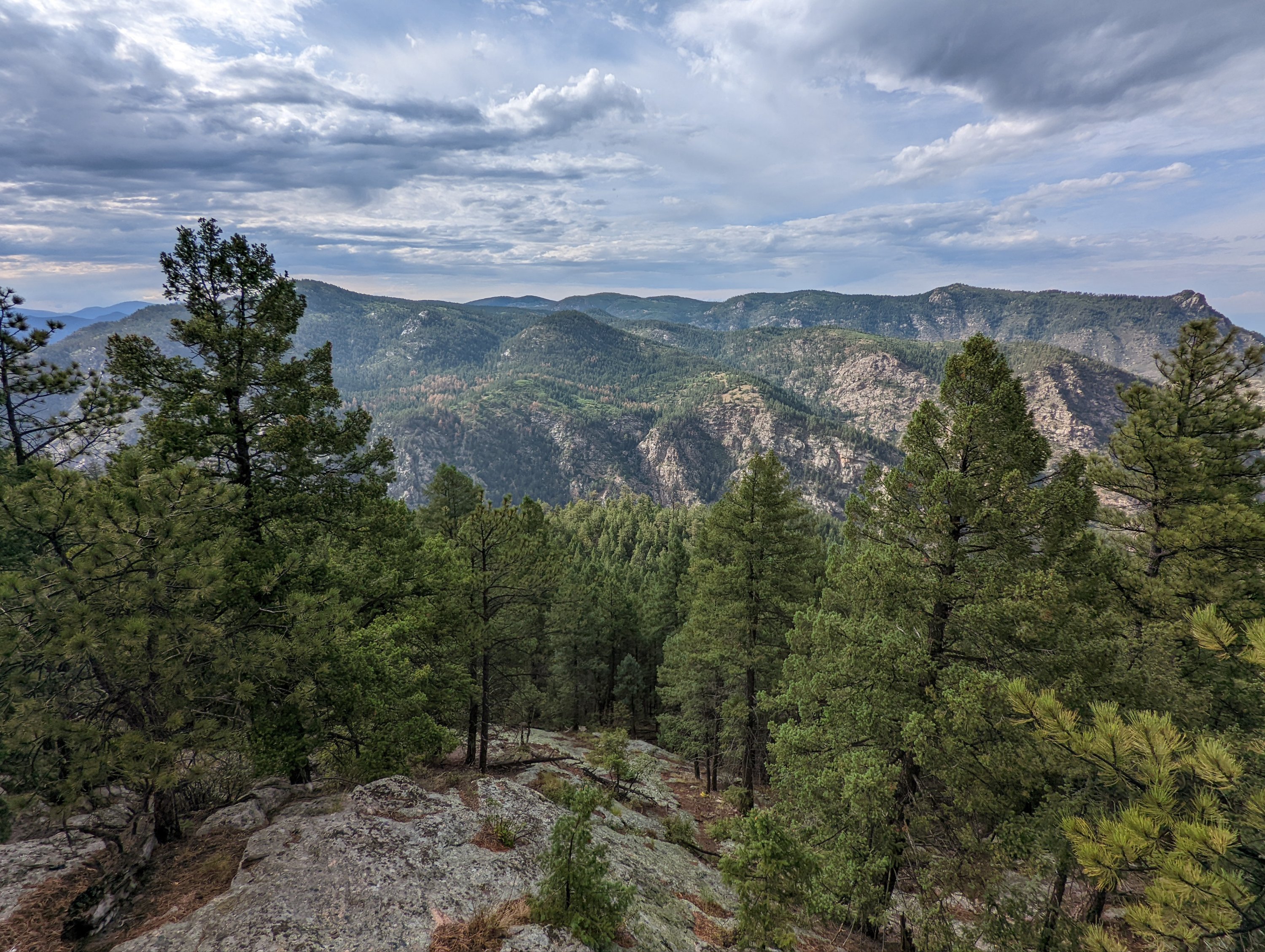
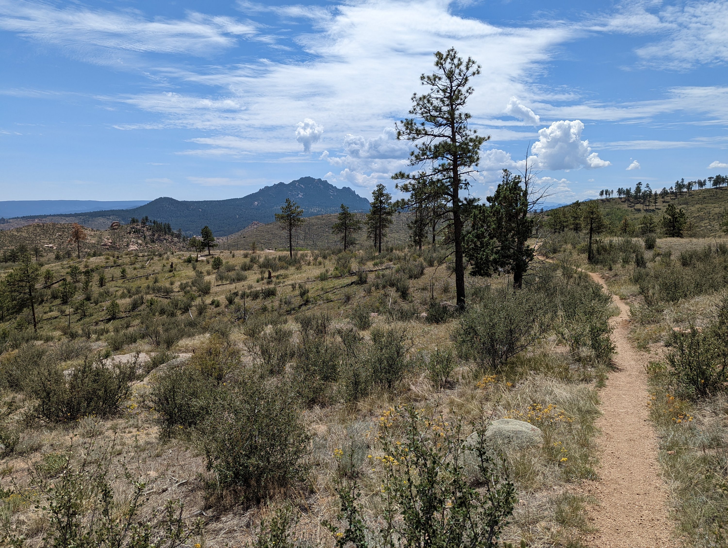
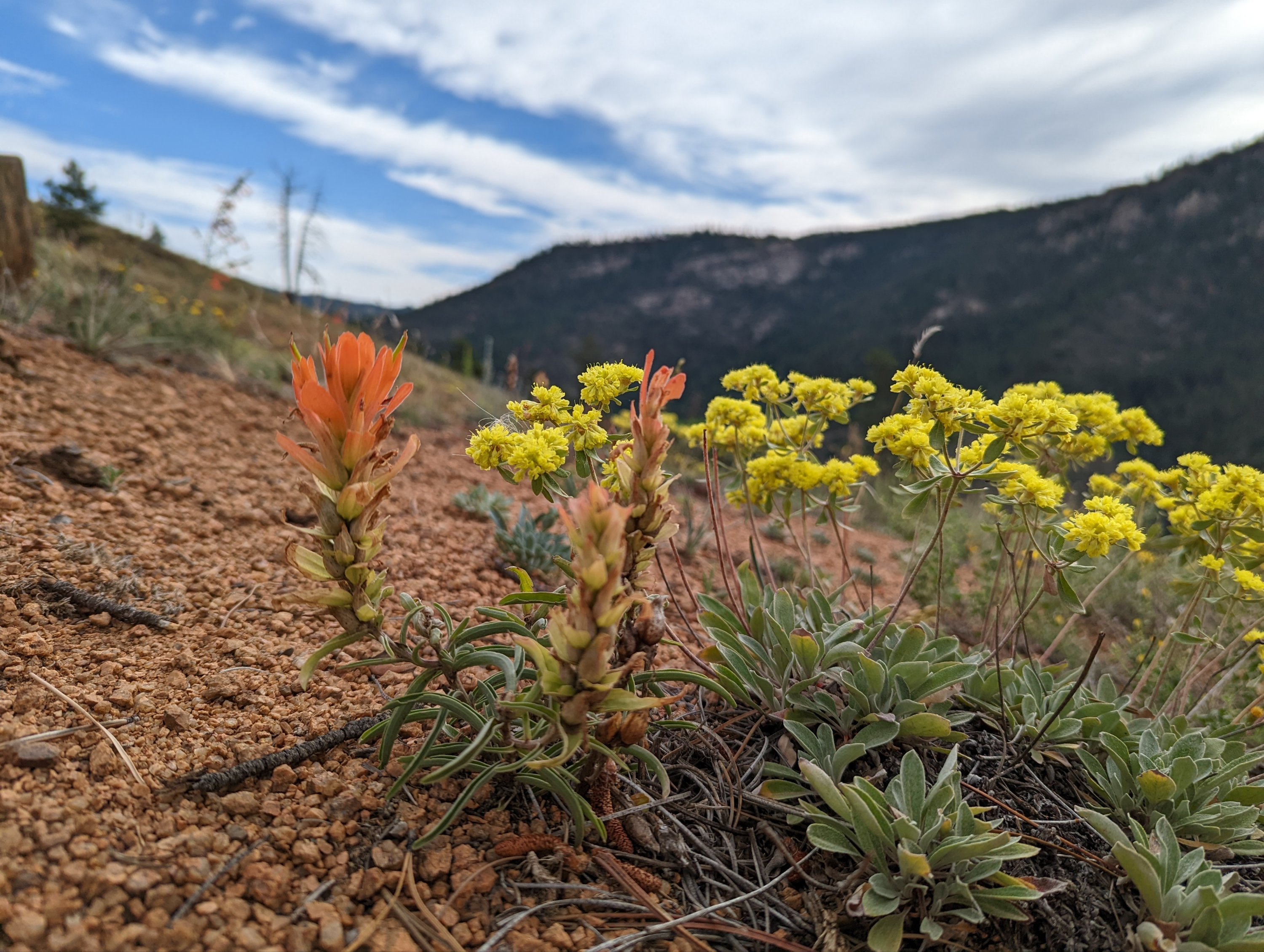
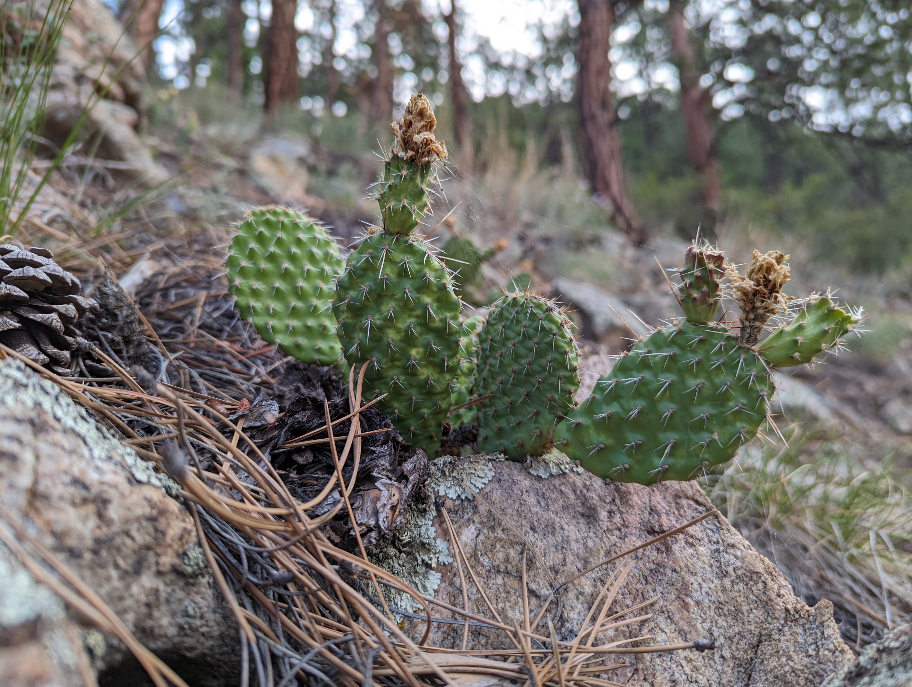
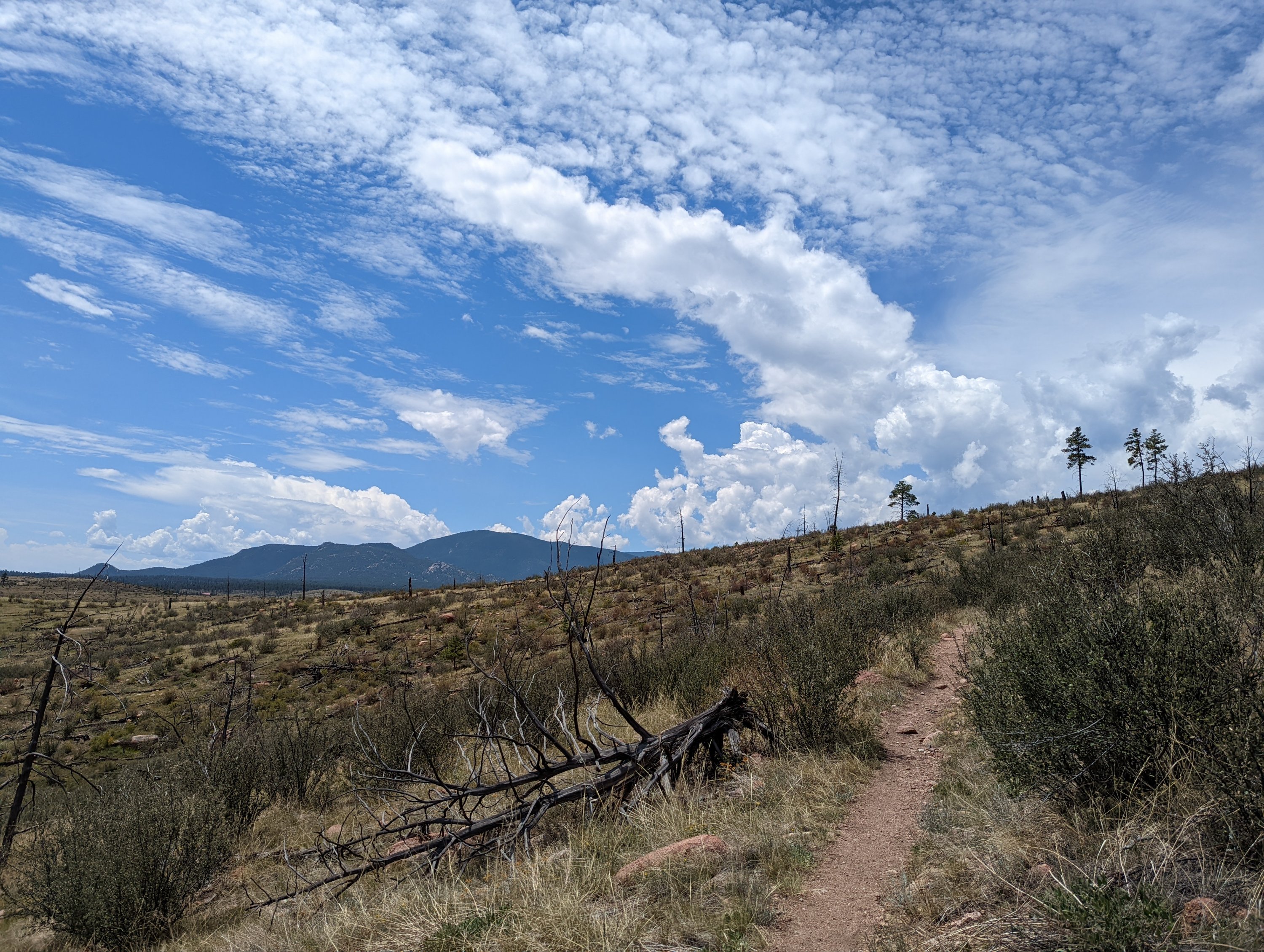
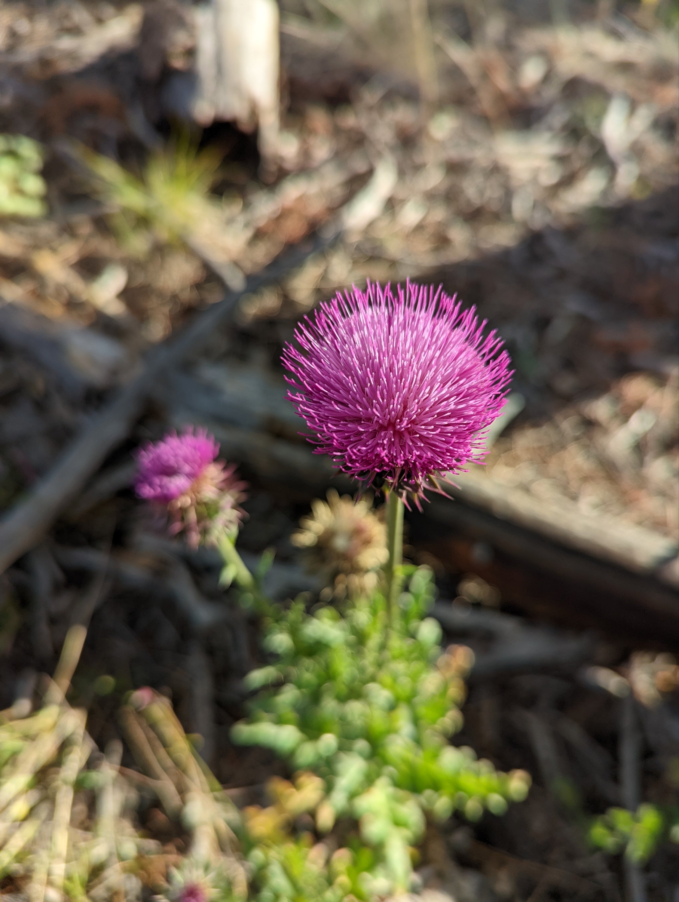
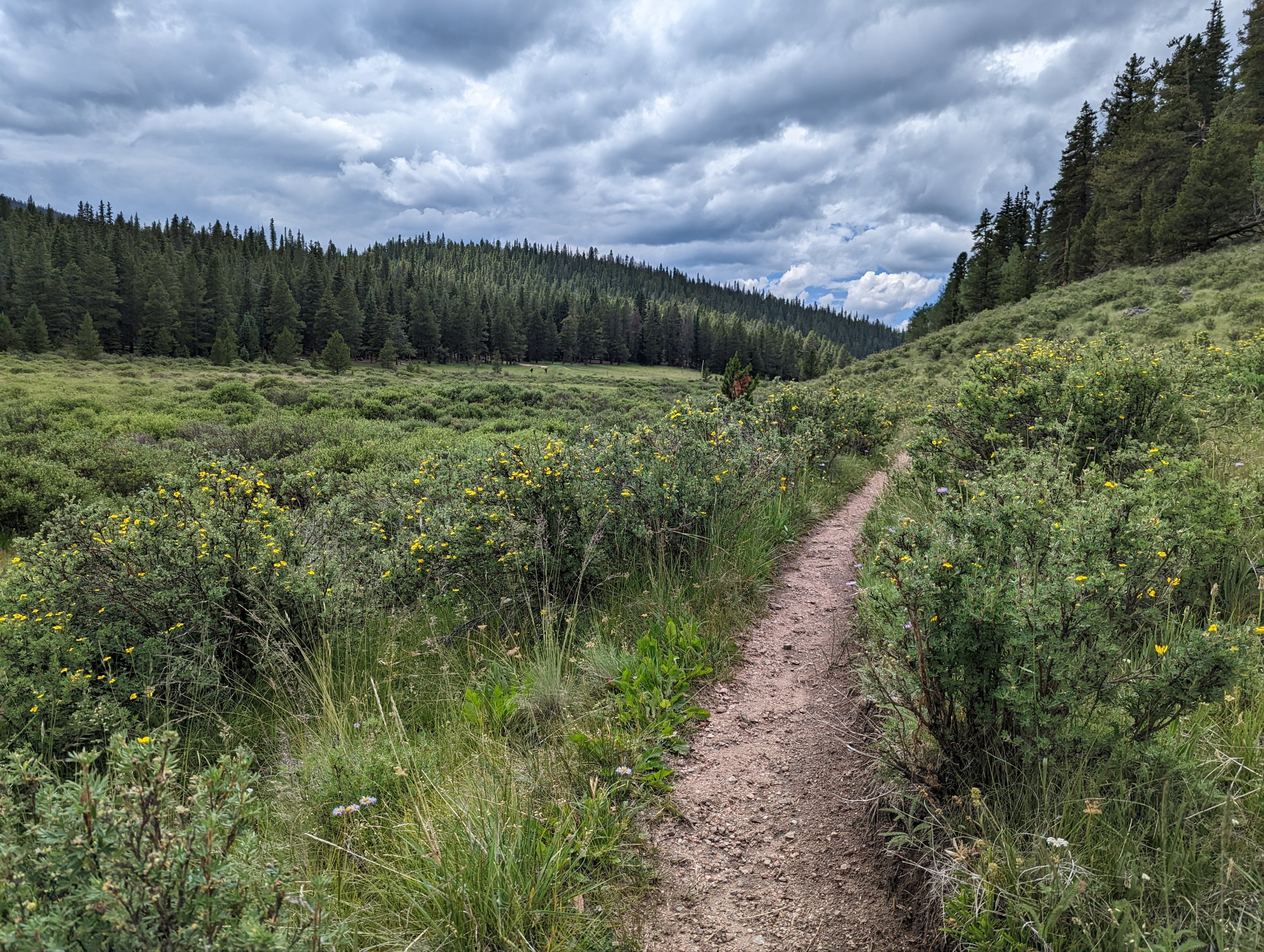
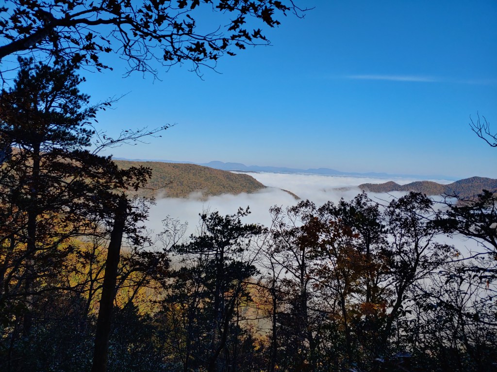
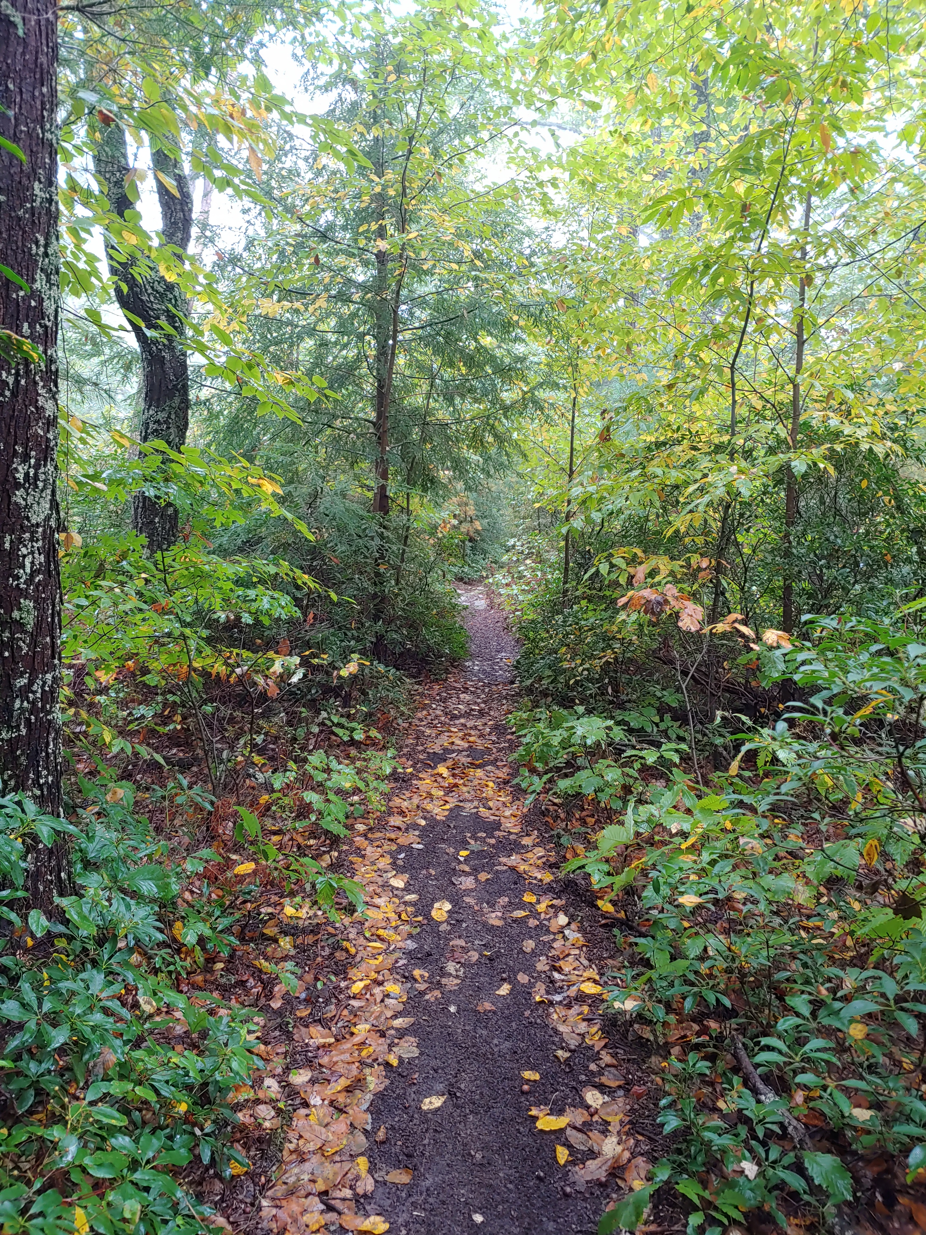
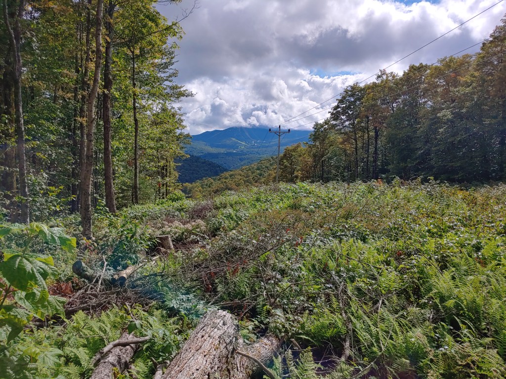
Restless sleep led to watching the sunrise on the morning of day two. Wild rabbit greeted me on the trail as I left for the day and headed off towards South Platte, a section cleared by wildfires. Abundant open views and colorful wildflowers kept me happily hiking through the 90° afternoon.
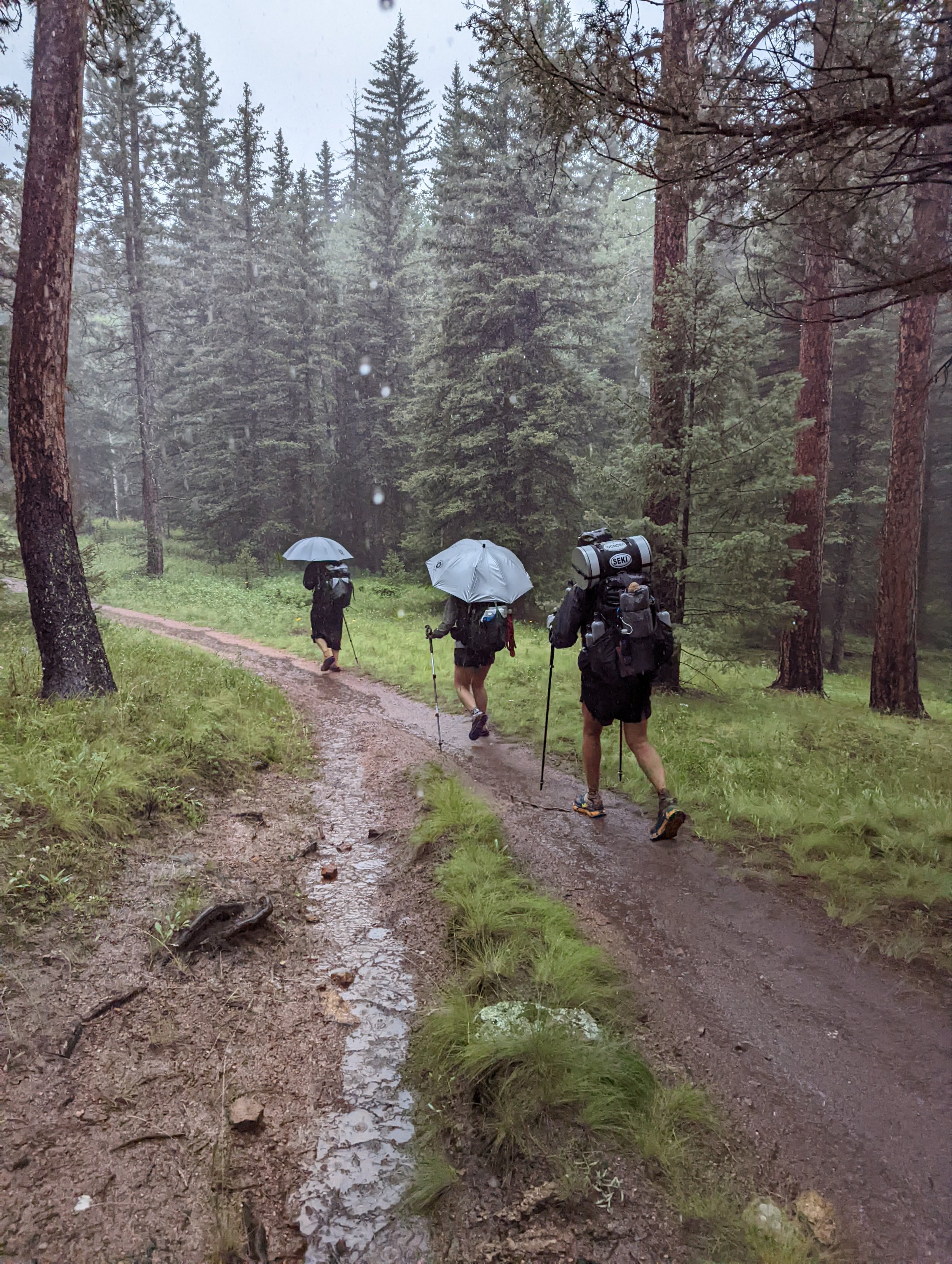
I stopped to grab water at the local fire department and from there could see the worsening clouds as rain was predicted for the evening. Linking up with a small mini tramily for the evening. We all created a convoy and headed out into the wet.
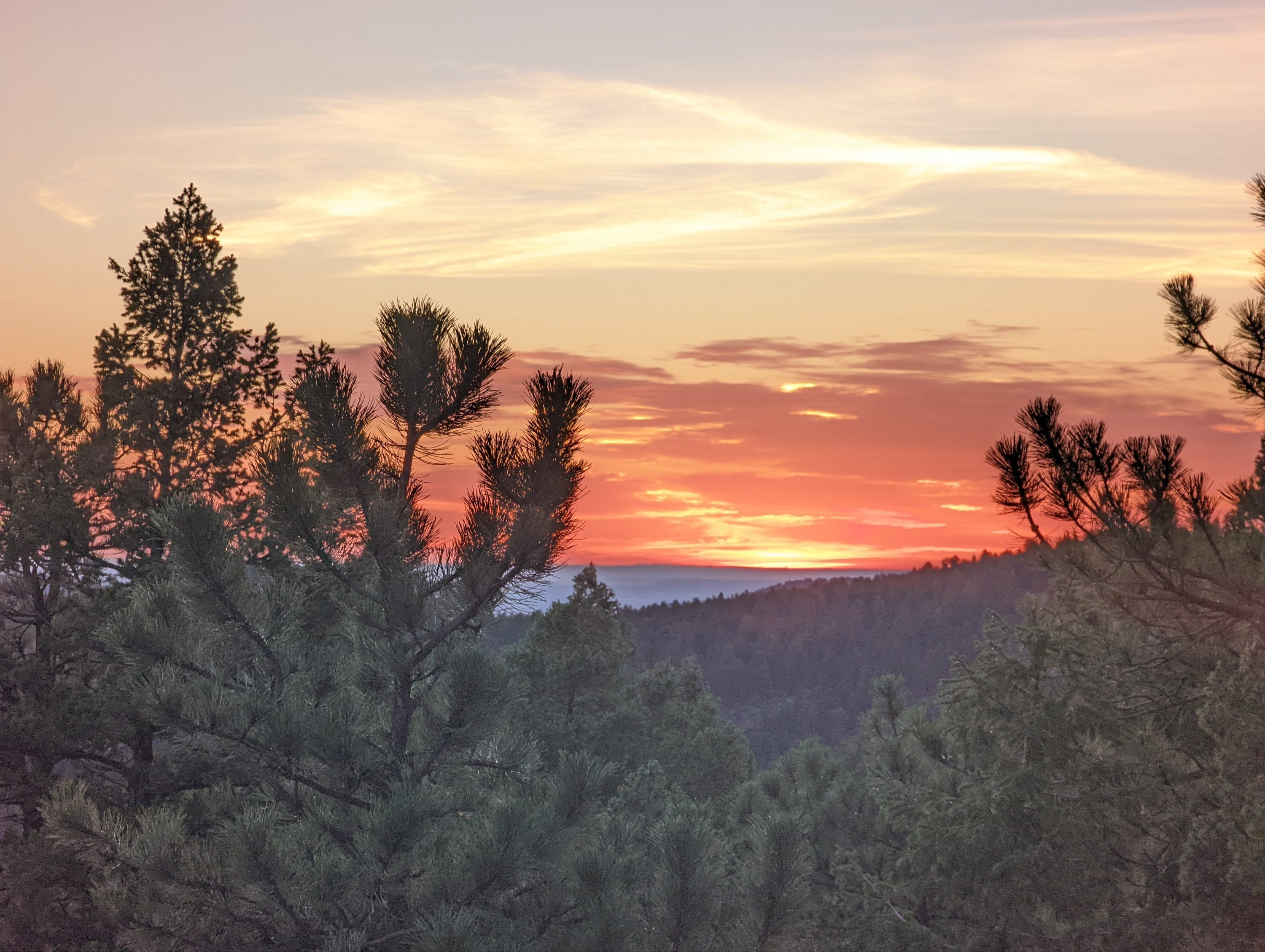


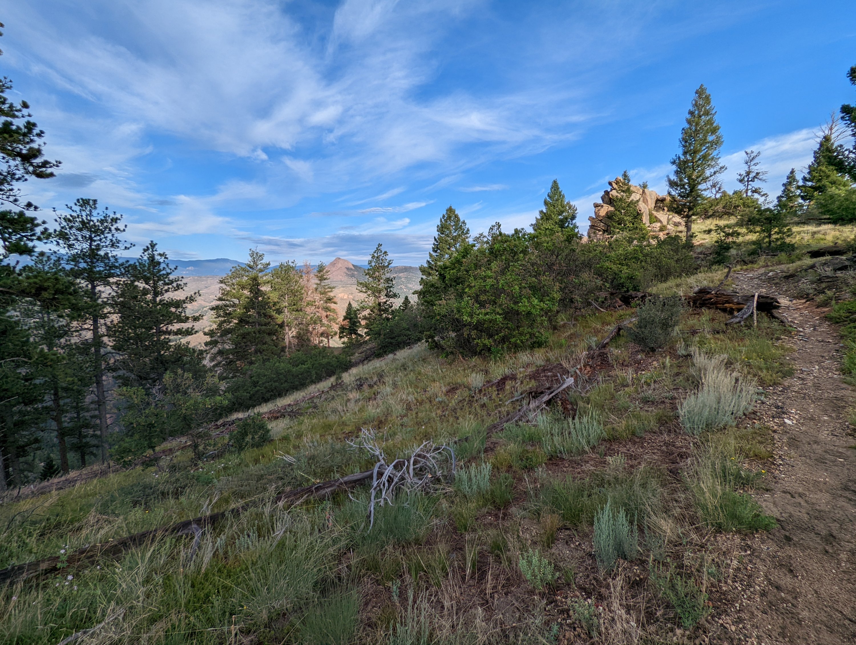

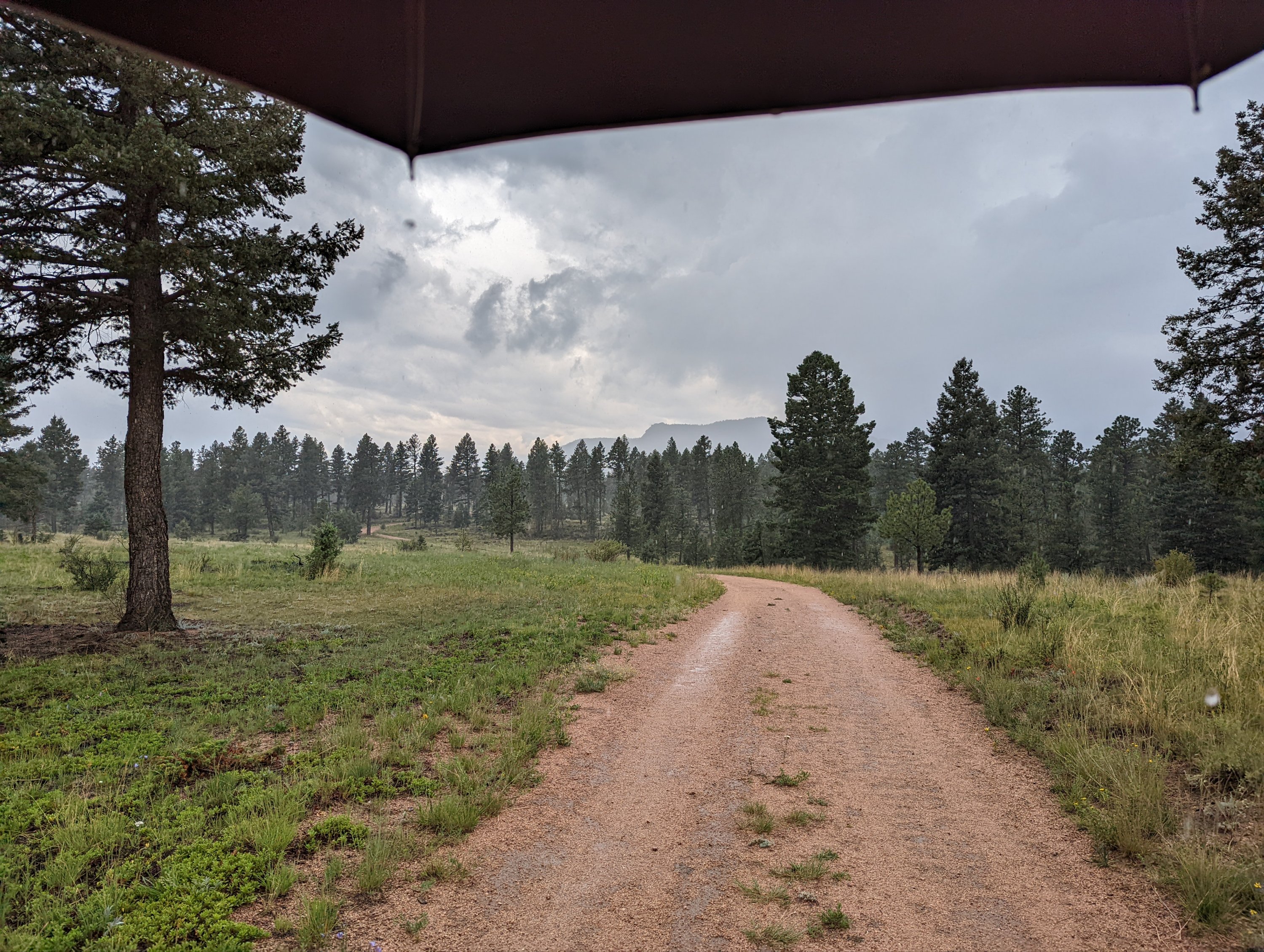
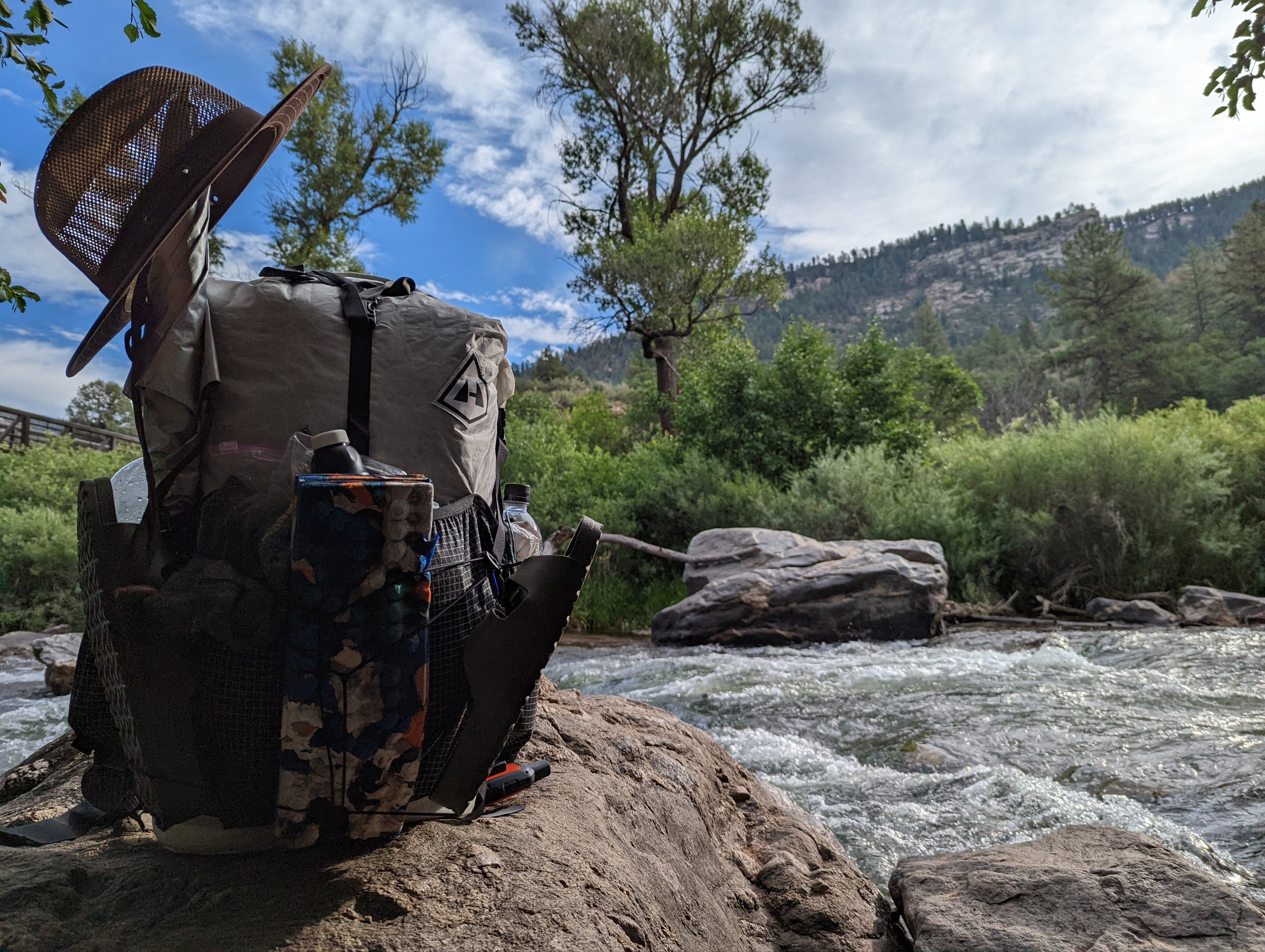
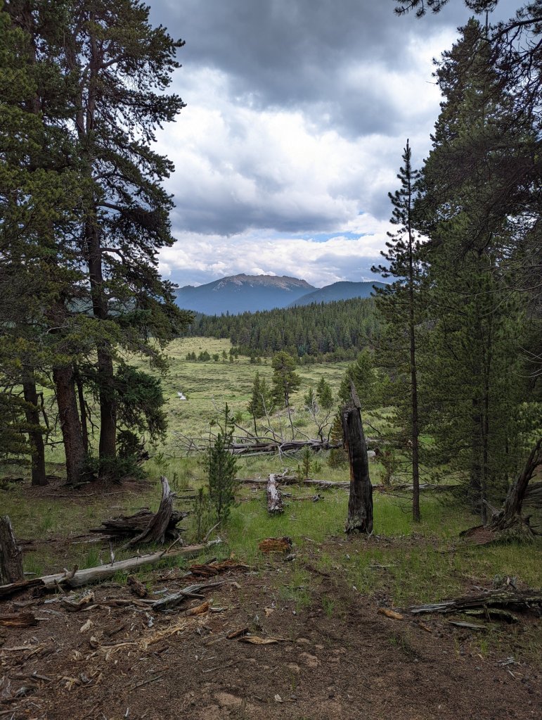
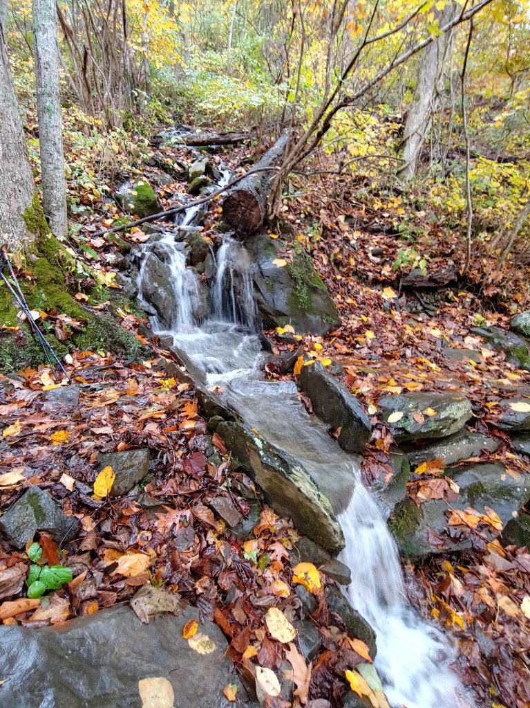
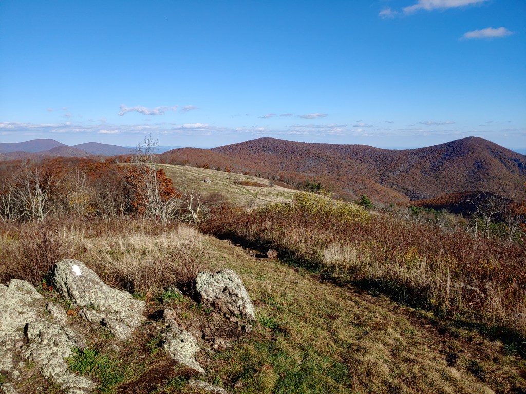
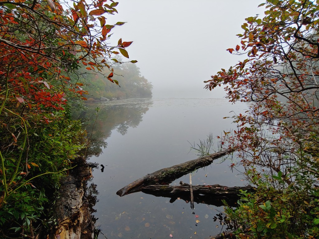
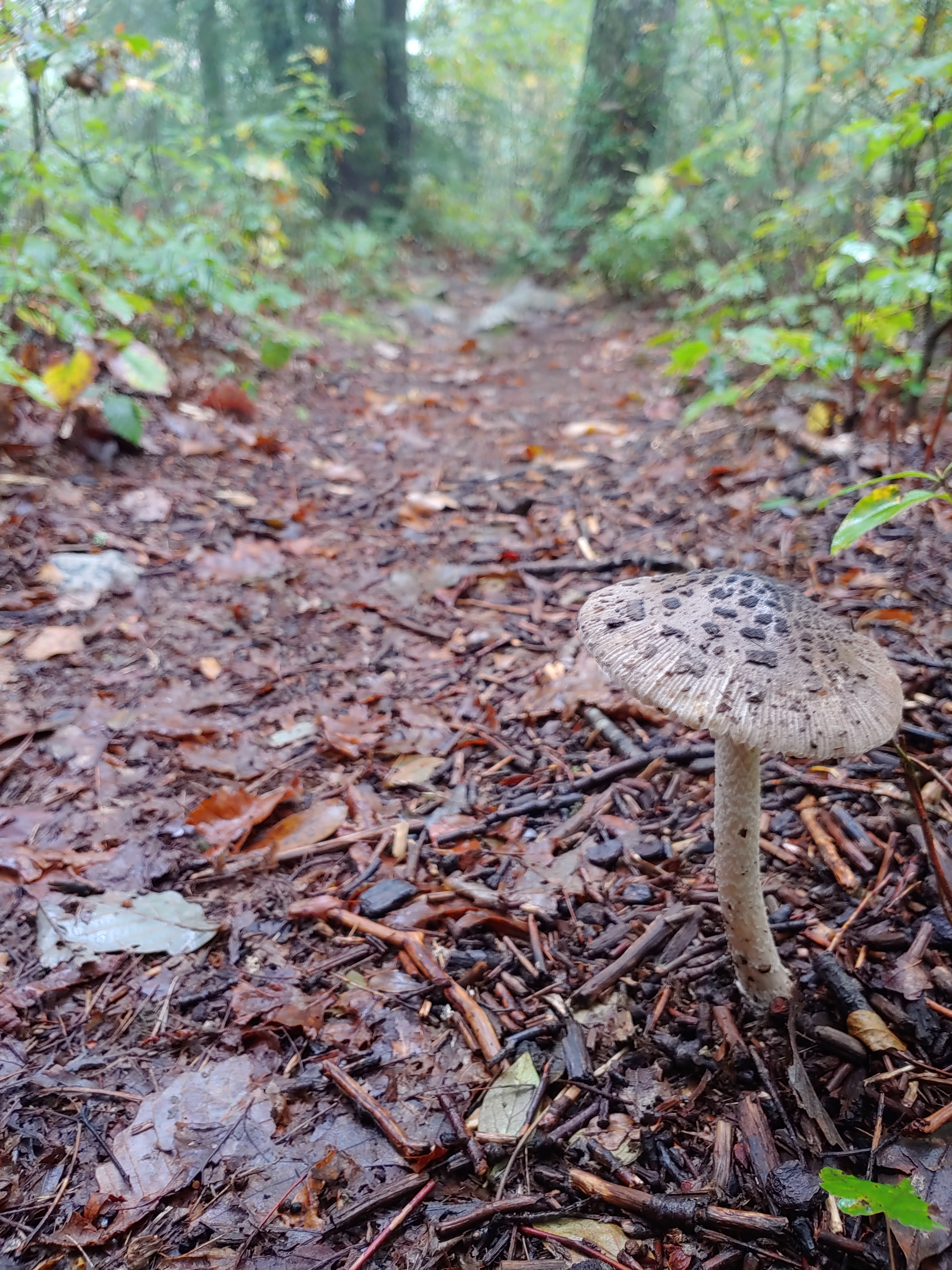
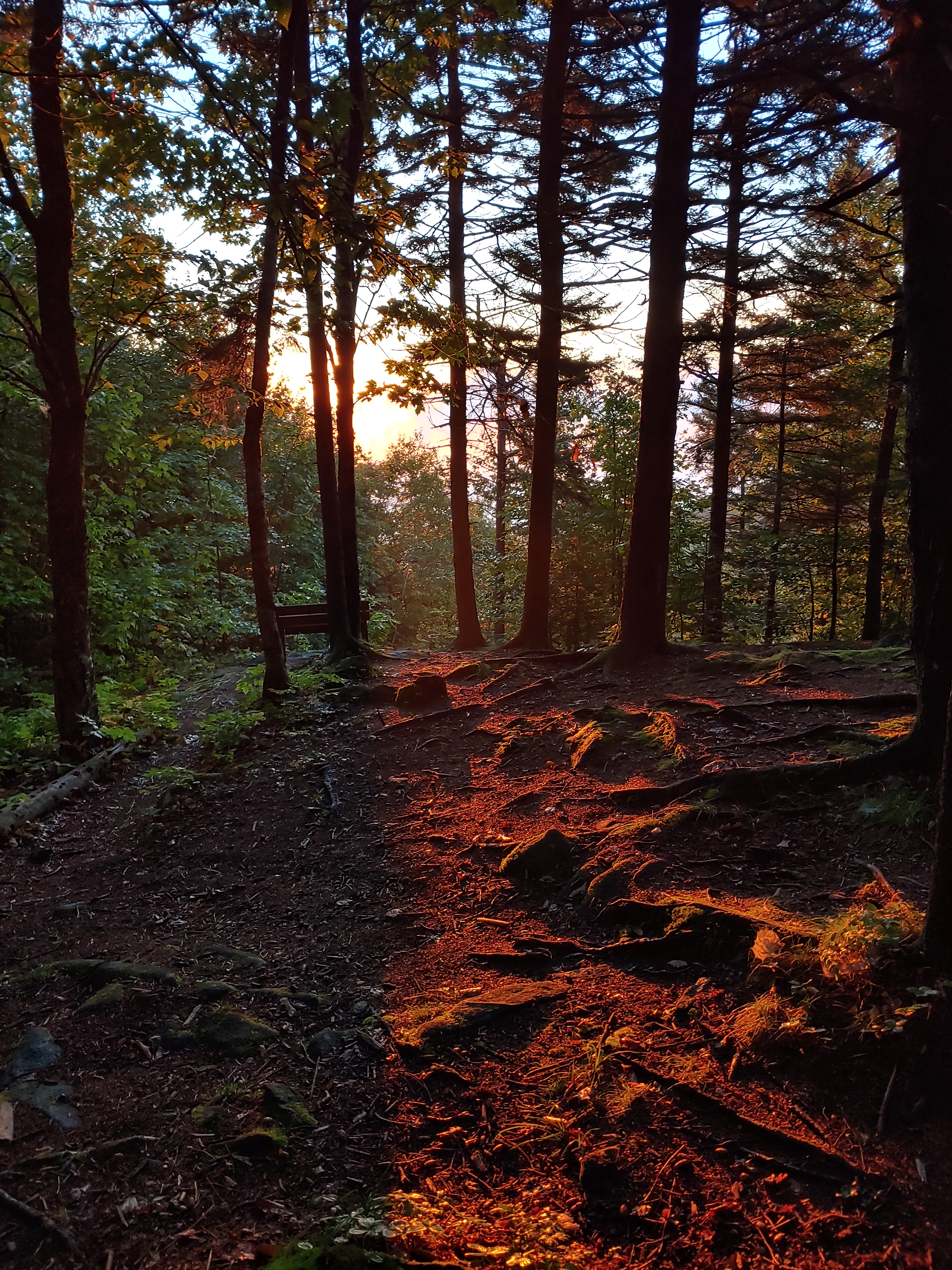
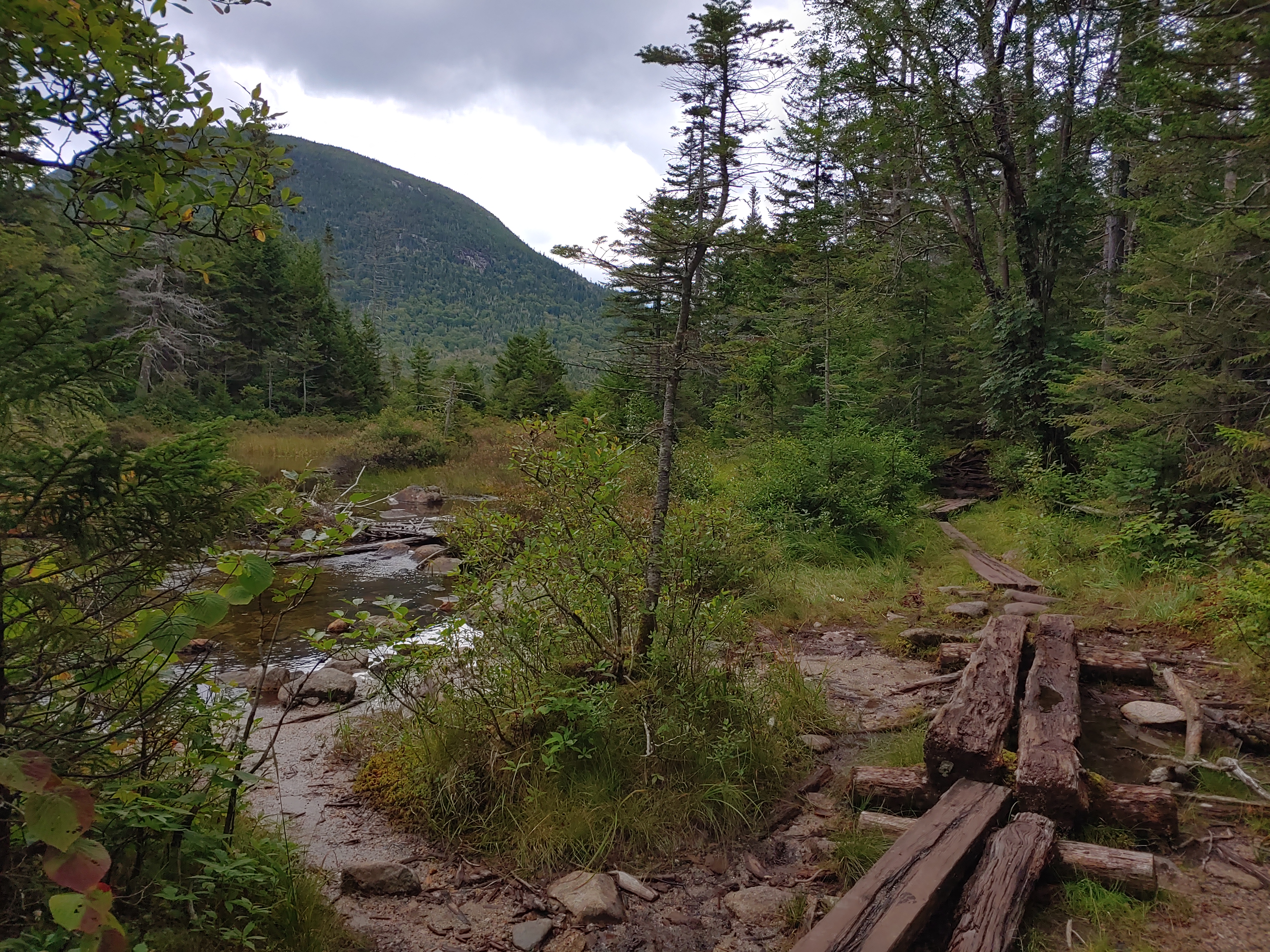
Damp clothes in 50° air temperatures is what I woke to on the third day on the Colorado Trail. Only a quick stop at the river for breakfast and water before a long climb up to a high alpine meadow.
Only after safely setting up camp, did a rainstorm roll through but then turned into a frigid hail storm which was a trail first for me.


My bag is packed and I’m ready to go. The Colorado Trail is next!

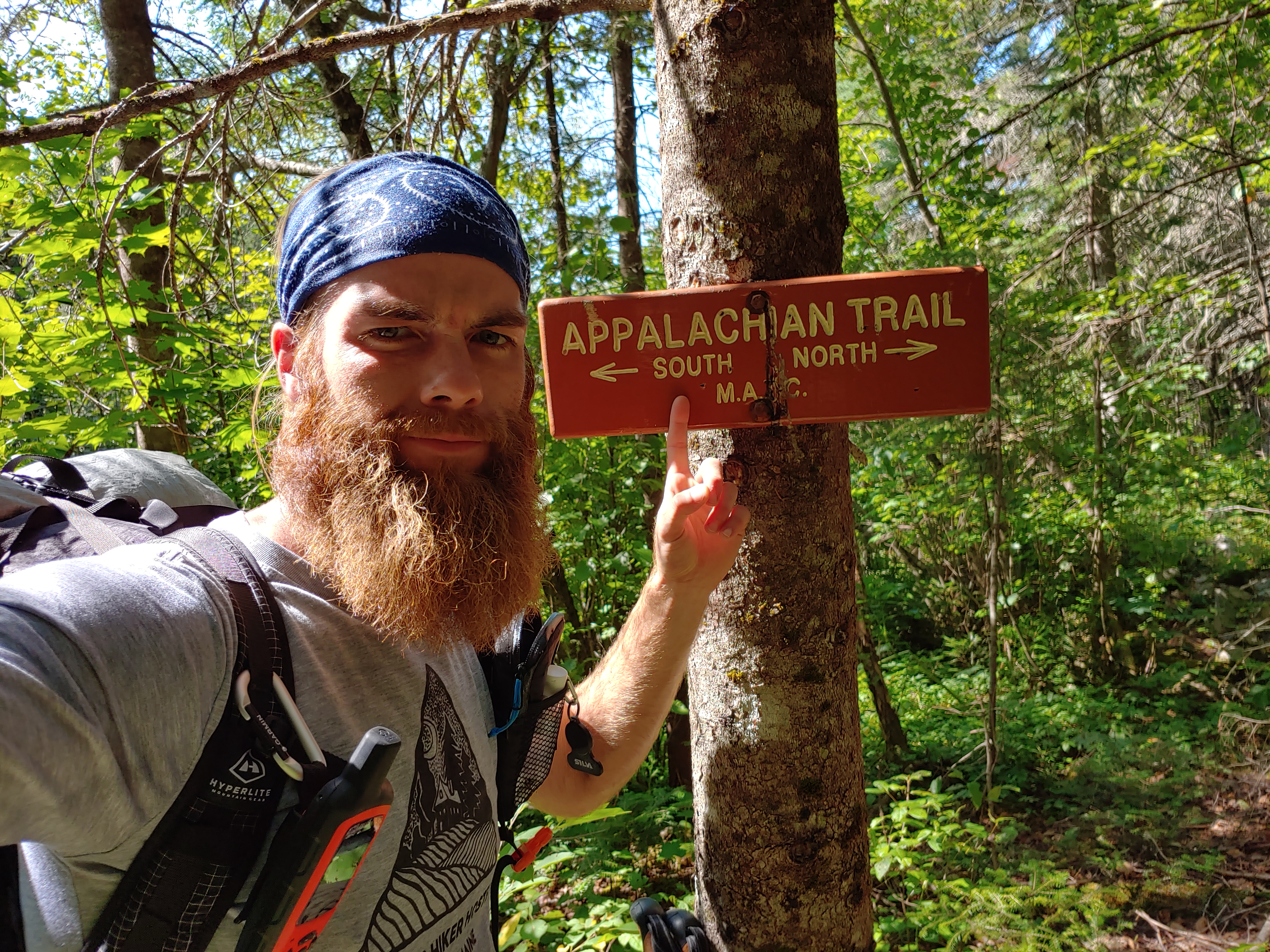
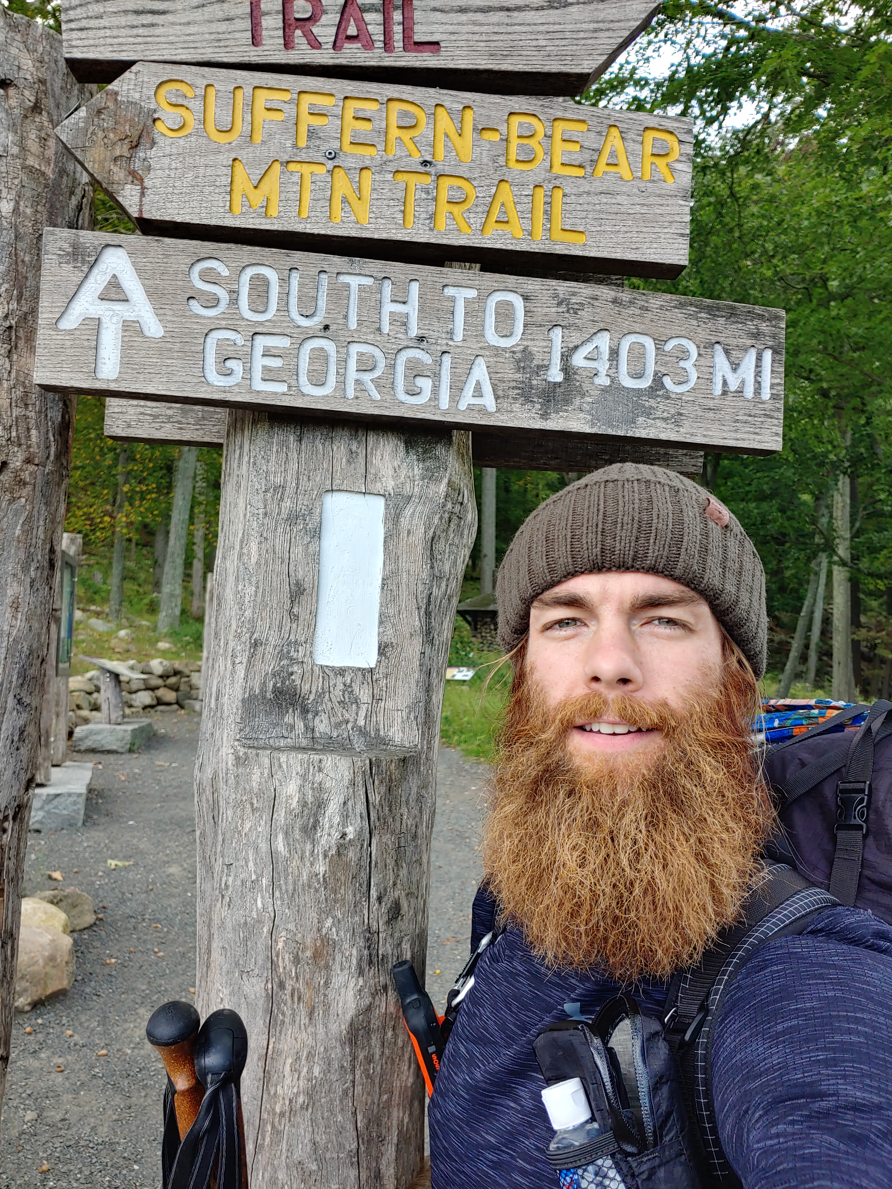
AT Week 12-13 _ Northern Virginia
You will have to excuse me for the long pause in updating this AT blog.

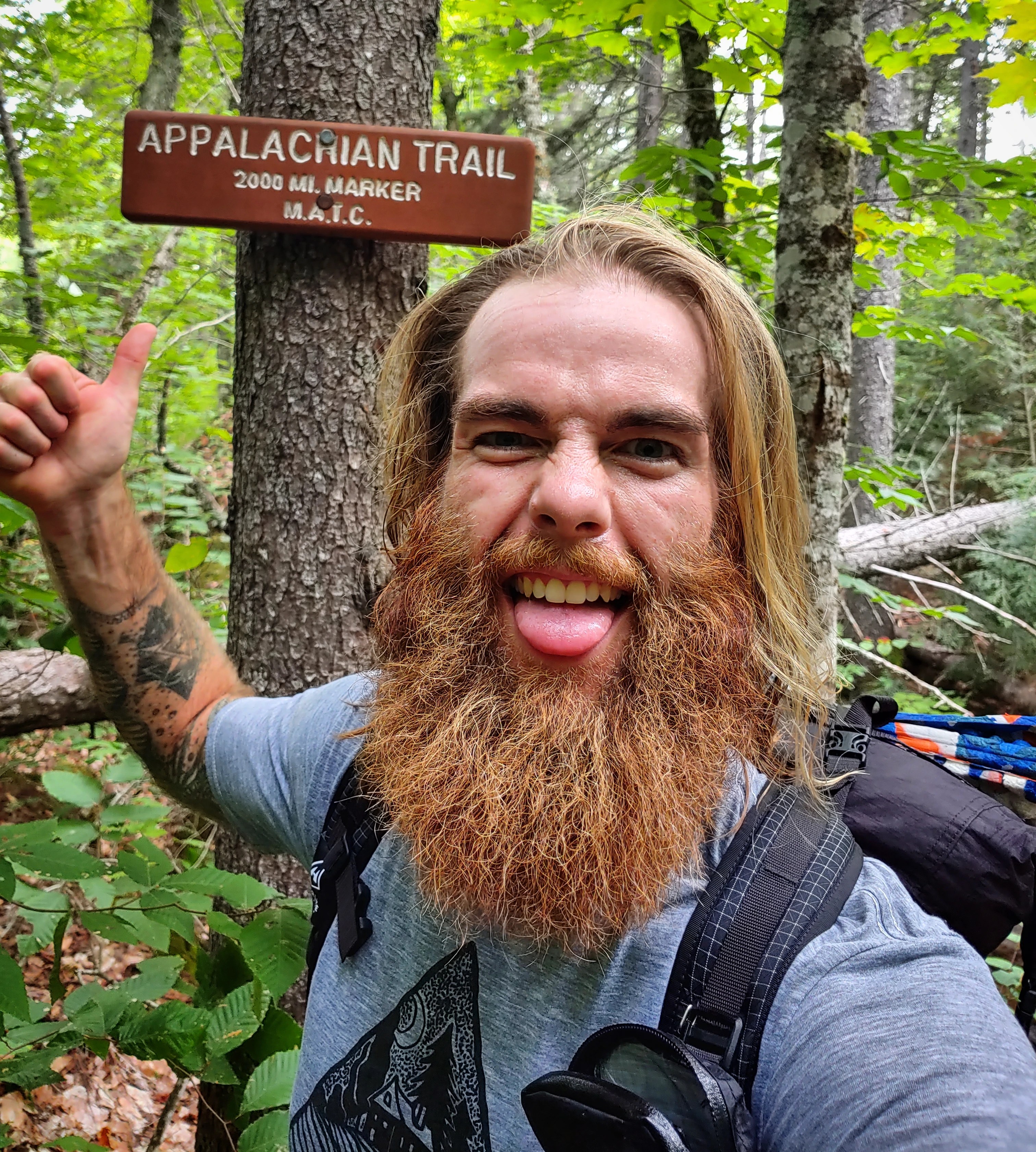
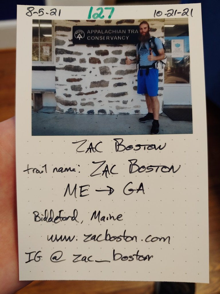
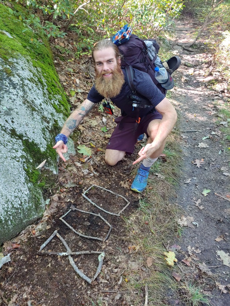
Waking up dazed and confused after a monumental day, I slowly gathered myself together and lumbered the two miles back into Harper’s Ferry for a much needed Zero (minus all the walking of course). Checked in and showered up, I headed towards the ATC headquarters to get my obligatory ‘half-way’ photo taken. While there, I perused the selection of maps, and checked out the sparsely adorned museum, which was under repairs during my visit.
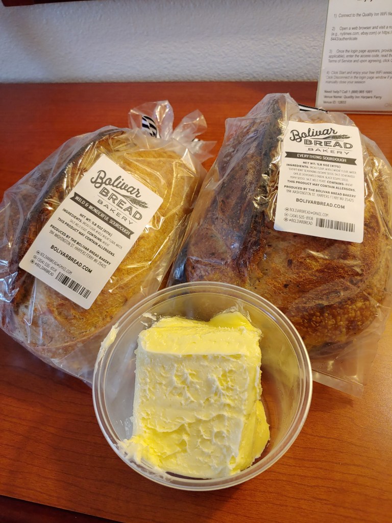
Walking through town afterward, having missed my usual Second Breakfast, I stopped by a local bakery that was listed on the map. Lights were on and shelves stocked, but the door was locked at Bolivar Breads. Hungrily eyeing the loaves, I dialed and the owner answered. I explained how I was passing thru to Georgia and longed for nothing more than fresh bread. Katie, the owner, welcomed me in saying how the new shop was due to open the following day but she graciously gifted me two beautiful loaves and a quart of fresh butter. Yes please and thank you.
Ready to see what Northern Virginia had to offer, I left town the next morning and restarted my southbound journey. Still feeling the beating from Pennsylvania and the more recent Four State Challenge, my swollen feet slowly acclimated to my trail runners while weaving back and forth over the many switchbacks now forming the trail.

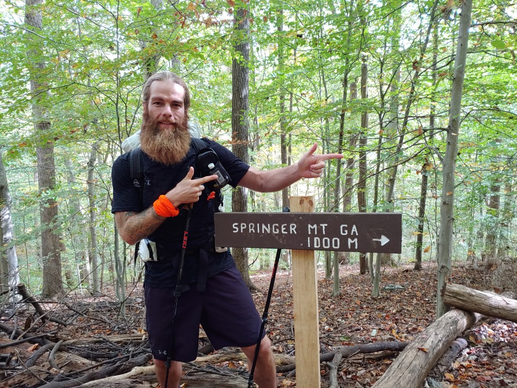
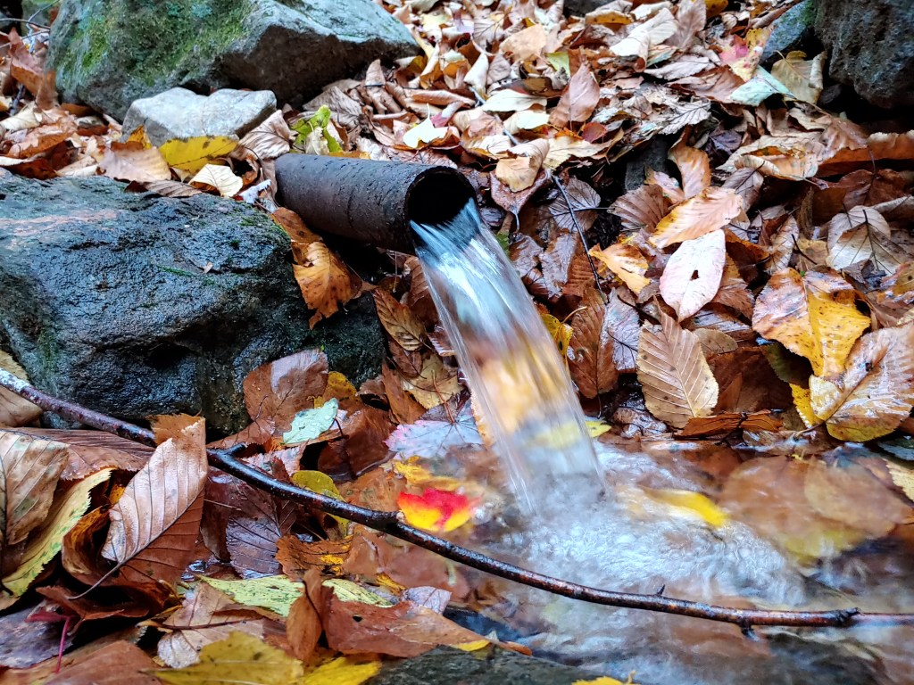
One day I was passing the 1000 mile remaining sign and the next I arrived in the magnificent Shenandoah National Park(SNP). It was a Sunday evening when I setup camp beneath a massive tree. I had found a barely trickling stream nearby which was my only water source for miles. Thirsty and tired, I remembered a technique taught to me by Poet back at the Shaw’s Hostel. Using a small tent repair tube held down with rocks I was able to collect and filter enough water for dinner and breakfast.

Overnight an incredible wind storm blew through. Autumn hadn’t taken full hold in this area leaving the majority of leaves attached to their limbs. Extraordinary sound was produced by the flutter and dancing of the deciduous canopy. I awoke thinking a jet plane was preparing for take-off and in an instant the chaos would cease like crashing waves.

Intending to capture this for the future, I started a recording on my phone…closed my eyes and waited. I opened my eyes, looked at the screen, shockingly realized the sound had lulled me to sleep, and that I now had a 38 minute and 24 second voice memo of wind noises from October 25, 2021 at 4:18 am. Science!
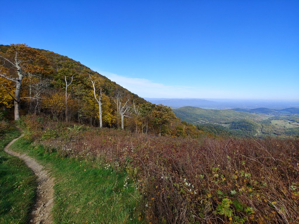
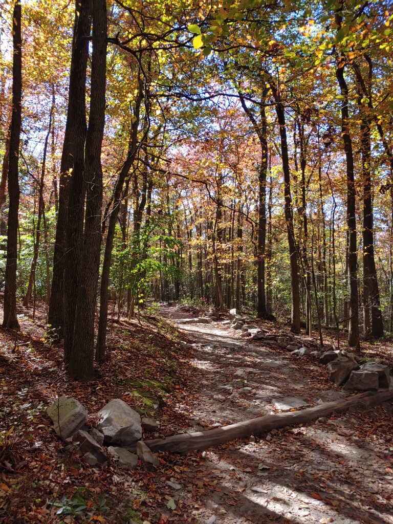
Although the Shenandoah is a hugely popular tourist spot, the time of year I arrived, and getting there during a workweek, meant I had the park basically to myself. The season also created a constantly morphing colorscape that brightened every vista and view. Trails throughout the park are wide, well groomed, and free of many tripping hazards, allowing visitors plenty of opportunities to look around at the glorious wilderness and soak in the beauty.


Solitude in one of the busiest national parks during autumn was a dream come true. Most days I would encounter more deer than people while spending hours alone exploring the “backcountry”. One morning after packing up, I noticed a family of deer, mother and two fawns, grazing a few feet away. They weren’t startled by my motion or presence and I felt a kinship with my wild brethren.

The foliage is pretty but goes hand-in-hand with colder temperatures and less daylight. My warmer gear was back home and needed to be in Virginia, so I made plans for my next resupply to include more layers, gloves, and a jacket. All things that were sorely needed a week earlier as the weather shifted starkly cooler during my trek through SNP.

To avoid the chilly blowing fog, I dunked into one of the many trail/roadside stores, known as waysides, and happened to bump into a couple of friendly Mainers. Stan and Lou-Anne from Damariscotta were most gracious and made me hot coffee in their RV. We chatted for about an hour as I ate my lunch and answered all their thru-hiking questions while I dried and warmed my clothes in the wayside’s coin-op laundry room. We said our goodbyes and I was back on the trail all “carbed up” on sodas and snacks, thanks to my home state trail angels.

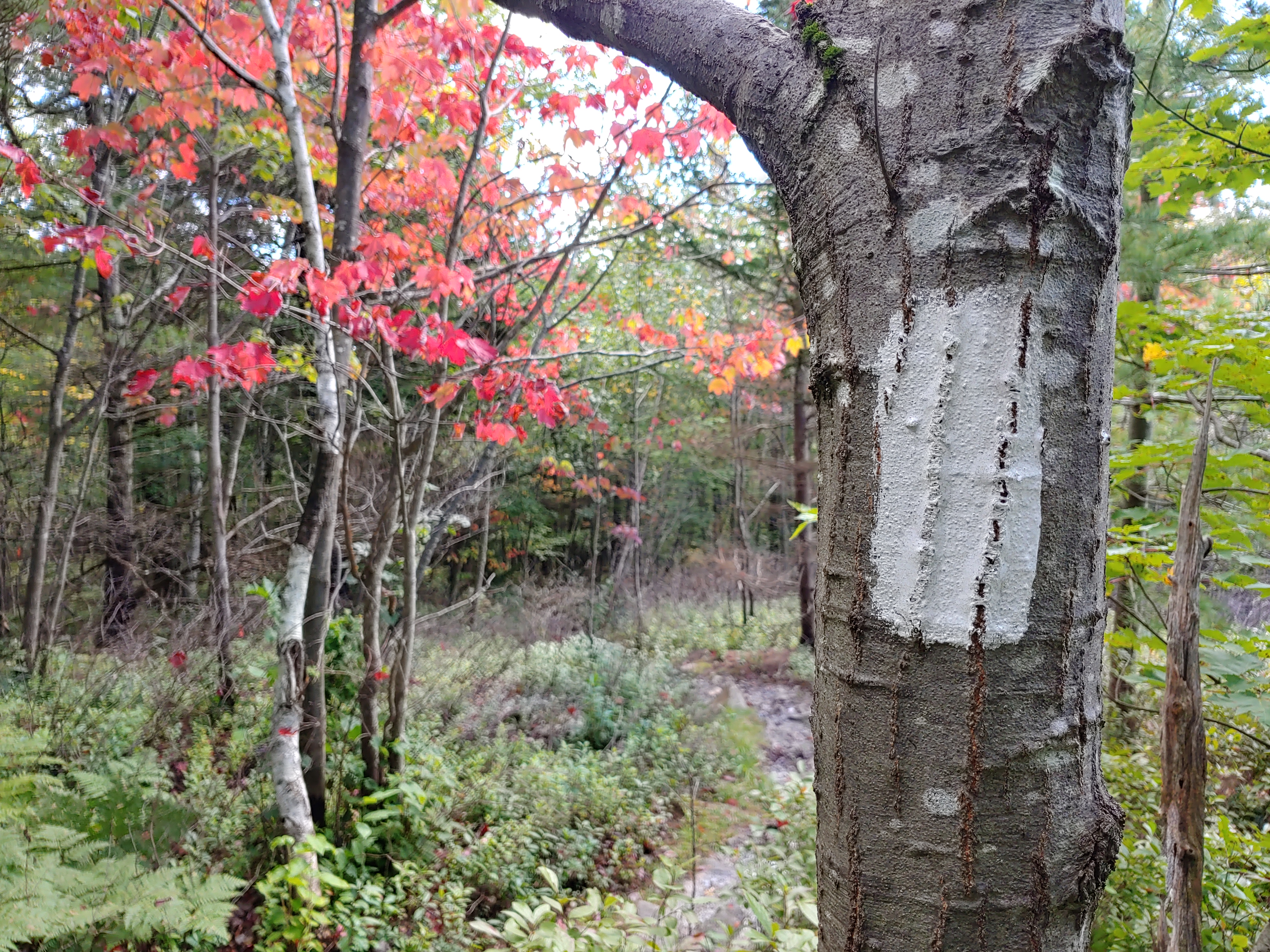
Fall happening in front of my eyes kept the excitement high and helped to fend off the dreaded ‘Virginia Blues’. The Appalachian Trail spans well over 500 miles in the state and the lack of border crossing milestones makes this section feel endless for weary hikers. Thankfully, there is something about dying leaves that is absolutely beautiful and gets me gears turning. Call me weird.

embrace this wonderous place.
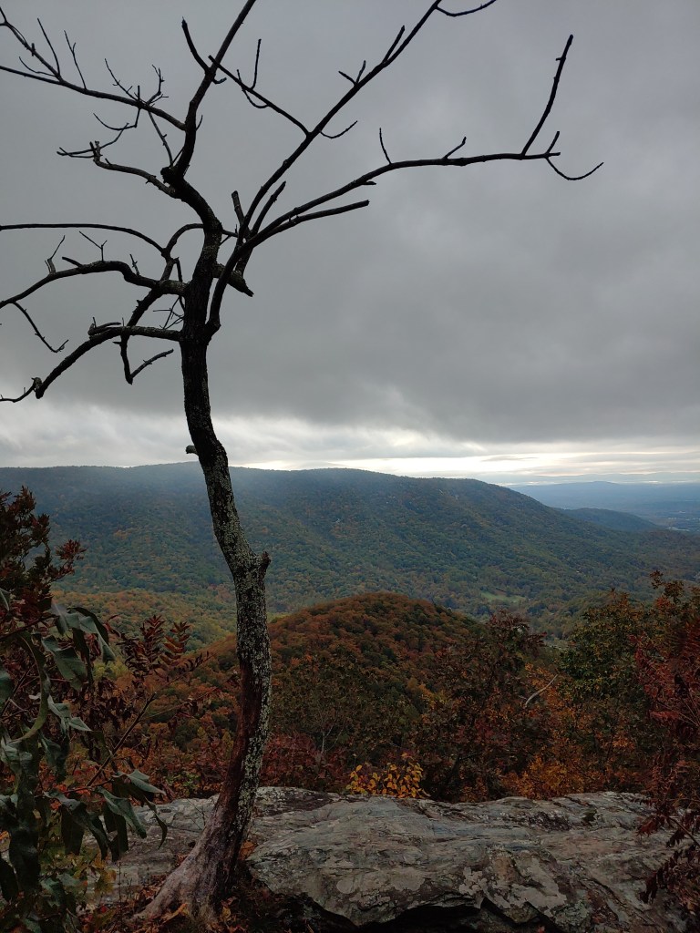
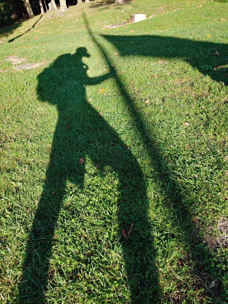
Silhouette in space.

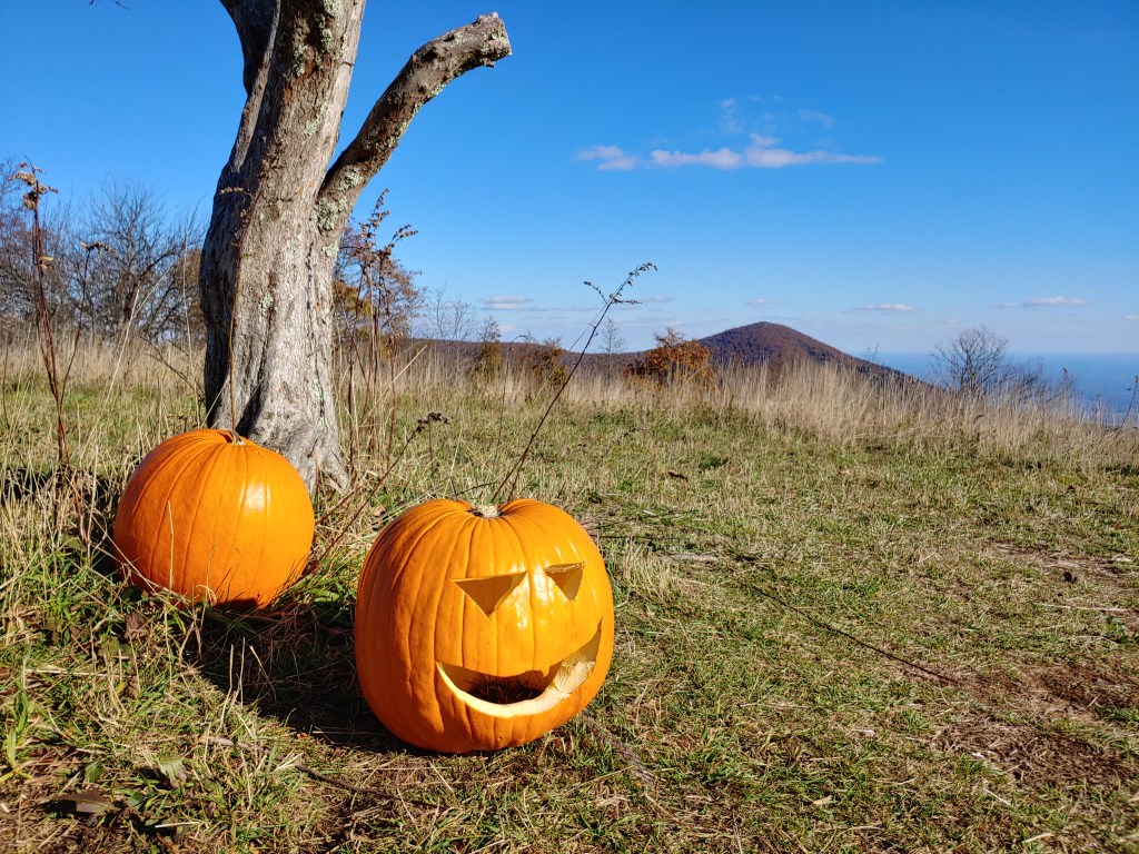
Halloween came and went with little to no tricks but the spirit elevating treat of having some of my writing featured on Hyperlite Mountain Gear’s blog. I encourage you to take a look. No Room For Elephants was my story to the world describing aspects of life that have driven me to hiking. Writing a little each day on my cell phone, often early in the morning, laying in my tent, I tried to piece together how my past is helping the shape the course of my future.


Long days can become monotonous but music or podcasts were my choice for zoning out during less inspiring sections of the trail. Fittingly, the Green Tunnel podcast was a favorite of mine. It was brand new in 2021 and featured episodes that illuminated and informed my travels. I actually camped at the Brown Mountain Creek shelter and stopped by Ottie Powell’s memorial, both sites are mentioned in Episode 2 (Super excited to announce I was selected in spring 2022 to be an ambassador for the podcast!) You should check it out as well.

Soaked to the bone and shivering, I couldn’t have been happier to hear the endearing New England accent of Charlie, the caretaker of Stanimals in Glasgow, as he arrived to shuttle me to the hostel. I shared a bunkroom in the quaint ranch turned boarding house with a friendly traveler Chris and a literal water closet. We made a gentleman’s agreement that neither one of us were to use said closet. We both kept our word.
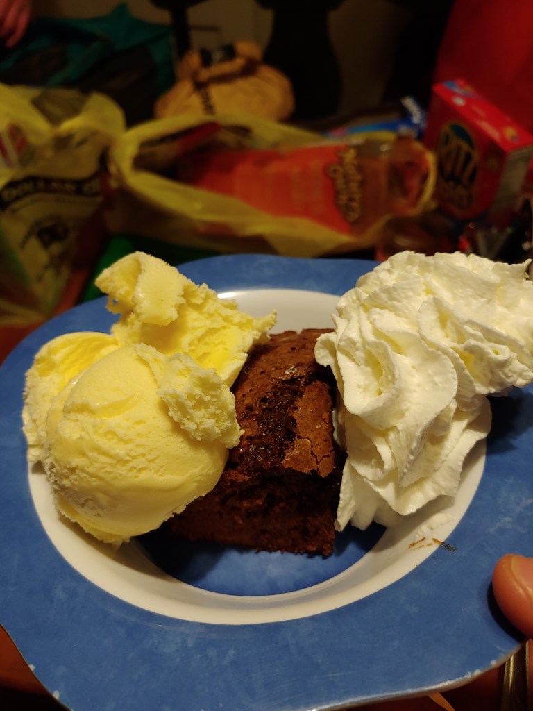
Two other SOBOs staying at Stanimals, Bluebs and Tadpole, joined me for the $6 all-you-can-eat spaghetti in town(not worth it). Unsatisfied, we then hit the Five Dollar General for glutinous trail rations, and all later gathered around freshly baked brownies à la mode back at the hostel, courtesy of Charlie.
The temperature dropped over night and thick undercast filled the low valley near the James River the following morning. Charlie’s fresh blueberry pancakes fueled me up the 6000 feet of climbing. I was glad to have received my warmer gear back in Glasgow, as later that day, I got my first glimpse of frost and icicles on trail just before barely surviving the spectacular Guillotine.


Northern Virginia is an imaginary concept since the state is unified and contiguous without a dividing line but a guillotine seems like a good place to wrap up this section… So. Cut!


Open House
Taking a tour of my “Tiny Home in a Bag”
New Hampshire is Complete
In case you haven’t been following along, I am posting daily vlogs on YouTube from my thru-hike last year of the AT.
Here is a short recap showing some highlights during the Granite State.
Second Breakfast
SOBO Day 10
Appalachian Trail Vlog_Day 1
The lengthy editing process is underway and I am very excited to release my first video in a series covering my thru hike last year. I plan to upload a new video at least once a week with a few surprises planned along the way.
Thank you for following my journey and I hope you enjoy 🙂
There are more videos to follow so be sure to like and subscribe to my YouTube Channel.
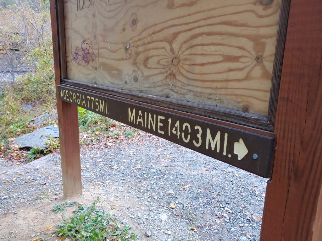
Four State Challenge
Coming off the excitement of reaching the AT halfway point, my confidence level was high as I approached Pen-Mar Park on a Tuesday evening. The setting sun was shining warm orange and pink light across vibrantly emerald blades of grass. I thrust my pack down onto a bench, rummaged for my stove and began heating water for dinner. My mind drifted toward the epic day to come. Many hikers who reach this point have built up the stamina to hike long days and, given the proximity of multiple statelines, the Four State Challenge was born.

To complete this challenge, willing participants start hiking in one state and end their day three states away in less than 24 hours. Close to 44 miles separate the Pennsylvania and Virginia borders with Maryland and West Virginia sandwiched in between.
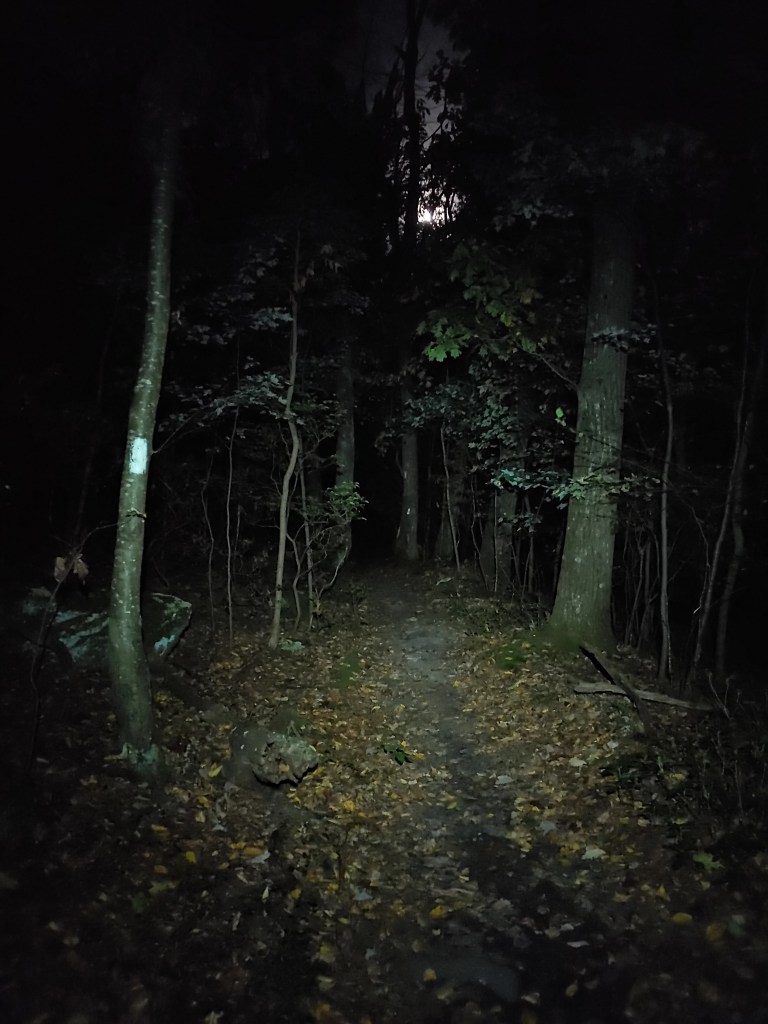
Leafless trees allowed the full moon’s light to illuminate my tent the entire night making sleep a chore. Restless, I got up around four a.m. and began my morning stretches. I made my breakfast in the gazebo at Pen-Mar Park before walking back to the Mason-Dixon line to start my four-state attempt a little after five on Wednesday morning. A long day ahead of me, I clicked on my stopwatch, and then set off by way of my headlamp with the intention of not stopping until I reached Virginia.
In the dark, quiet calmness of the early morning, my thunderous momentum startled many groups of bedding deer that lay in clusters a few yards away from the trail. Each time an eruption of crunching leaves and snapping twigs grabbed my attention, I would stop and survey the woods around me. Occasionally the noise would cease and, with my headlamp on its brightest setting, the deer’s reflective glowing green eyes would appear floating formlessly among the trees. Wanting to avoid becoming a “deer caught in headlights” myself, I put on some music and kept my eyes locked on the uneven trail in front of me.
After two hours and six miles of rock hopping, the daylight was bright enough to shut off my headlamp so, right on schedule, I stopped for a second breakfast and water break by a flowing stream. With a Clif bar, meat stick, and peanut butter happily in my belly, I set a timer for another two hours and started up again. I knew that if I paced myself with water, food and short rest breaks, each chunk would feel more manageable and let me focus on little wins throughout the day.
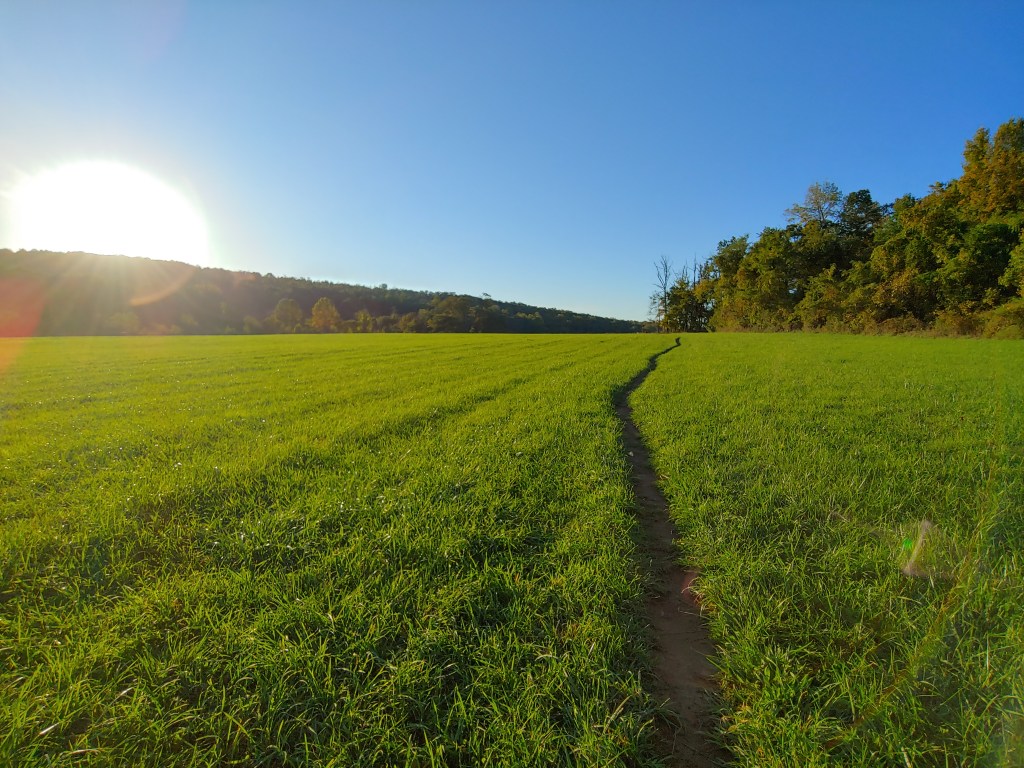
Meandering through some fields and void of any high peaks, the Maryland section of the trail was relatively easy hiking. The Mid-Atlantic states feel like the valley of the Appalachian Trail, nestled between Mt. Katahdin and the Whites up north and the Shenandoahs and Great Smokies to the south.
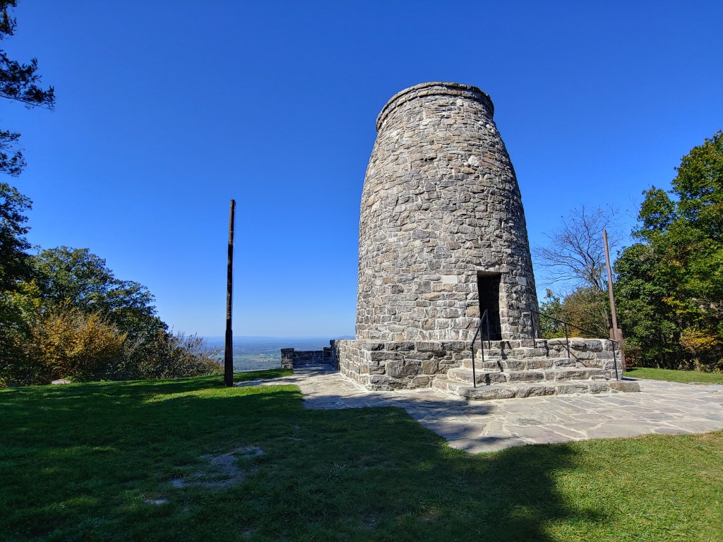
At around one o’clock, I stopped at the Washington Monument State Park to eat lunch and take a brief rest. Twenty-two miles completed and a similar amount remaining, I sat at a picnic table in the warm sun studying the map and planning out my next water stops when a golf-cart-driving man, who could have been Santa Claus’ brother, pulled up and said, “Hello”. Krispy Kreme, a former long distance hiker, introduced himself and explained that he is the caretaker of the area and was just checking in to see if I needed anything.
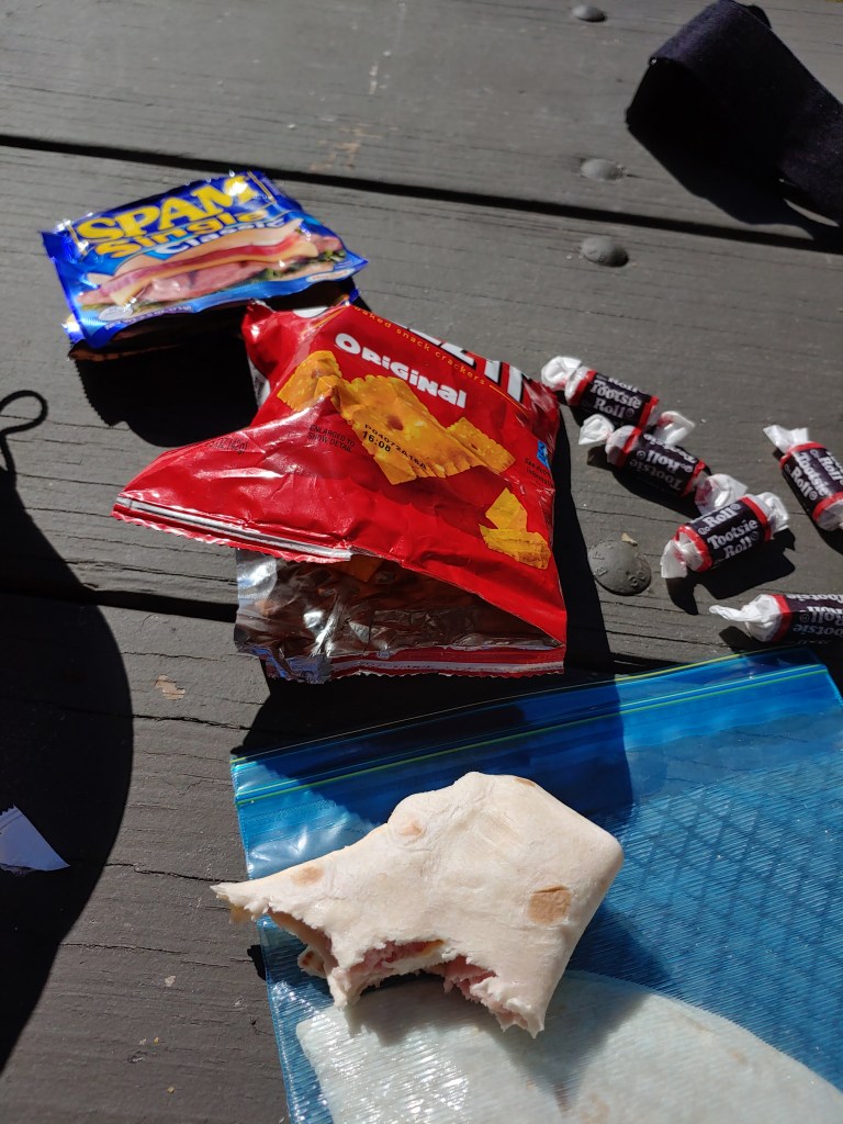
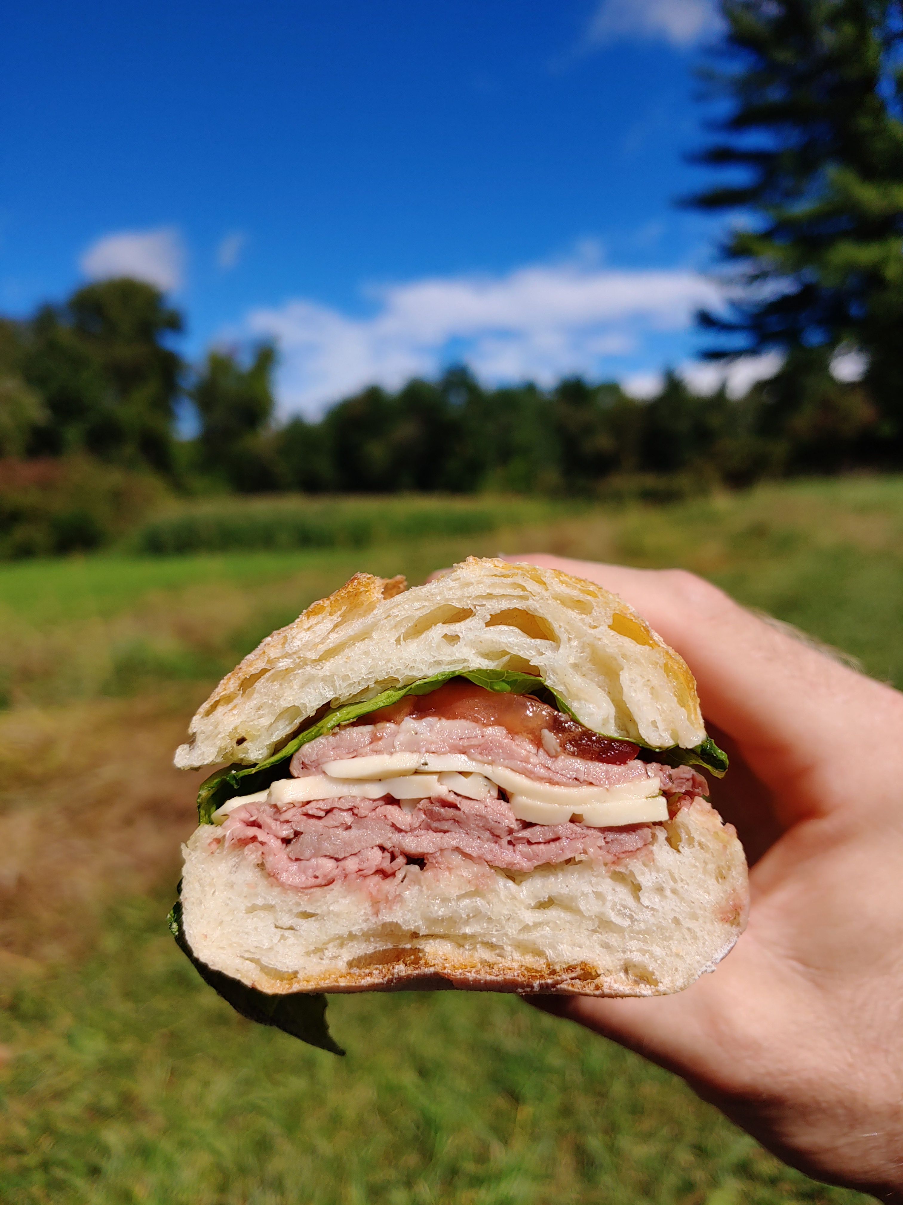
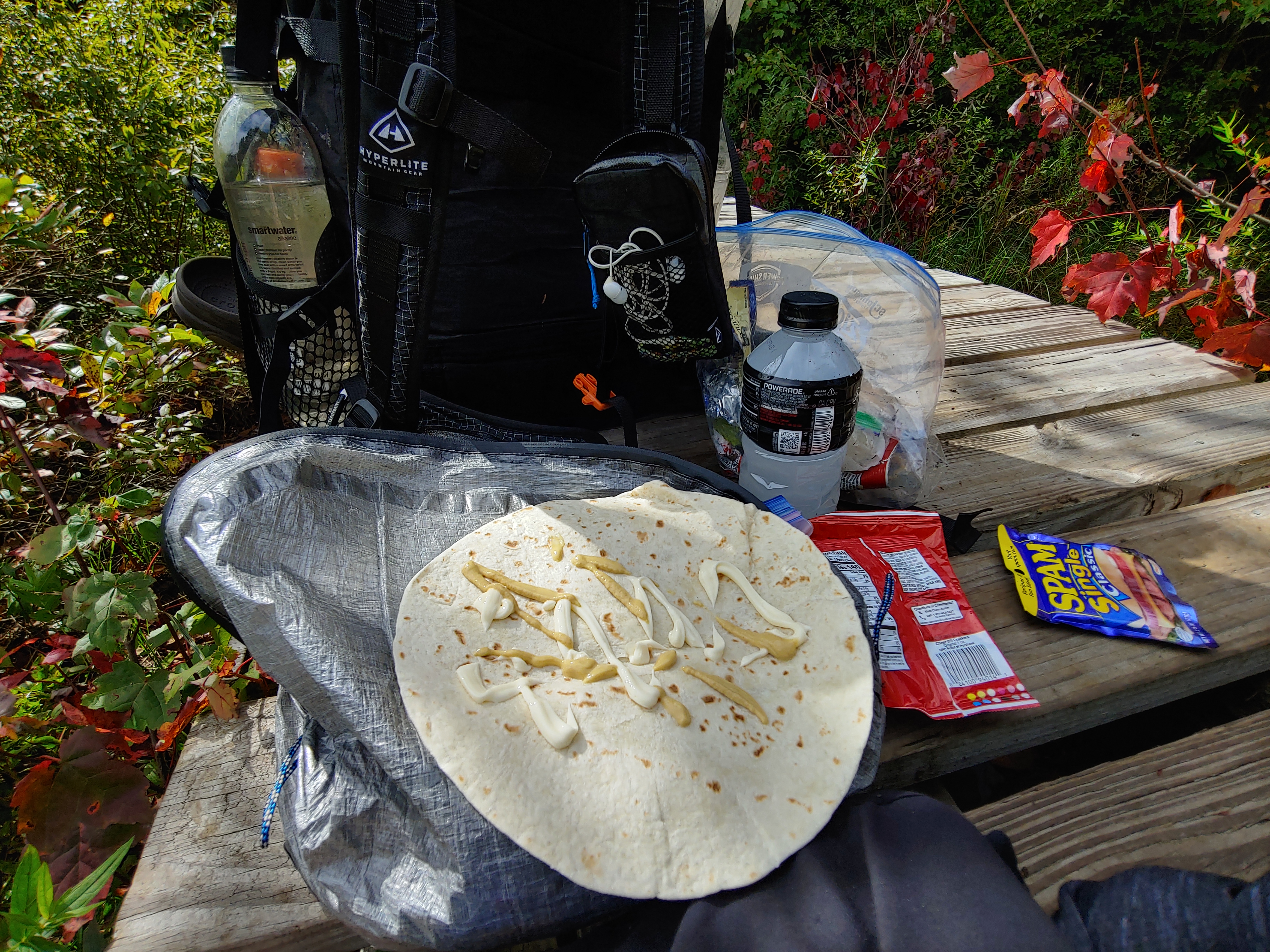
As I added mustard to my second spam and tortilla sandwich, another gentleman walked up and sat at the picnic table with Krispy Kreme and me. His trail name was Otter and, sensing from the conversation that I was a thru-hiker, he inquired about the trail conditions heading north and I offered up a few interesting places for him to stop at along his section hike.
Lost in conversation with the two visitors, an hour quickly passed, so I started to pack up and get ready to leave. On the way back to the trail, Otter wished me well and handed me a twenty dollar bill, encouraging me to treat myself to a real dinner when I reached Harper’s Ferry. I thanked him for his kindness and proceeded southbound. The boost in calories from lunch and unexpected trail magic put me on cloud nine as I sailed on my way.
In two and a half months on the AT, I had over eleven hundred miles under my belt and had hiked on average seventeen miles a day. This fact dawned on me while trotting through sun speckled foliage shortly after lunch as I checked the map and realized I was at mile 25. Some quick mental math revealed that, even with the nine hours I’d already been hiking, I still needed to hike another full day’s worth of miles to complete the Four State Challenge.
Headphones securely lodged in my ear canals, my pace increased at the cost of my form. Desiring to finish the 44-mile gauntlet, I began rushing my steps, walking roughly on feet that had not yet fully recovered from the beating they took back in Rocksylvania.
At around five o’clock, the War Correspondents Memorial Arch came into view as I descended towards Gapland Road. Lumbering down beneath the shade of a large tree, I refueled on all the essentials (snacks, water, and vitamin I) while elevating my throbbing feet. My barking dogs caused the planned fifteen-minute break to become forty-five. Checking the time, I got up and headed down the trail again with a baker’s dozen worth of miles left to go.

Riding on top of a six-mile ridge, the next two hours crept by with the sunlight diminishing as the day slowly blurred into night. Dusk was basically dark by the time I took out my headlamp. The city lights were getting visible through the patchy autumn forest and my excitement built during the quick descent down the switchbacks of Weverton Cliffs.
Spilling out of the trees on to the historic Chesapeake & Ohio Towpath lost its charm rather fast. The wide smooth dirt trail leading three miles to Harper’s Ferry would appear to be a welcome site at first but my swollen tired feet hurt more walking on hard flat ground than they did back in the woods. Hovering over my shoulder, the moon cast a shadow of my form ahead. In the dark, without anyone around, it was a reminder that I am always on my side.
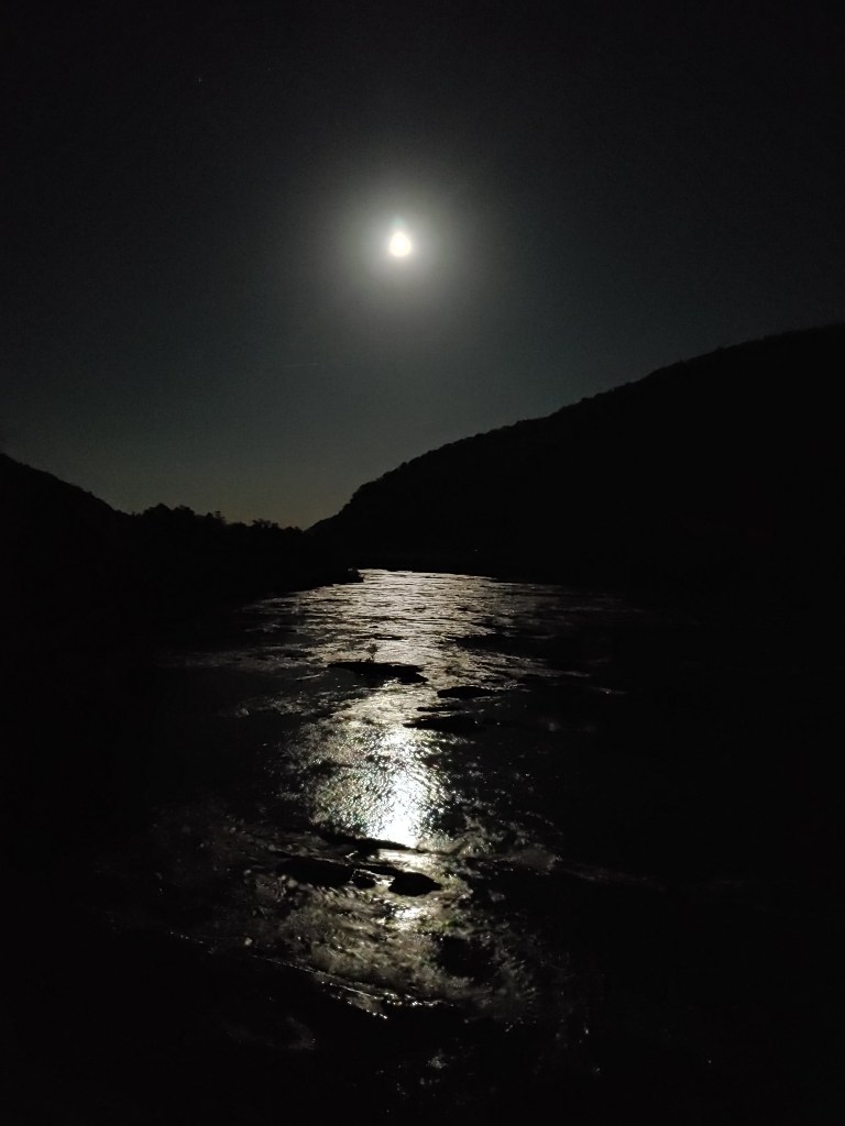
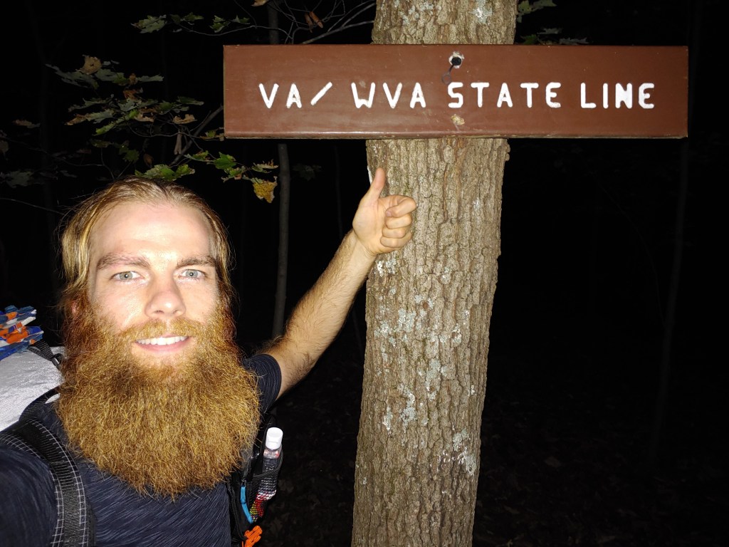
Moonlight glimmered on the Potomac like a river of flowing obsidian as I crossed the bridge into West Virginia, reaching the “spiritual halfway point” of the Appalachian Trail. Navigating through the dimly lit cobblestone streets lined with Civil War era buildings and walking ghost tour groups, I got a small sample of the town before linking back with the wooded trail paralleling the Shenandoah River.
Harper’s Ferry is a peninsula with two great rivers forming its northeast and southern borders. Anytime the trail crosses a waterway or enters a town, it usually results in a steep descent in and equally steep climb out. The effort is offset most of the time by the reward of a resupply stop, hot shower or town food, but I was on a mission with no stopping planned until I reached the border of Virginia, just a few miles away.

Hiking up Loudoun Heights took all the energy I had left. My feet were screaming and my lower back and shoulders were sore from wearing a pack all day, but I kept pushing through pain and “embraced the suck”. Glancing at my GPS every five minutes to get a status update of my slow progress didn’t help and only made the last hour drag on. As the incline started to ease, I knew the end of my long day was near.
Nothing on the map signified the border but, rounding a bend, my eye spotted a brown placard with white embossed letters. Adrenaline and joy brought a tingling sensation that led to lone triumphant cheers. Pausing my stopwatch, I couldn’t believe my accomplishment. In exactly sixteen hours and sixteen minutes, I had hiked through four states, covering close to 44 miles. I had achieved my goal!
After the elation of completing the biggest physical challenge I had yet faced subsided, the reality of life on trail set back in and I remembered I had not decided where I was going to camp for the night. It was getting close to ten o’clock and, with no energy remaining, I glanced around for a suitable stealth site, pitched my tent and crawled in. I longed for rest more than food at that point so, with a smile on my face, I lay down, closed my eyes, and instantly fell asleep.
Before starting my thru-hike, the Four State Challenge held a mythical status in my mind. The level of fitness and strength required to join the ranks of successful hikers who finished this test seemed unreachable. I proved to myself that I have what it takes. Determination and grit saw me through the challenge and I felt empowered to tackle anything the trail could throw my way next.


AT Week 10-11_Pennsylvania
Sometimes things don’t go exactly according to plan but we have to make the best of it. This was the case for me upon reaching Pennsylvania. When looking at the AWOL guidebook, it appeared that the small town of Delaware Water Gap (DWG) would be a great place to resupply and recharge after completing another state.
My excitement at reaching Delaware Water Gap quickly faded as I walked through town to my hotel and realized the bulk of the businesses were closed. Not knowing the area, I checked the internet and saw that the town’s numerous shops and restaurants, thanks to Covid, were only open on the weekends. Sadly, I had arrived on a Wednesday.

Making do with what was available, I enjoyed some overpriced pizza and beer before retiring to my rundown hotel room for the evening. The place where I stayed had onsite laundry but the hotel’s dryer had apparently caught on fire and was not useable. So, taking life’s lemons and juggling them, I spent the rest of the night cycling my damp clothing in front of the room’s heater to finish drying all my wet gear.
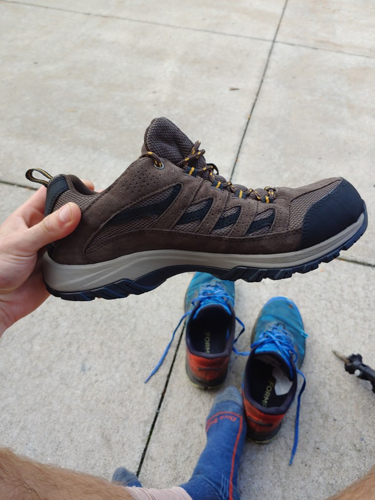
Pennsylvania is referred to amongst the thru-hiking community as “Rocksylvania” due to the abundance of small rocks that make up the trail surface for much of the state. With over 600 miles of wear and tear on them, my tattered trail runners were ready to be replaced. Expecting this in advance, I had a new pair mailed to meet me in DWG along with a food resupply box. Due to a snafu with the postal service however, I received the food but not the shoes, so I left town with my old dilapidated pair of foam and rubber, feeling the point of every rock jabbing up into the soles of my feet.

Knowing this situation required a change sooner rather than later, I studied the map to find a town close to the AT that would have an outdoor store. Two days further down the trail, in Palmerton, there was a retailer who confirmed they had “something you can hike in” available and in my size.
By chance, on the way out of town, I linked up with Frambo who had decided to spend the night at the local church hostel. We hiked together the rest of the day, swapping stories, laughing, and enjoying each other’s company while cranking out twenty miles to reach the Leroy Smith shelter. When we arrived, there was one other hiker, named Gary, setting up for the night who happened to be a fellow Mainer. The three of us ate dinner around the fire ring, discussing worldly topics, and then retired to our tents.

With differing goals guiding our plans, we each left separately the next morning. Pushing through the foot pain, I hiked solo for the next 15 miles, mostly following along an open ridgeline. Looking down to my right, I could see the farmlands and factories slowly give way to my destination of Palmerton which was visible off in the distance. Stopping to survey the land, I snapped a few pictures before descending the steep and rocky Lehigh Gap then walked into town along the idyllic Main Street to reach “My Store”. With new shoes on my feet, I ventured around to fill up on town food, and stopped at the post office to mail home the old pair for my collection.


Just outside of town was the George Outerbridge shelter where Gary had mentioned planning to stop for the night. We all had discussed our fondness and longing for New England style IPA beer the night before and, since it was a Friday night and a beer store was within a short walk, I grabbed a four pack, a bag of ice, and hand carried the boozy goodness another three miles through town and up to the shelter. Needless to say, Gary and Frambo were pleasantly surprised by my canned care package, and we all sat sipping cold brews as the sun began to set, listening to the competing sounds of chirping insects against the murmur of a high school football game announcer off in the distance.
Having filmed myself while hiking some of the New Hampshire 4000 footers, I thought it would good to capture my AT hike the same way. Each day I had been recording bits of my journey to look back on in the future. Before the hike, I upgraded to a newer camera that captured better images but came with some annoying bugs. My frustrations peaked one afternoon when I pressed record but instead the camera turned off on its own. Slightly irritated, I got it to turn on again only to realize that the memory card had been corrupted and I had lost weeks of footage.
After multiple loud outbursts into the empty wilderness, my temper slowly subsided and I continued down the trail, swearing to myself silently as I blew past a pair of day hikers. All I could do was keep hiking and focus on moving forward. The anger, although an unpleasant feeling, added about a half mile an hour to my pace and made the rest of the day go by quickly.

Things improved that evening as I arrived at the Eckville shelter. One hundred yards away from where the trail crosses a paved road, you’ll find this shelter which is a private piece of land that is free for thru-hikers to use for camping. Running low on fuel, I was weighing my options for getting to a store to resupply the following day but at dinner Hoon, another south bounder, offered up his spare canister saving me the lengthy detour.
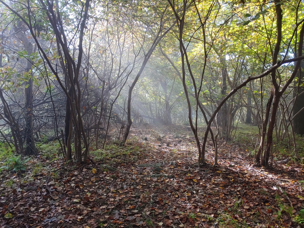
A light rain fell that night, and I awoke to another foggy drizzle filled day. The weather was a mixture of fog, mist, and “slow rain” for the bulk of my time in Pennsylvania. Most days I would walk right past any viewpoints because the lack of visibility meant the extra footsteps would be in vain. The tedium of walking along a loose stone covered trail made the hours drag on. Focusing on maintaining balance while keeping my eyes locked in front of me to avoid an ankle-spraining, hike-ending fall meant most of the day was spent looking down and six feet ahead at all times.
Before leaving to hike the AT, people asked me questions about my preparations and gear choices. I often was asked how I would handle a bear sighting but had always stated that people, more than animals, gave me a reason for concern while on trail. This fear was understood by more people this fall during the national manhunt for Brian Laundrie when it was thought he was using the Appalachian Trail as a means of evading authorities.

After a particularly long day of hiking alone in dense secluded woods, without seeing another person for hours, I ventured down a one-third mile side trail just as dusk was setting in. By cell phone light I approached the Eagle’s Nest shelter and noticed another person inside. I said “Hello” but knew instantly the figure in the shelter was not a thru-hiker. Rummaging through my pack, I grabbed my headlamp and took a few stretches, looking around with my light scanning to assess my situation. Noticing that the other guest lacked proper hiking attire, and given the incoherent nature of his conversation, I decided to make my exit.

Gathering my gear into my bag, I expressed the need to go find a more suitable tent site away from the shelter. In short haste, I silently proceeded back to the main trail. It was dark by now and the unexpected run-in had me startled and unsure where to go. Without an obvious option presenting itself, I continued into the night, hiking with the eerie feeling of being followed and stopping often to look behind me and listen for any noise beyond the worry in my head.
It was close to ten o’clock when I decided to stealth camp at a random foggy clearing set a few hundred yards off the trail. My tent was soaked from the night before and the stress of the evening zapped my appetite. I had been hiking for fourteen hours, making it my biggest day up to that point, slightly further than a marathon. After 26.4 miles on trail, I was tired and feeling defeated. I crawled into my quilt, and shut my eyes, waiting for sleep to take me away to dreamland.

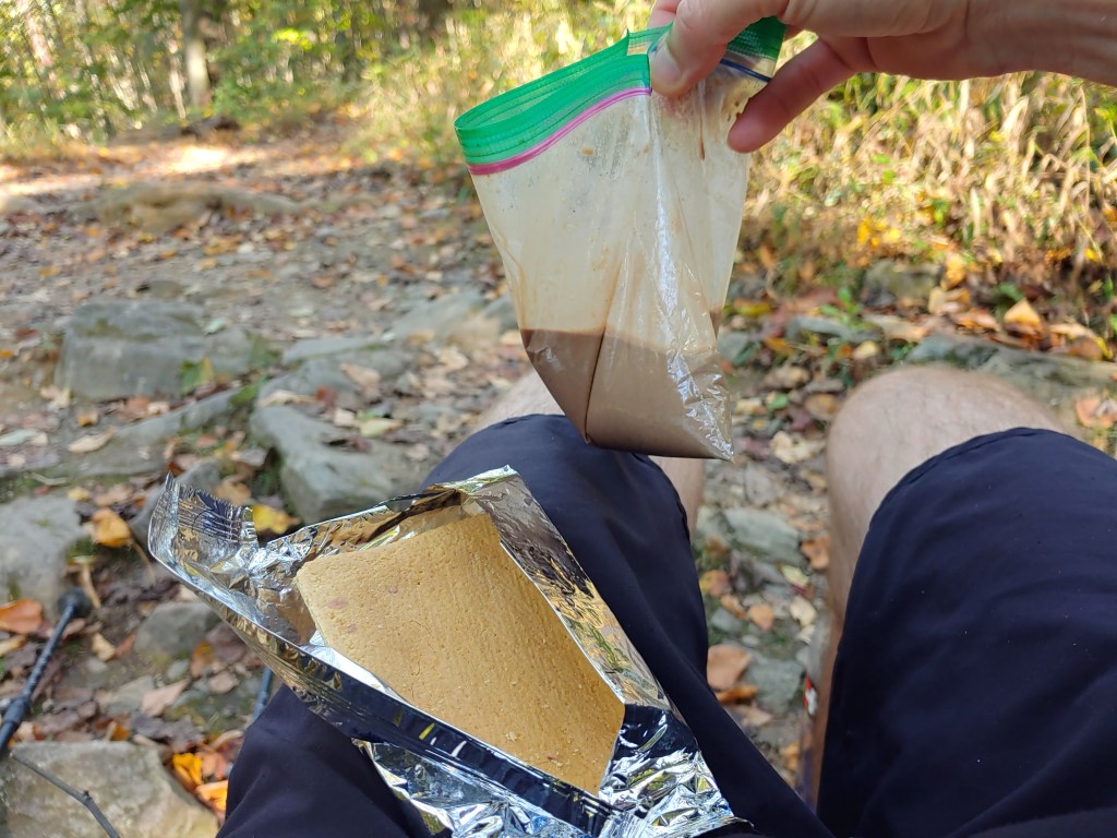
Back home in Maine, my parents had been helping mail my food resupply boxes and tracking my daily progress on the map. Seeing I was near the fifty percent mark, we made plans to meet at Pine Grove Furnace State Park which houses an Appalachian Trail Museum and is roughly the halfway point of the AT. I thought it would be nice to have my family there for a big milestone but also to have them witness and cheer me on during the only challenge of my hike that involves sitting. I am talking about the infamous Half Gallon Challenge, which the self-enforced rules require that the hiker “must consume a half gallon of ice cream in under one hour” to successfully complete the challenge.
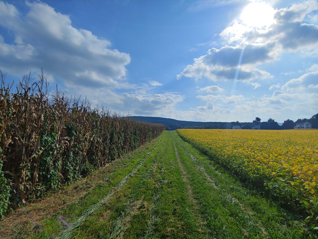
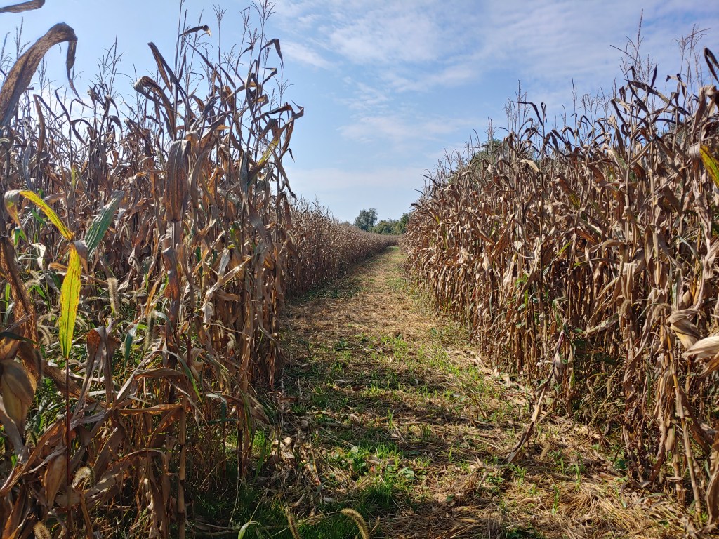
Before reaching the state park, the trail passes through Boiling Springs which gets its name from a prominent natural spring that feeds a lake in the center of town. The mostly wooded and rocky trail takes a delightful detour and, for roughly a dozen miles near town, the AT passes along massive open farmland. Hiking between fields of corn and soy beans as the sun peeked out from behind the clouds, I stopped and savored the beauty, allowing the moment to imprint itself into my memory.
I started the next morning like any other, awake in my tent before sunrise, stretching briefly before rising to fetch and filter water. Water was destined for my daily “first breakfast”, consisting of instant coffee with breakfast powder packets and pop tarts, except that each bite into my maple cinnamon sugar pastry tasted different on this morning. The excitement of seeing my family after weeks apart and the upcoming achievement of hiking close to 1100 miles to get there brought me happiness and a sense of validation. Reassurance that I would be able to see this to the end.

The state park was bustling on Saturday morning with fall festival visitors bouncing between vendor tents but, through the crowd, I could spot two familiar outlines. Hugs and hellos were exchanged with my beaming parents before we walked together along the paved sidewalk the trail follows. We visited the museum before making our way over to the main event for the day, the Half Gallon Challenge.
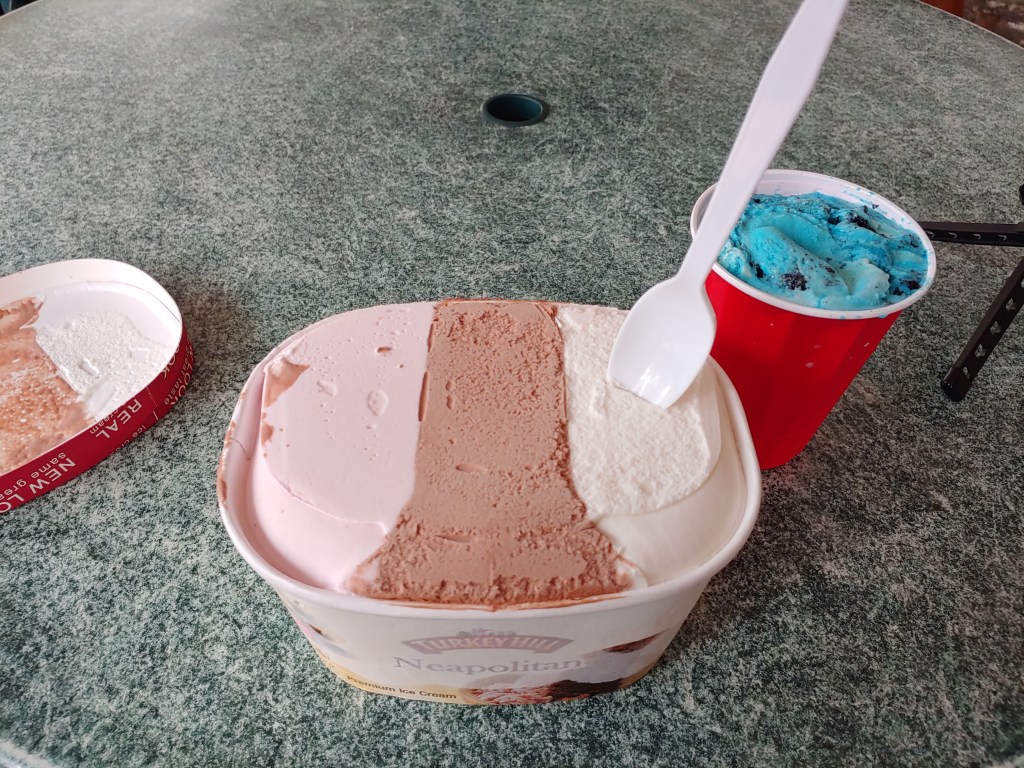
It was about noon when I picked out my flavor choices from the limited options at the General Store. Due to rising fuel prices, ice cream servings are smaller than in the past, so contestants pick out a large carton plus a plastic party cup filled up to the top to make an entire half gallon. My large portion was a classic flavor, Neapolitan, but my small portion was something called “Blue Tornado” (basically cotton candy with cookie bits).
A curious crowd formed as I drove my plastic spoon into the mostly frozen solid block of sugar and cream. I had planned accordingly and skipped out on my “second breakfast” and lunch so that my hiker hunger was sure to help out. My technique involved warming the outer edge of the carton with my hands and scooping in a circular manner to get at the softened deliciousness as it began to melt. My family/cheering squad proved their support by assisting with hot coffee delivery and being there for every bite.
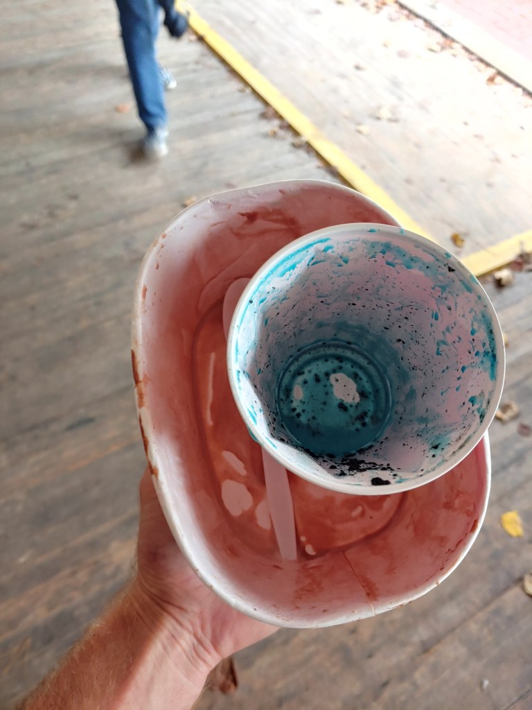
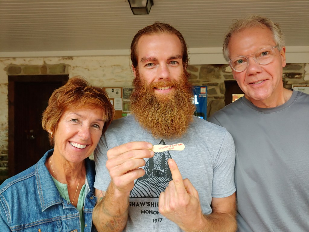
Only forty-four brain freezing minutes later and to the sound of applause from passing onlookers, I finished the last spoonful and took a bow in front of my adoring audience. Grinning happily, I went inside the general store to retrieve my prize and returned with my tiny wooden commemorative spoon…it was totally worth it!
Pine Grove Furnace isn’t the actual halfway point of the AT and, given it was only a few miles more to get there, I grabbed my pack, threw on my poncho, and hit the trail as the drizzle progressed into a steady rain. My parents planned to meet me at Shippensburg Road and, fueled by the 2500 calories of pure sugar I consumed only moments prior, I hiked the 8.5 mile distance in a little over two hours.
The Boston family spent the next 48 hours together in Gettysburg, sightseeing and shopping along the historic downtown before strolling through history on the reverent battlefield at sunset. It had been four weeks since I last took a day off from hiking and, over the course of those 28 days, I had hiked an average of eighteen miles a day. Without question, the zero day was well deserved and much welcomed.
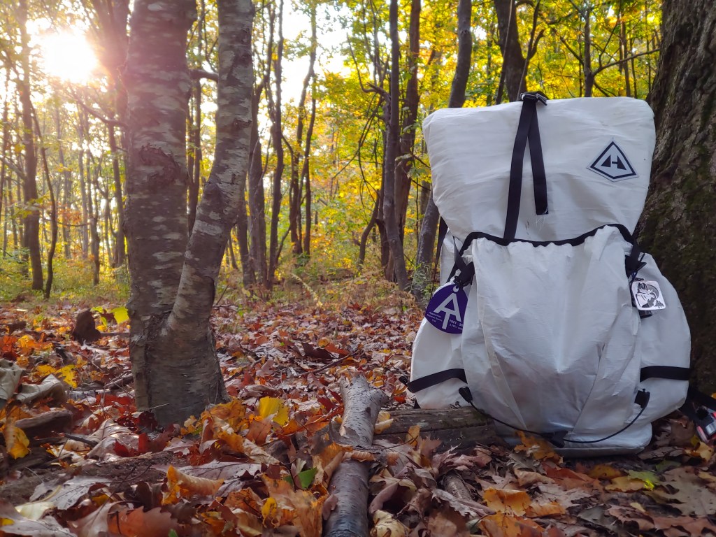
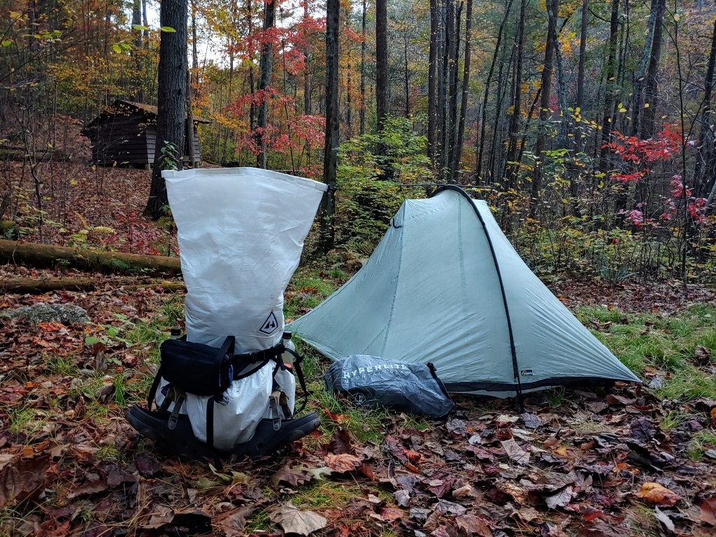
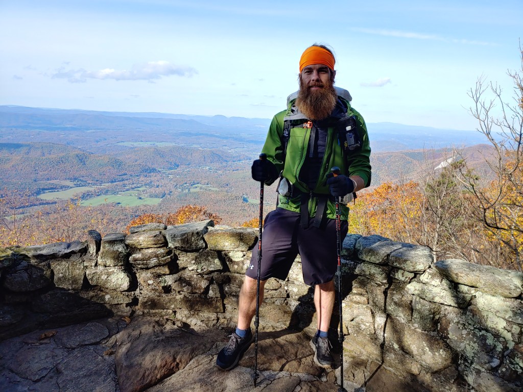
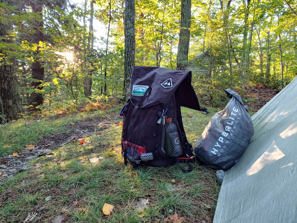
As a field tester for Hyperlite Mountain Gear, I have been providing feedback on new designs they’ve had me test during my thru-hike. Hyperlite wanted to see how a new type of Dyneema fabric would hold up in the wild so at the halfway point I swapped out my beloved black Windrider with a shiny new white Northrim pack.
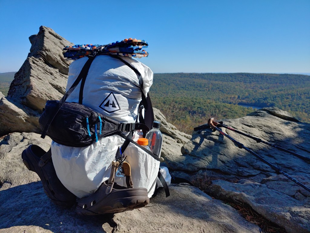
It was bittersweet timing to exchange backpacks at the midpoint because I was at a crossroads with my hiking experience. My black bag represented the time on trail spent learning how to get this far. I shared blood, sweat and tears with that bag as we both got through the hardest part of the trail together. Now after reaching halfway, I could regroup knowing all the lessons learned up to this point. The new white pack was a clean slate on which to keep improving my methods. A blank canvas yet to be filled…and stained.
Monday afternoon, I was returned to the road crossing after a scrumptious meal of biscuits and gravy. I hoisted my restocked pack from the trunk, saying one last goodbye to my parents as I set off down the trail, gloating on having reached halfway, and wondering what the next half would bring me. The time off spent with my family in Gettysburg felt like a major celebration. Even though there were still roughly thirty miles remaining in Pennsylvania, my attention turned to what lay beyond. I felt the difficulties already faced had strengthened my drive to see what else I was capable of doing.
The weather through most of the state was wet and miserable but during my zero day the air turned cool and crisp. I took my time and enjoyed the clear skies as I thought about the next difficulty ahead. In two days, I planned to do something I never believed I would be capable of attempting. The Four State Challenge, a twenty-four hour, forty-four mile test of a thru-hiker’s endurance.

Setting my sights on Pen-Mar park, I cruised through the rest of Pennsylvania so fixated on this next hurdle that I almost walked right past the Mason Dixon line. It was a warm Tuesday evening as the sun was setting when I reached Maryland. Happily leaving Yankee territory and setting foot back in the south, I felt like I’d walked home.
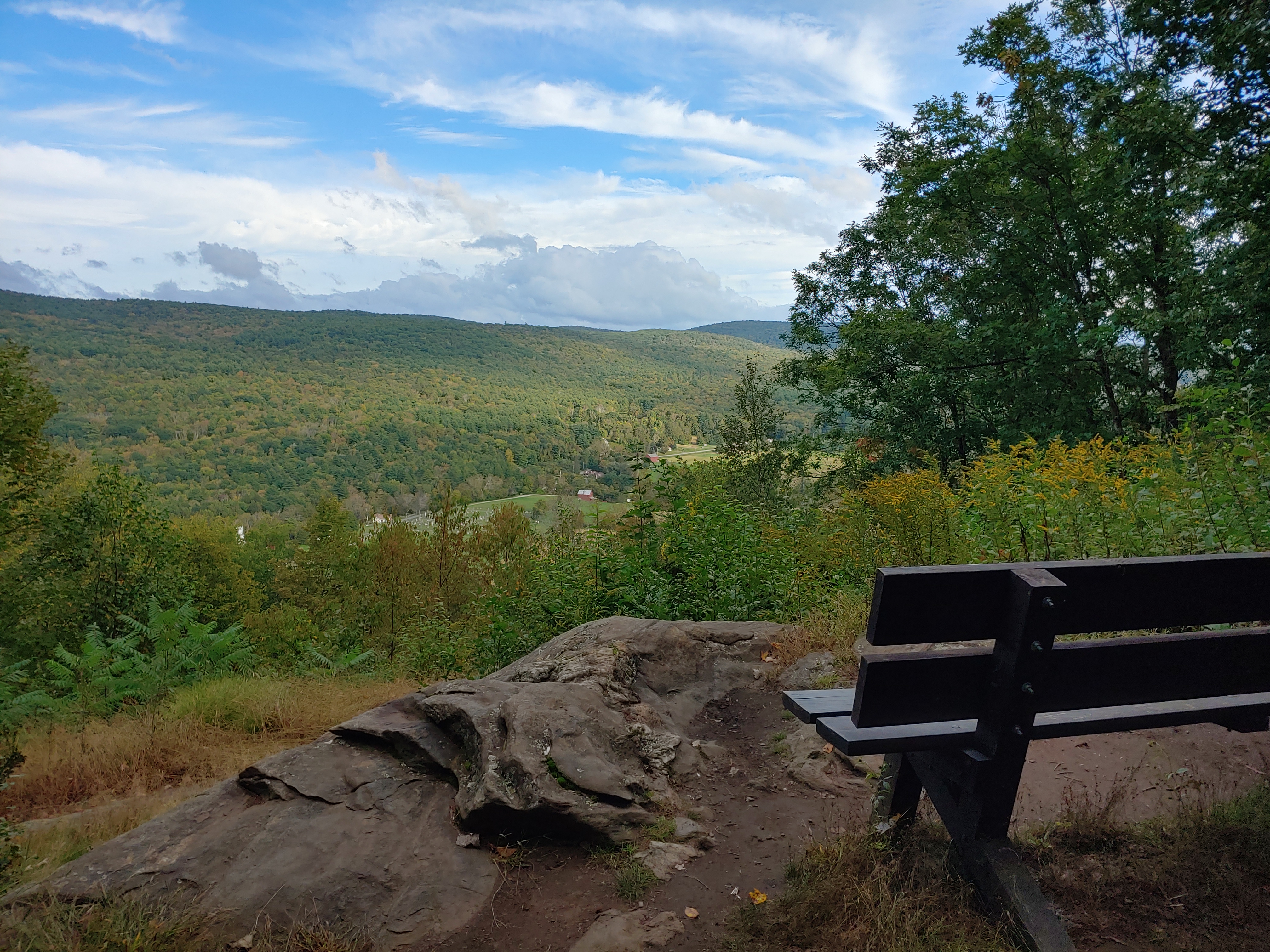
Cresting the grassy hill, I sat on an old wooden park bench underneath an American flag flapping in the humid breeze. I thought about the unpleasant history of our country represented by this spot and how, for me, it will become a place of pride. At this point on the trail, I had gone further than I ever imagined, and in less than twelve hours, this would be the spot where I continued on to go further than ever before. Taking it one step at a time while learning from the past.


AT Week 9_New Jersey

My favorite season of the year is fall which is why I chose to do a southbound hike, hoping that the majority of my trek would be done during the autumn timeframe. Consequently, because I was out on the trail hiking, I was also missing all the fairs, festivals and activities that traditionally happen back home in September and October. But that all changed in New Jersey.
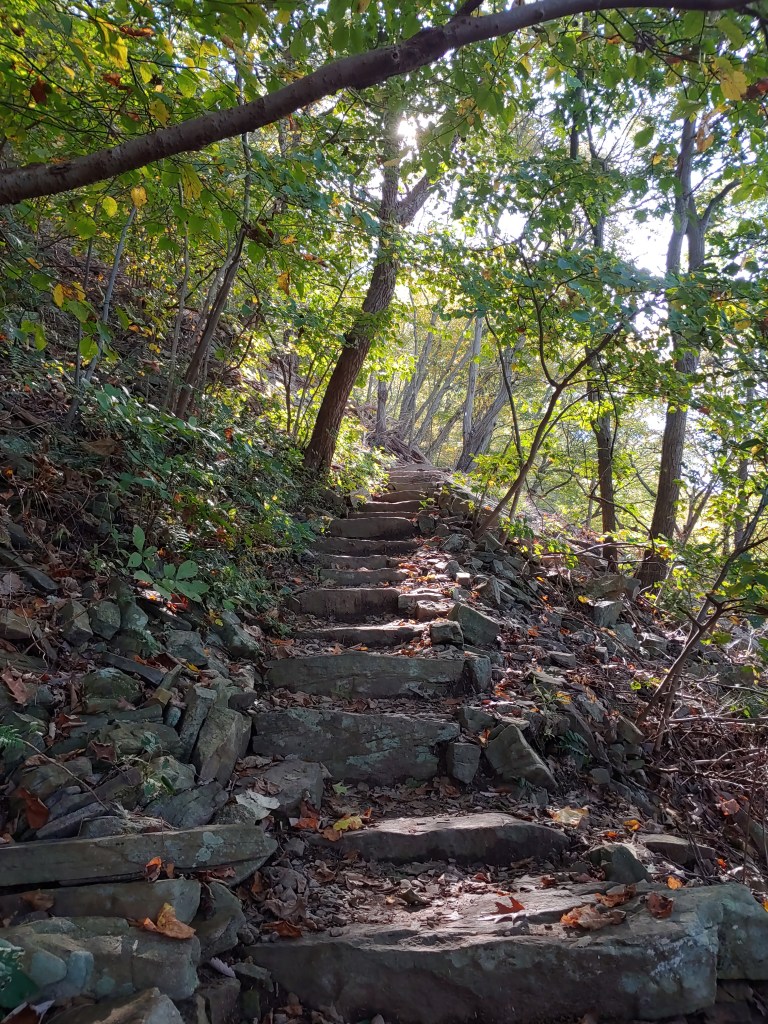
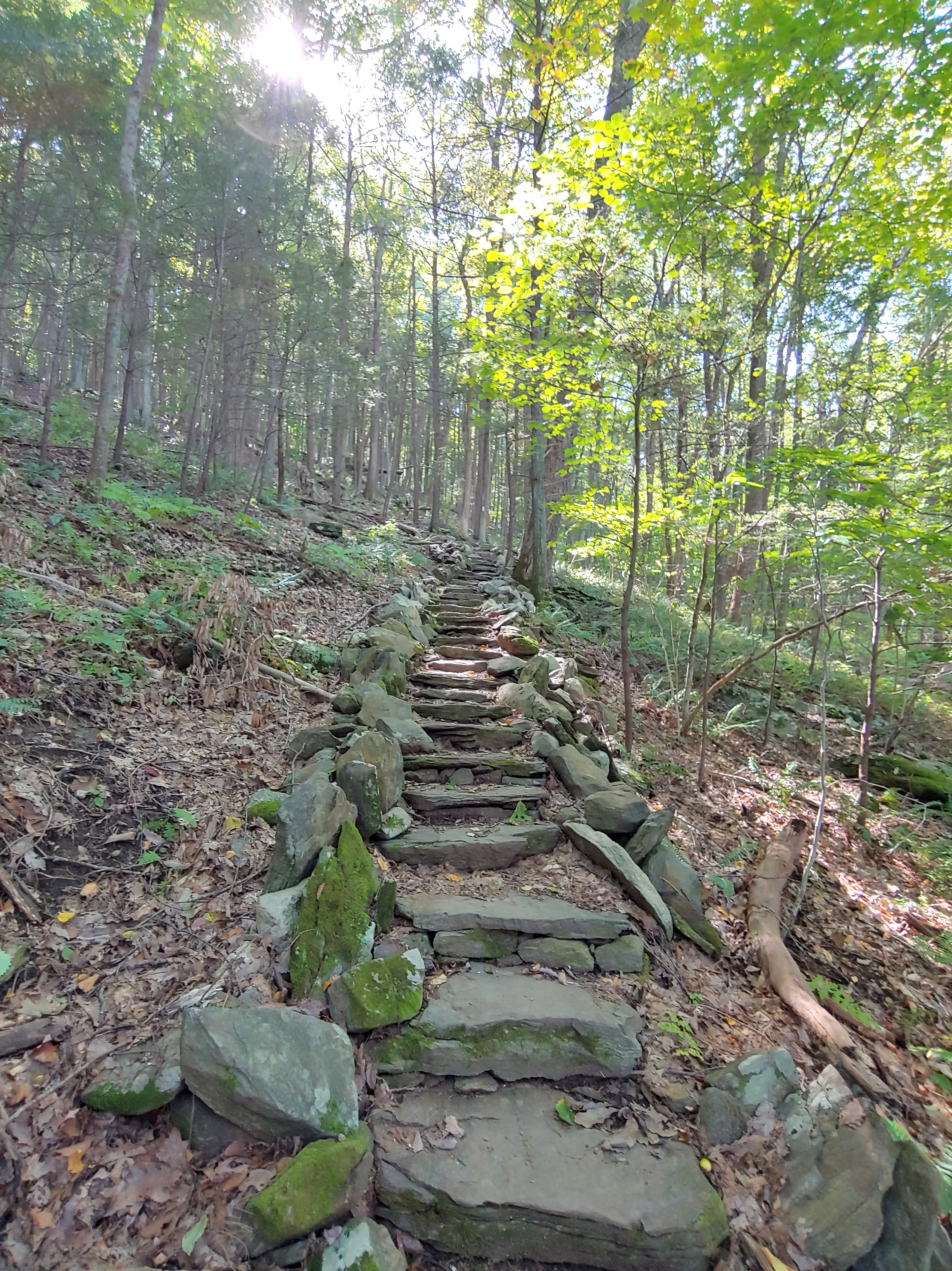
At around ten o’clock one morning, I emerged from the trees after hiking down the Stairway to Heaven, a steep stone staircase that’s a very popular day hike, and was surprised to see a large ferris wheel off in the distance. Intrigued by the sighting, I walked down the road over to the Happy Hill Farm where hundreds of flannel-clad locals were enjoying a Sunday full of fall festivities. Excited by the sights, sounds, smells, and not wanting to miss the opportunity for gluttonous eating, I decided to stop in for a second breakfast. Dodging past the crowds, I made my rounds through the fairgrounds and bought some fried apple donuts, maple yogurt milkshake, a greasy corn dog, and fire roasted meat on a stick to munch on before returning back to the trail.

Even though I was hundreds of miles away from home, the modern technology that keeps me connected crept up and got in the way of my progress. Because of a cell phone, I was able to find out some unfortunate news that set my day into a semi-tailspin, so I decided to turn my phone off and just focus on the task at hand, which was hiking.

Leaving the fairgrounds, I reunited with the trail by passing through a large cow pasture with a sign warning not to approach the cattle. Putting my head down and “pounding the pavement” were techniques that seemed to work for a short while but you can only avoid your frustrations for so long before they creep back up on you.

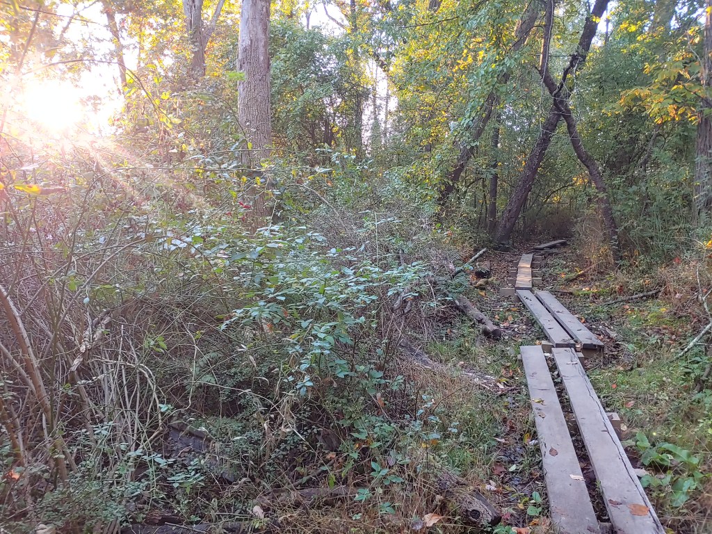
After the farm, the trail followed elevated boardwalks that cut through low boggy wetlands. Adding to my frustrations for the day were swarms of mosquitoes and black flies. No matter how rapidly I swatted at my face, arms and neck or at what pace I hiked down the trail, I was constantly feeling the itch-inducing stings and pestering facial assault from the annoying insects. My poorly choreographed and only partially effective bug repellent dance amplified my discontentment for the day. Multiple times I stopped in my tracks feeling defeated, slamming my poles into the ground. Yelling many expletives into the silently empty woods seemed to work as a check valve on my building exasperation.

The northern section of the AT in New Jersey hovers along the border with New York. Because my discomfort led to a faster than normal pace, after checking the map I noticed that I was coming up on the small town of Unionville, New York. Still with plenty of time left in the day, I decided to stop and take a break in town. I arrived at the aptly named Wits End Tavern and dropped my pack outside under a table. Another thru hiker, Buellit, was inside charging his phone by an outlet. I pulled out my electronics to follow suit, introduced myself, bought us a round of beers, and we struck up a conversation.
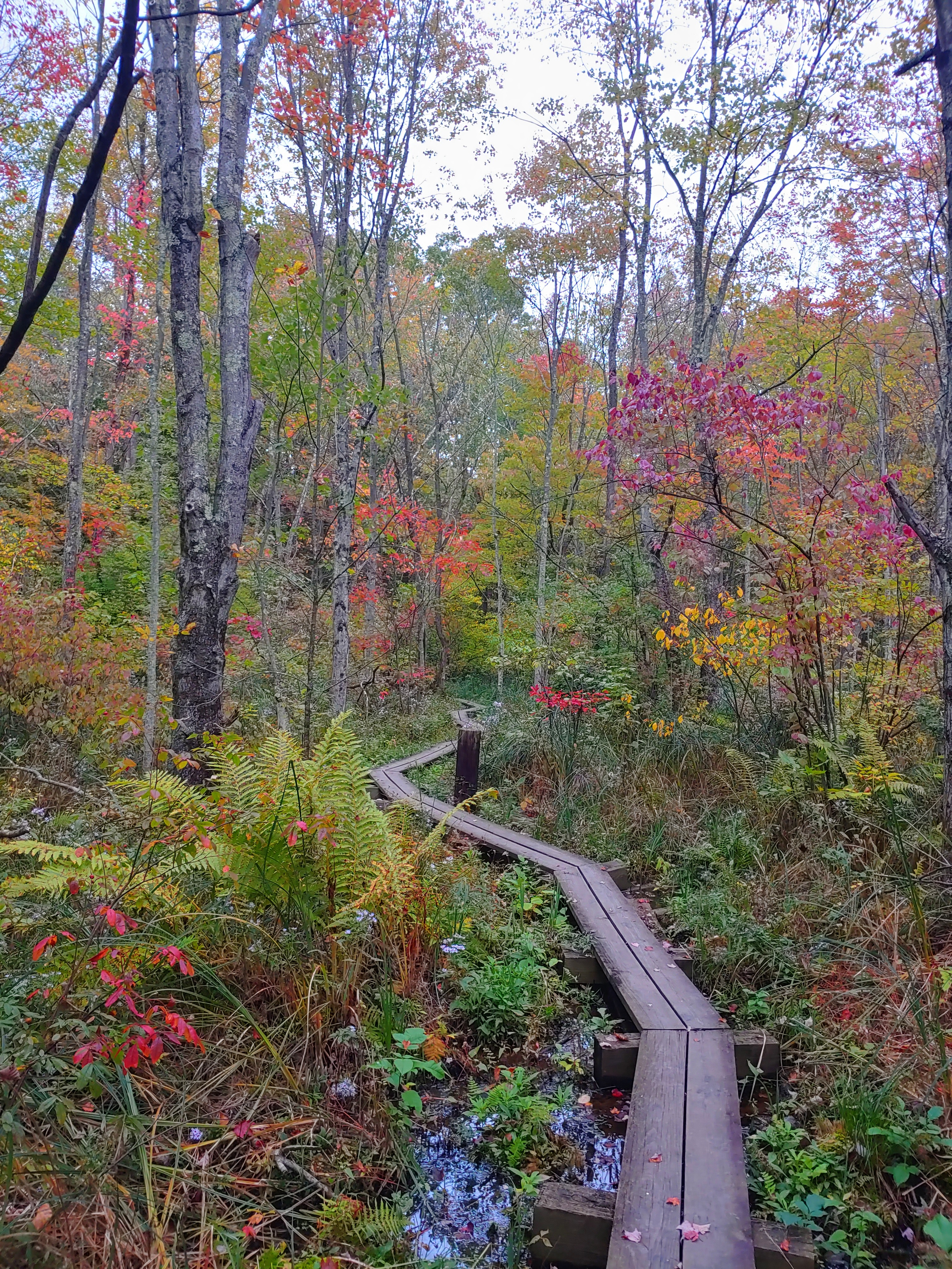
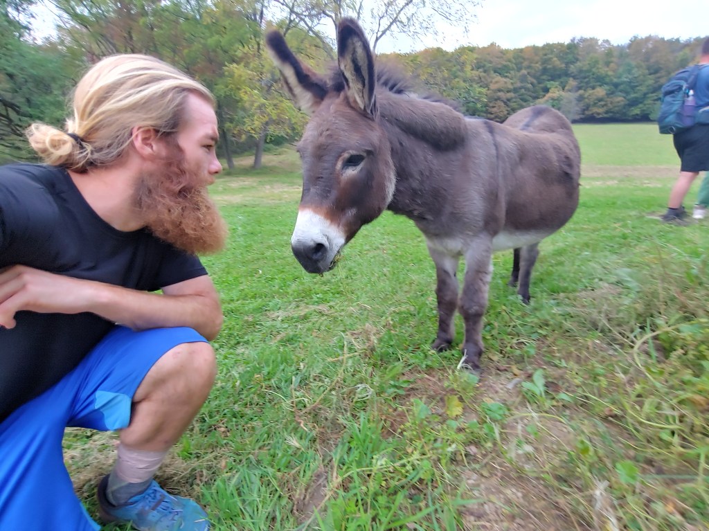
After a few more rounds, I grabbed my pack and headed out of town to my final stop for the evening, the “Secret Shelter”. Following boardwalks flowing past colorful foliage, the trail crossed a dirt road where a small sign directed me to the right. My accommodations for the evening were neither secret nor a shelter but rather a private cabin on an idyllic small farm that is made accessible to passing thru-hikers by the land owner. Jim Murray has opened his property to the hiker community for over 30 years and provides lodging, water, and electricity free of charge. Aside from the short-term AT residents, a handsome donkey named Jake lives here full time. I brushed his fur and hand-fed him wildflowers so, needless to say, we formed a quick friendship. By staying in the cabin, I awoke the next morning well rested and dry, having avoided the heavy rains that passed through overnight.
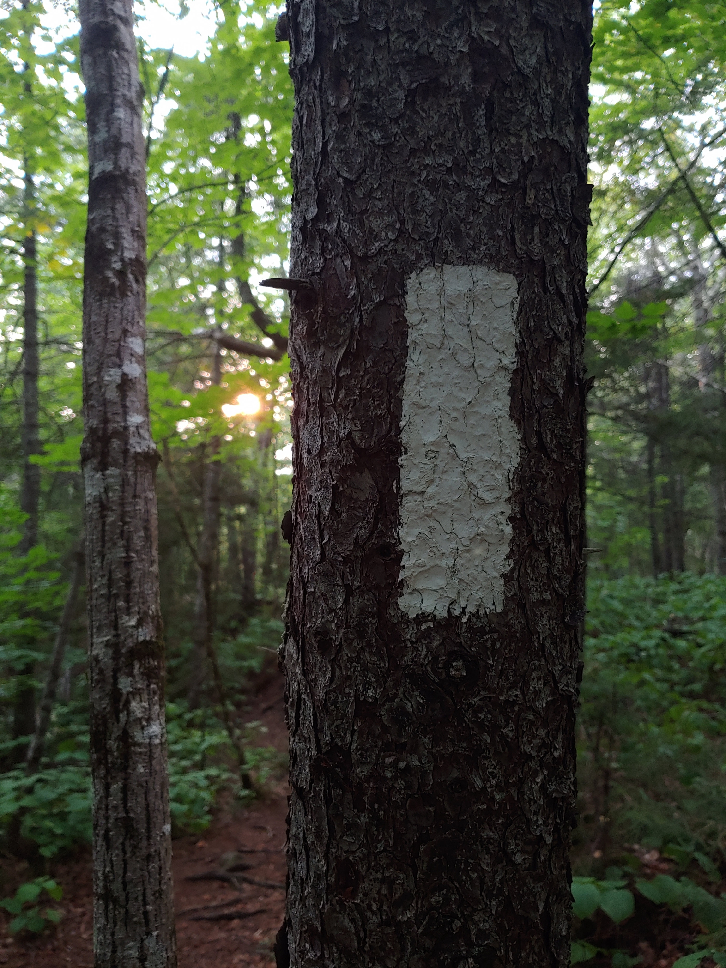
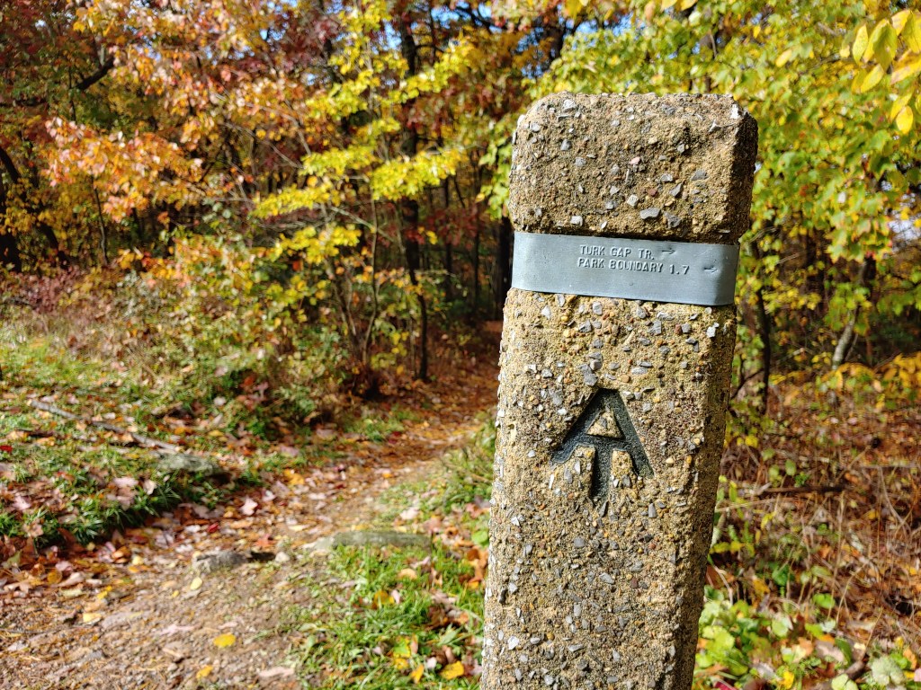
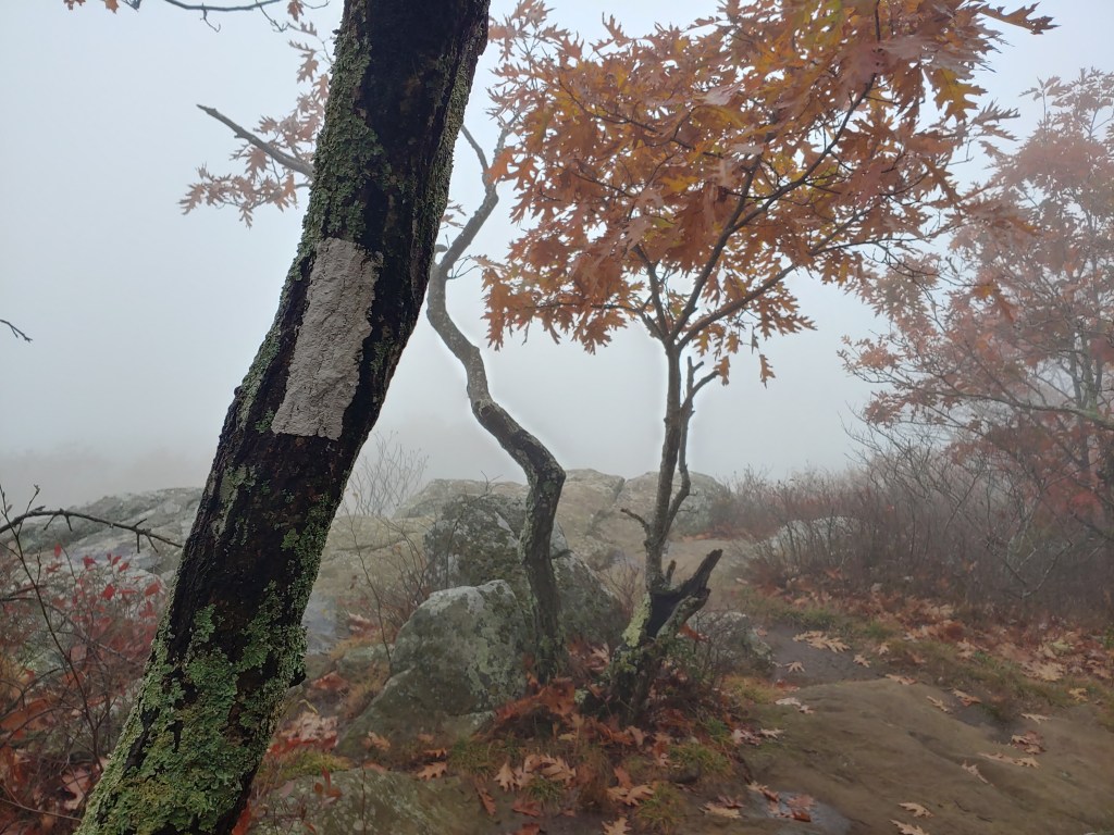
The Appalachian Trail is known for using blazes or vertically painted stripes on trees to help guide hikers. Traditionally, white blazes are used solely to denote the path that the AT takes from Maine to Georgia. Often times you will encounter blue blazes which indicate side paths that lead out to viewpoints, summits the AT skips past, or trails leading down to parking areas. Trail lingo also includes the term “yellow blazing” which is used to describe avoiding sections of the trail on foot and instead driving ahead in a car. The yellow dashes in the middle of the roadway signify the blazes that they’re following. Another lesser talked about blaze color that I’ve heard on trail is “pink blazing”, but maybe you can check Urban Dictionary for that definition on your own.
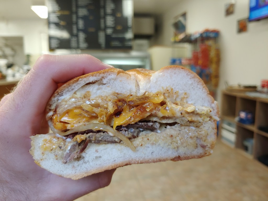
Something I was very excited about through New York and New Jersey was the concept of “Deli blazing” where you stop at the many sandwich shops and delis that are relatively close to the trail to avoid carrying a heavier pack full of food. One such morning, I stopped at the Sandwich Lobby, which is quite literally a stone’s throw away from the trail as you cross Route 206 at Culvers Gap. The owner, Latifah, greeted me as I walked in and I immediately was overwhelmed by the delicious smell of smoked meat in the air. She explained that for lunch time they would be serving a southern style BBQ menu. I ordered a steak, egg and cheese sandwich, large coffee and ate my tasty breakfast inside the warm store.
Given that my food bag was running low and since they had some light resupply options, I bought a few things from their ‘camp store’ and also ordered a sandwich to go. Later, as I was hiking away, the wind was blowing from behind when I kept noticing a lovely fragrance in the air. A very pleasing aroma of smoked brisket and barbecue chicken kept reminding me of my morning detour. Hiking along a ridge the entire day, I hadn’t yet picked exactly where I would be camping for the night. Knowing I was in bear country and with my clothes and backpack smelling like tasty meats, I decided to push on a little further and not camp up on the ridgeline. Instead, I opted to hike the extra miles to the Mohican Outdoor Center where I could sleep safely indoors away from the clenches of a hungry bear’s jaw.

At the main lodge building, I ran into a hiker named Frambo who I had seen twice before. The first time we met was in the 100 Mile Wilderness back in August and the second time had been just a few days prior as he was heading north in New York. We shared the four-room cabin with a section hiker and made our dinner in the common area, swapping tales from the trail while lounging on dormitory style couches. Frambo had flip flopped a few sections due to scheduling conflicts but now was completing his thru-hike heading full southbound.
The outdoor center had poor cell signal and advertised having Wi-Fi and a telephone back at the lodge. Being only one of three people in the entire campground felt eerie and the low visibility brought on by thick fog didn’t help alleviate my anxiety. It was after dark but I wanted to check emails and make a few calls so I grabbed my headlamp and began to walk the half mile up to the main building. Scanning the campground, pairs of glowing eyes stared back at me through the dark as I walked. Pausing to inspect the creatures gazing at me, I saw they belonged to bedding deer in the woods, but the sets of green orbs in the trees still left me feeling uneasy.

When I got to the lodge, the lights were on but no one was present. I could connect to the wireless modem but the internet was not working. Looking around, I found the cordless phone and tried calling home but didn’t get a dial tone. Having seen way too many 80’s slasher movies as a kid, my imagination was racing. I was in the middle of the woods, with no phone service, on a stormy night, and staying at an old youth camp started back in the 1950s named after a Native American tribe. I swiftly hustled back to the cabin and retired for the night trying to focus on happier thoughts.
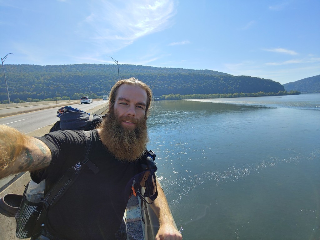
Unvisited by spirits or hockey mask clad killers, I got up early the next morning and was the first one to leave the cabin, heading out into the thick fog and mist that would plague the next few weeks. Frambo caught up later on down the trail near Sunfish Pond and together we hiked the remaining miles out of New Jersey.
It was a busy morning with vehicular traffic flying by as we both walked across the Interstate 80 bridge high above the Delaware River. The numerous lines of heavy tractor trailers caused the bridge to bounce and sway as each barreled past. Stopping in the middle at the brightly painted state border for a photo opportunity, we took each other’s picture and then continued onward to reach our first trail town in Pennsylvania, known as Delaware Water Gap.


AT Week 8_New York

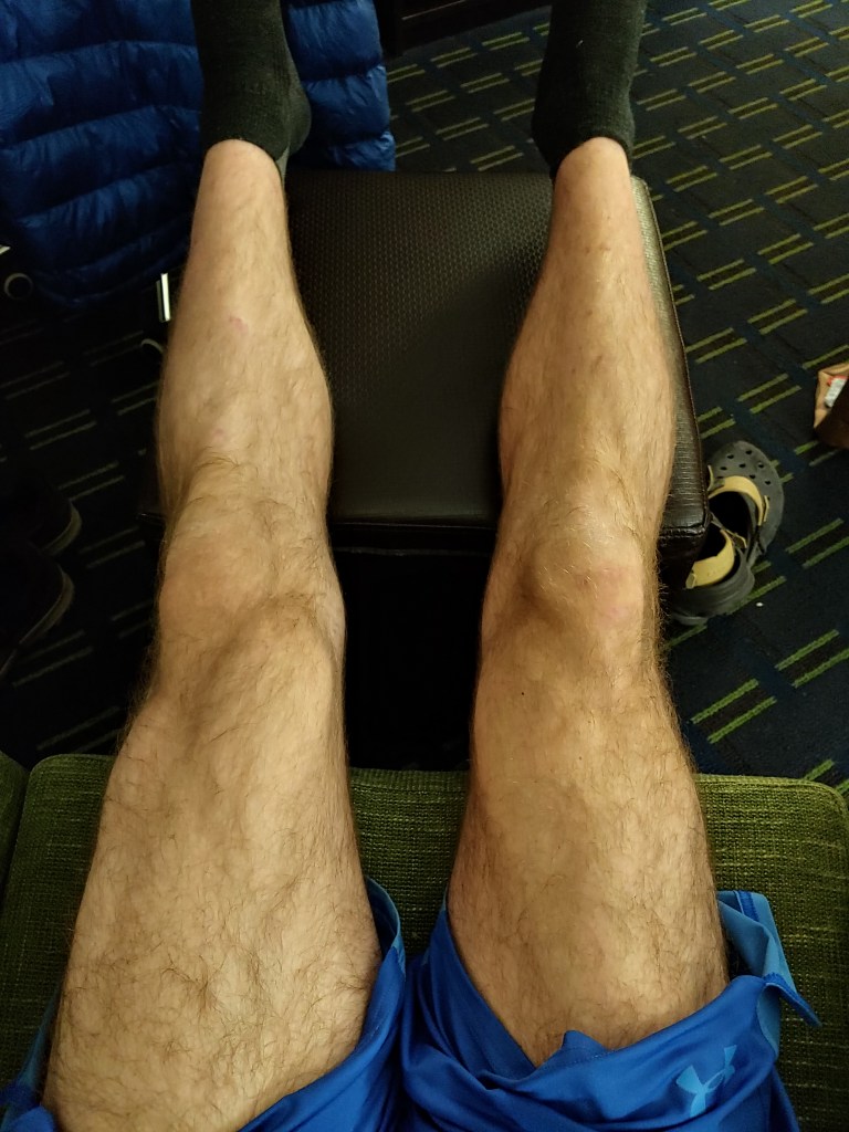
Repeat rounds of pain and swelling that I experienced in Connecticut followed with me into New York. Some evenings I would end my day of hiking and be shocked at the width and fullness of my left leg compared to my right leg. Knowing I had many miles ahead, I slowed my pace down in an effort to prevent further injury, only going as far as I could manage without having to push myself to make the daily mileage.
The trail at times reminded me of walking through an unendingly beautiful park. There were sections with numerous large trees separated by big open spaces with very minimal vegetation growing. In some places there were soft grasses filling the understory that felt out of place in the wooded backcountry. If you threw in a park bench here or there, I would believe it was a remote section of Central Park. Another obvious but welcome difference in New York is that most of the water crossings had a sandy stream bed surface causing the runoff to be very clear and crisp, making for refreshing water breaks.

With the cool fall weather, it had been a few days since I had last made my way into a town to take a shower, but that changed one morning with heavy rains and thunderstorms predicted. Miraculously, in between bursts of thunder and lightning, I received a text message. To my surprise, it was Janet, the trail angel I met in Connecticut. She had seen the stormy forecast and offered to have me stay at her house to rest and clean up inside for the night to avoid the rain.
Ducking under the cover of the Morgan Stewart shelter as the downpours intensified and the sky darkened, I responded to Janet, accepted her generous offer, and we made plans to meet around five o’clock at a particular road crossing. Waiting in the shelter for almost an hour as the rain slowly subsided, I ate my typical spam tortilla lunch and conversed with the two separate groups that were also waiting out the rain. Like clockwork, we all decided around the same time to pack up and head out as the rain subsided. I trudged back on to the wet trail with soggy shoes reassured that my discomfort would be short-lived, knowing there was a warm dry bed awaiting me.
The remainder of my afternoon was occupied by weaving through sloped hillsides, around streams, and crossing many roads including major interstate highways. Shortly before five o’clock, I met up with Janet on the trail. She had hiked a little ways from the trailhead to meet me. We walked back to her car, I hopped in front and we drove about a half hour back to her house.

Once settled in “at home”, Italian takeout was ordered while I got cleaned up and started my laundry. We sat together at the kitchen table discussing life, politics, and sharing much jovial laughter as I munched down on a meat stromboli appetizer along with a side salad, chicken fettuccine alfredo, and many portions of bread. After dinner, I retired for the evening taking care of my usual town chores of charging electronics and packing cleaned clothes while elevating and icing my injured leg.
Filled from a delicious breakfast of bacon, fried eggs and toast the next morning, I was returned back to the trailhead by my extremely gracious and generous host. We said our goodbyes, Janet snapped a photo to send to my mom, and I headed back into the wilderness ready to take on more. Less than a mile into the hike, I climbed up to a sunny rock outcrop with a large painting of the United States flag where I saw a hiker, Osha, who I had first encountered weeks prior. We met at the Vermont state line after separately completing the Long Trail section of the AT. Osha earned that name from a well-meaning and often recited statement he shares with other passing hikers, “Have fun, be safe.”
Reacquainting ourselves briefly on the hilltop, we decided to spend the morning hiking together, given that my pace was reduced with my injury and we both could stand for some talkative company. The terrain wasn’t as challenging that day and we spent the better part of eight to ten hours talking while hiking, regaling each other with the trials and tribulations of the pasts that we left behind to take on this journey. It was quite nice to share some in-depth and personal emotions with a complete stranger. We got to empathize with one another about the hardships we both had faced leading us to the trail. With each step taken and every sentence spoken, we grew closer as friends by sharing the things that identify ourselves as individuals.
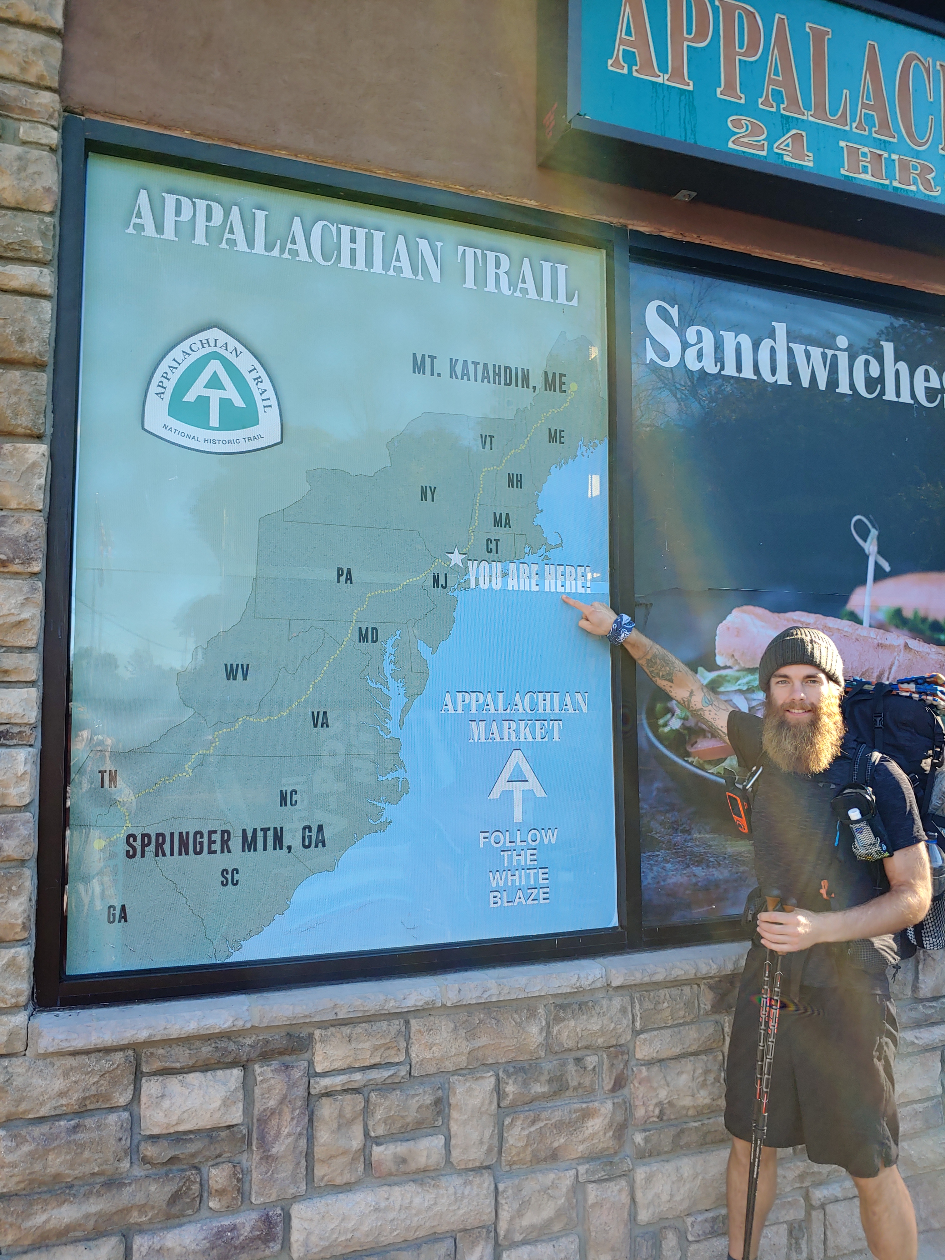
Given the proximity of my next resupply box at the Appalachian Market, Osha and I decided to stay at the nearby Graymoor Spiritual Life Center, a place “dedicated to the reconciliation, or at-one-ment, of people with themselves, each other.” The church allows long distance hikers to camp for free on the baseball field with access to electrical outlets, running water and porta potties. We shared the camp space that night with four other gentlemen who were doing a modified section hike. Two members of their group would park one vehicle at the northern end of the trail section and hike south while the other two would park at the southern end and hike north. Meeting halfway they would exchange car keys and then would regroup at the end of the day. By doing so, they were able to carry fewer supplies and essentially provide their own shuttle while they slack packed the trail.
A quite unexpected and but therapeutic moment happened the following dewey morning when Osha and I came upon the Telephone of the Wind. It’s an old rotary dial telephone posted to a signboard with no connection to the outside world. It’s meant solely to provide individuals a way to reconnect symbolically with lost loved ones by picking up the phone and calling them to help get through a tough time and to make peace with the afterlife.

Last year, around October, a friend of mine that I met at music concerts and who had kept in contact over the years informed me he would be visiting Maine. We made arrangements to have dinner together in Portland. At the restaurant, we shared stories, explaining to each other our past woes and our future hopes. After dinner, standing beside our parked cars on the street, I gave my good friend Chris two hugs as we made plans to go on a camping trip later that month, and we said goodbye to each other. A few days later, I got a missed call from an unknown number and, out of curiosity, I called back. A woman responded. She asked who I was and asked if I knew her brother Chris, at which point her voice started to break. She then informed me, as my stomach tightened into a knot, that two days after our dinner together Chris had died in a tragic car accident.
Fast forward to that day on the trail and I was hiking in New York, Chris’s home state. A sudden upwelling of emotions revisited me as that moment, which I had almost forgotten about, came back into clear focus. I picked up the Telephone of the Wind and made my peace with Chris, while thinking of the camping trip that we had planned to take together. It felt good to wish goodbye to my friend, although I knew no one was on the other end of the line. After sharing many sensitive subjects with Osha the previous day, I was glad to have an experience that felt like closure.
Still without a trail name, I figured my time spent with Osha would eventually land me with a new moniker for which my hike would be remembered. Often I led our two person group hiking through the woods where I would be so lost in conversation and eventually realize that there were no longer any white blazes ahead of me. Consulting the map, we ended up having to backtrack multiple times throughout the day, retracing our steps to the fork in the trail where I’d clearly missed the proper turn. I assumed with my name being “Zac” that Backtrack was going to be a fitting name for me but I never earned such a title.
Looking ahead on the map, one of the spots I was really excited to visit was the Bear Mountain Zoo but unfortunately, after we crossed over the Hudson River, we read a sign saying that it was closed due to construction. We stopped for a lunch break at the Bear Mountain Park and then began hiking the beautifully manicured ascent to the summit. Large granite footsteps made the journey up quick and easy while also providing many picturesque vantage points to admire all the handiwork that went into its construction.
Something I had wanted to do while on the Appalachian Trail was to camp out at the top of a mountain so that I could watch the sunset and sunrise the next morning. Osha and I decided after summiting Bear Mt. that we would stop for the day at Black Mountain, which according to the AWOL guide, has one of the best views of the Big Apple.
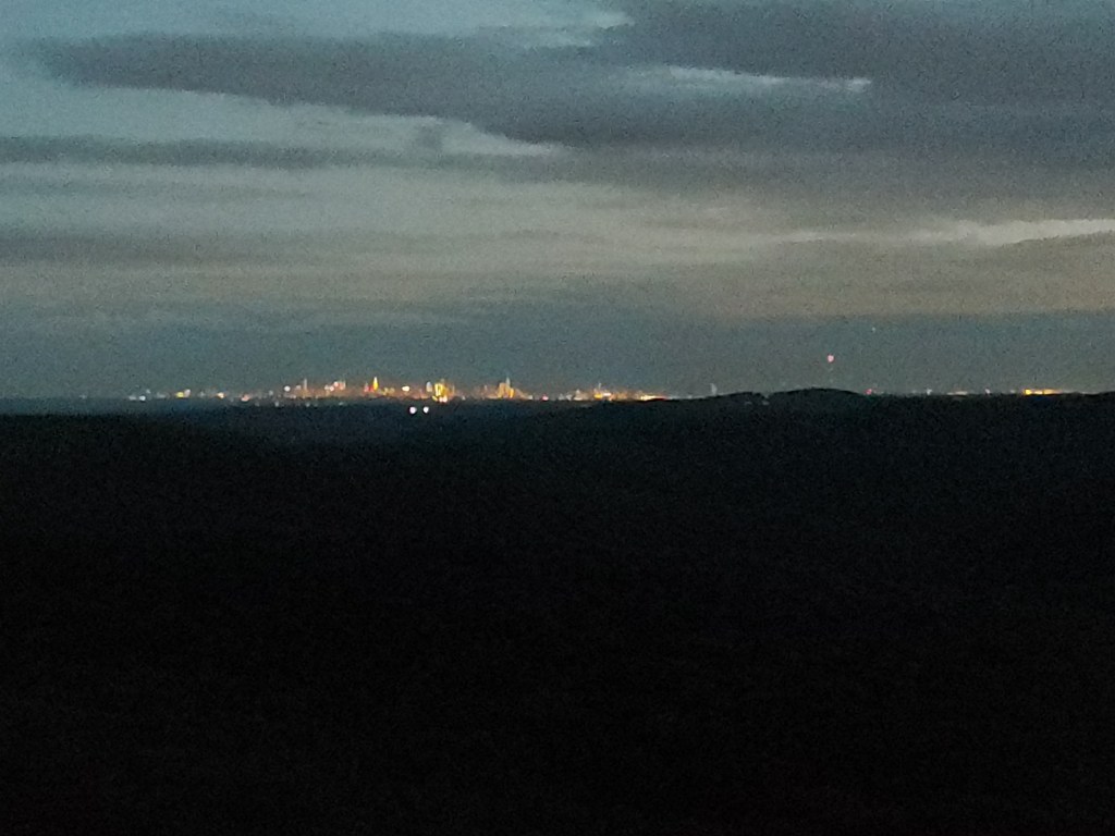
Osha and I reached the top of Black Mt. about an hour before sunset. We both picked a campsite, set up our tents, and started making dinner. Just as I was about to bite into my rehydrated Rice Sides, the sun was starting to create a pink hue in the sky. I set up my GoPro on a time lapse mode and pressed record as we both watched in awe. While we ate, the sky got darker and the New York City skyline started to illuminate. We watched the sky fill with beautiful colors of purple, pink and orange as the stars started to appear.
I had made plans earlier in the week to meet up with my good friend Tom so, on that next morning, Osha and I parted ways, and I hiked ahead to meet up with my friend at a road crossing. Thankfully he didn’t arrive empty-handed and brought tasty trail magic. Tom had ice cold soda and a big bag of sun chips for me to snack on. We chatted for a while as I was filling my face with junk food and, when I was finished, Tom joined me on a brief hike up Buchanan Mt. At the peak, we had some more conversation, gave each other a good hug and said goodbye.
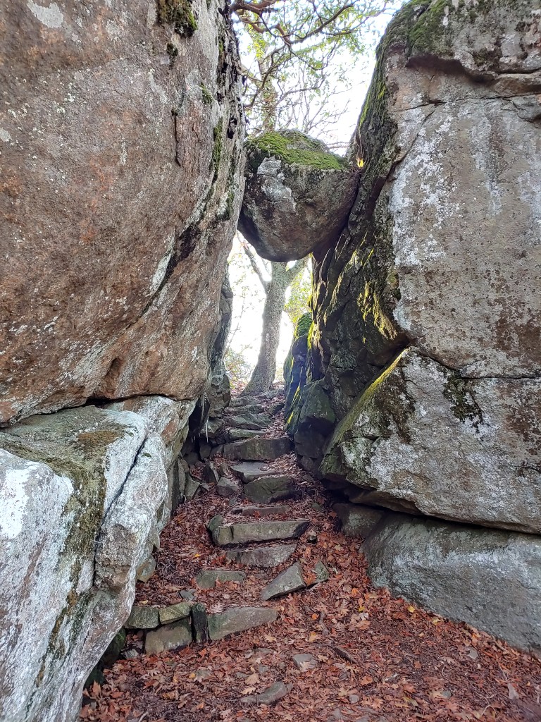
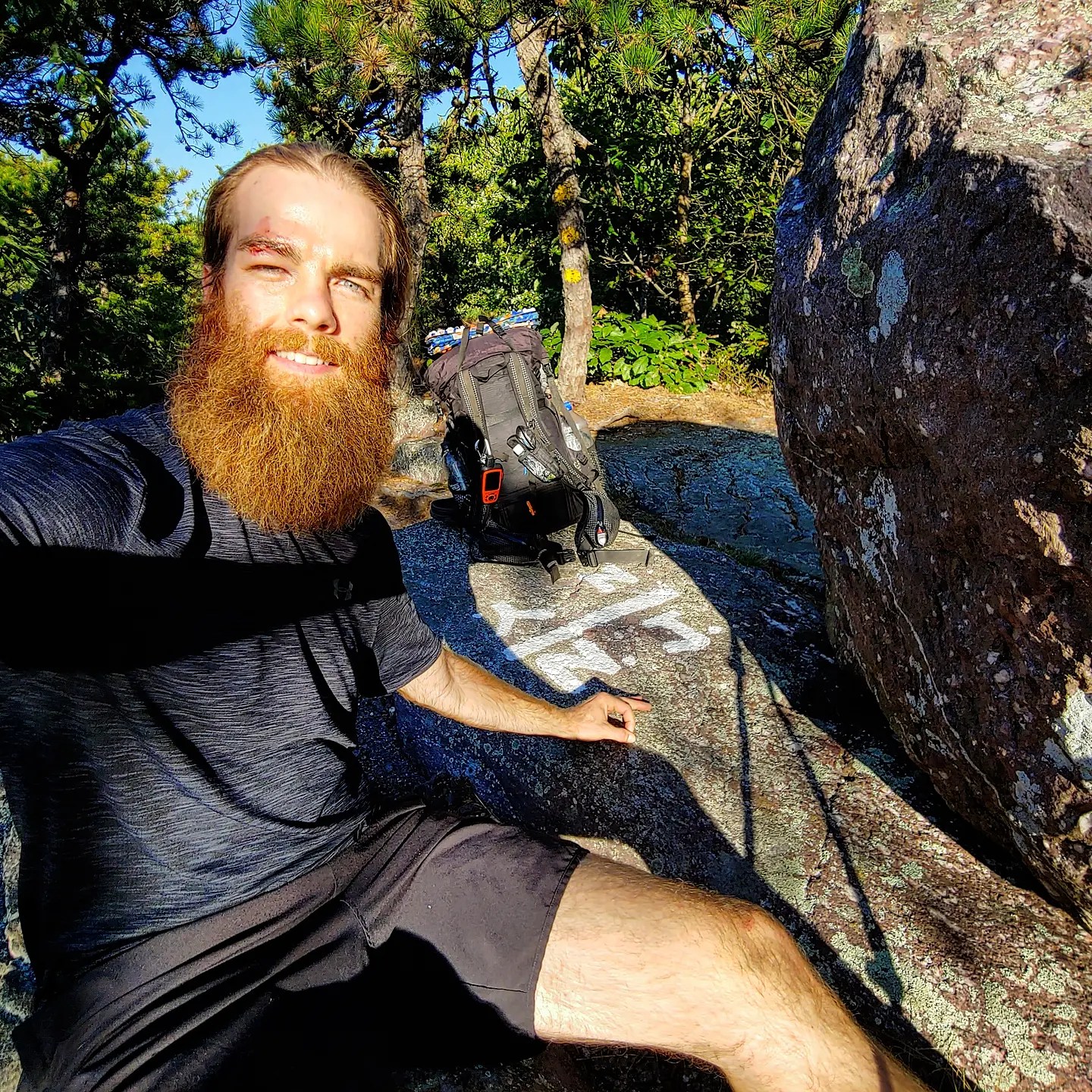
Later that afternoon, I had a brief run in with a large boulder. Two rocks made a narrow passage that caused my foot to get stuck and, as I tried to step forward, I tripped, fell, and my head smacked against the edge of a huge rock. Fearing the worst, I put my hand to my head and, when I withdrew my palm, it was covered in blood. Instinctively, I reached into my bag to grab the first thing I had that was absorbent and started pressing it against my forehead. Shaken up from the fall while out hiking alone, I checked the map and found that I was less than a half mile from the nearest road crossing. Gathering my things that had spilled from my bag, I quickly assessed my injury. Given that it was near my eye, I was very concerned about loss of vision. Quickly and mechanically I grabbed my bag and walked with purpose to the nearest road crossing.
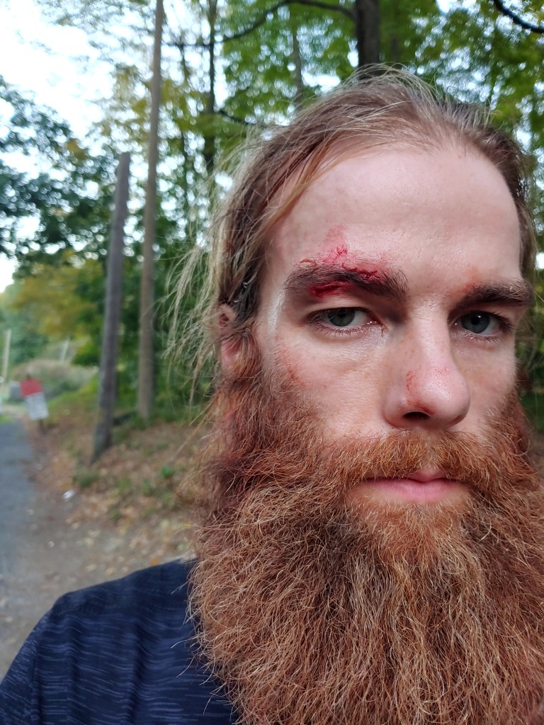
I reached the road as dusk was setting in and multiple cars passed by, ignoring my outstretched thumb. Using my phone’s camera as a mirror, I inspected my injury and determined it was mostly a large gash that had caused the majority of the bleeding and nothing seemed to be broken in my orbital socket. Since the bleeding had stopped and being late at night with limited options for a ride, I decided it would be okay to just clean up the injury roadside, bandage it up and hike the next mile and a half to stay at the nearest shelter for the night.

Concerned about the possibility of an infection near my eye, the next morning I called Tom and made a plan to have him pick me up down the trail and bring me to an urgent care facility. Since it had been more than 12 hours after the fall, protocol says not to suture the cut, so all they could do is clean up the wound and prescribe antibiotics. Patched up, we grabbed coffee and bagels for a late breakfast and he dropped me off back at the trailhead where I resumed my hike. I continued on bobbing in and out of the trees for the rest of the afternoon along a sunny rocky ridge until I reached the seventh state on my journey, New Jersey.
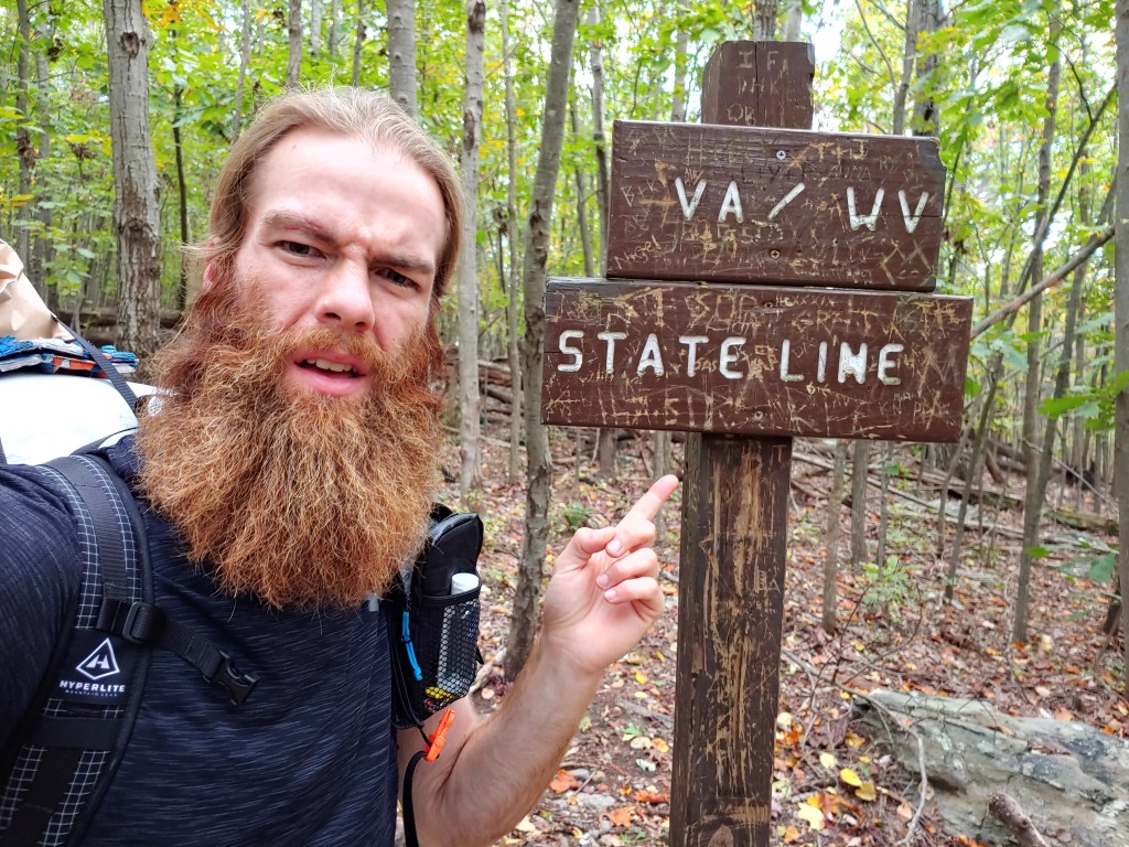
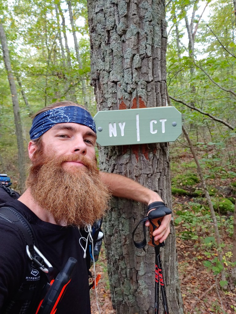
A rudimentary painted NY / NJ sign on a rock indicated my time in New York had ended but not without some good memories, healed wounds, and new scars to show for it. I left walking with my bandaged head held high by the pride of successfully handling what the trail threw at me and excited for what was in store next.


No Room For Elephants
For me, hiking has become an influential exercise in self-determination along with physical and mental toughness. While hiking the Appalachian Trail I have been sharing photos from the trail, blogging my adventures and testing out new product designs for Hyperlite Mountain Gear. I’m privileged to have some of my writing featured on their blog.
We all have a uniquely winding journey to the present point in life. No Room For Elephants; Why I Hike and Keep Hiking was written in an attempt to explain my story.
I hope you enjoy.
My article can be found on the Hyperlite website @ https://www.hyperlitemountaingear.com/blogs/ultralight/no-room-for-elephants-why-i-hike-and-keep-hiking
–
Use code ZBAT15 to save 15% off any Hyperlite pack.
AT Week 7_Massachusetts & Connecticut

Arriving back in North Adams after three days of rest and relaxation, I had a nagging feeling of guilt, having spent time away from my long distance mission. The weather had been exceptional over the weekend and the thought of missing great days of fall hiking and southbound progress weighed heavy on me, so I hastily restarted my journey late Monday afternoon. Graciously my mother had shuttled me the three and a half hours back to the trail and we shared a barbeque lunch together in town before I set off hiking.

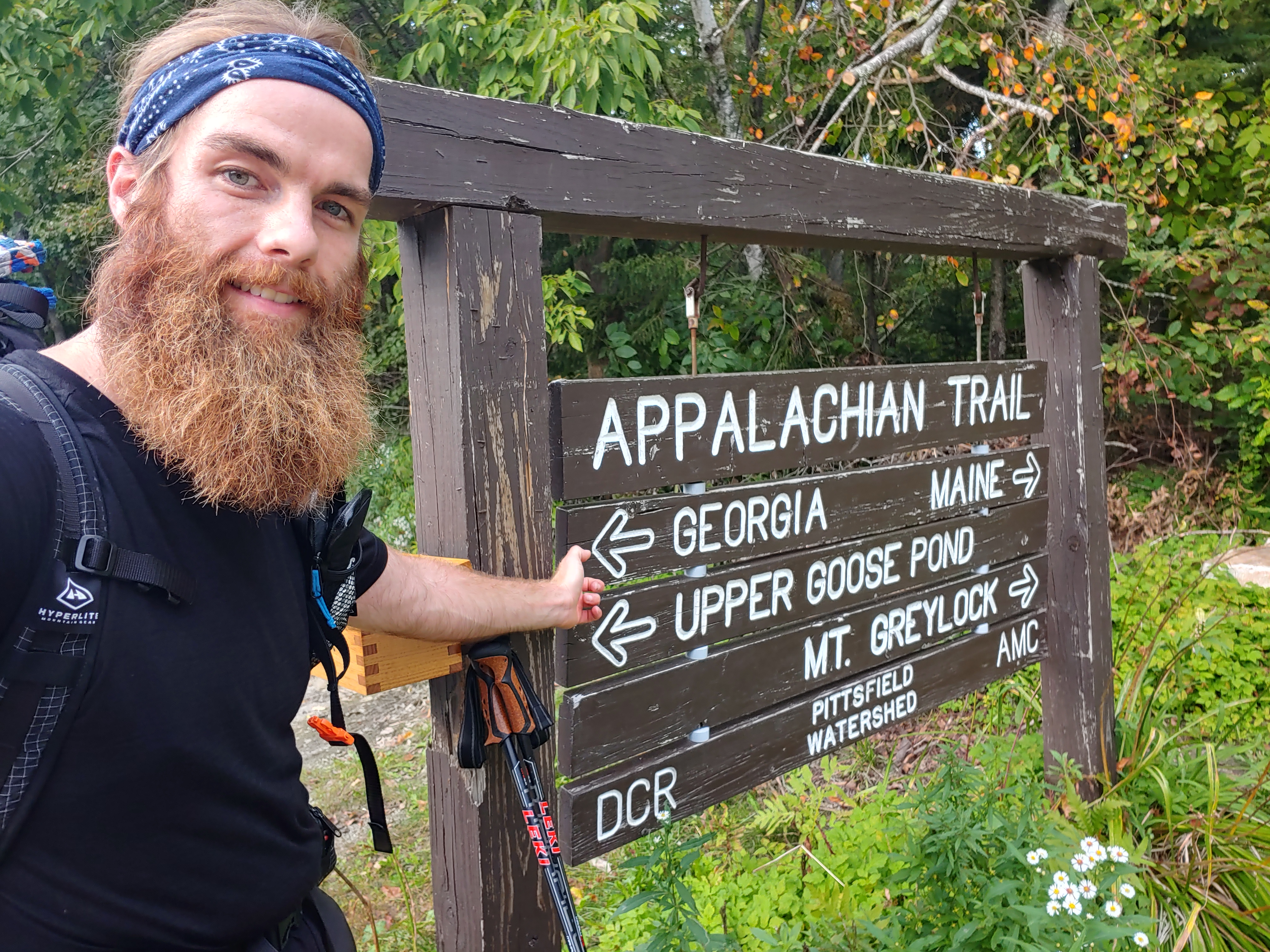
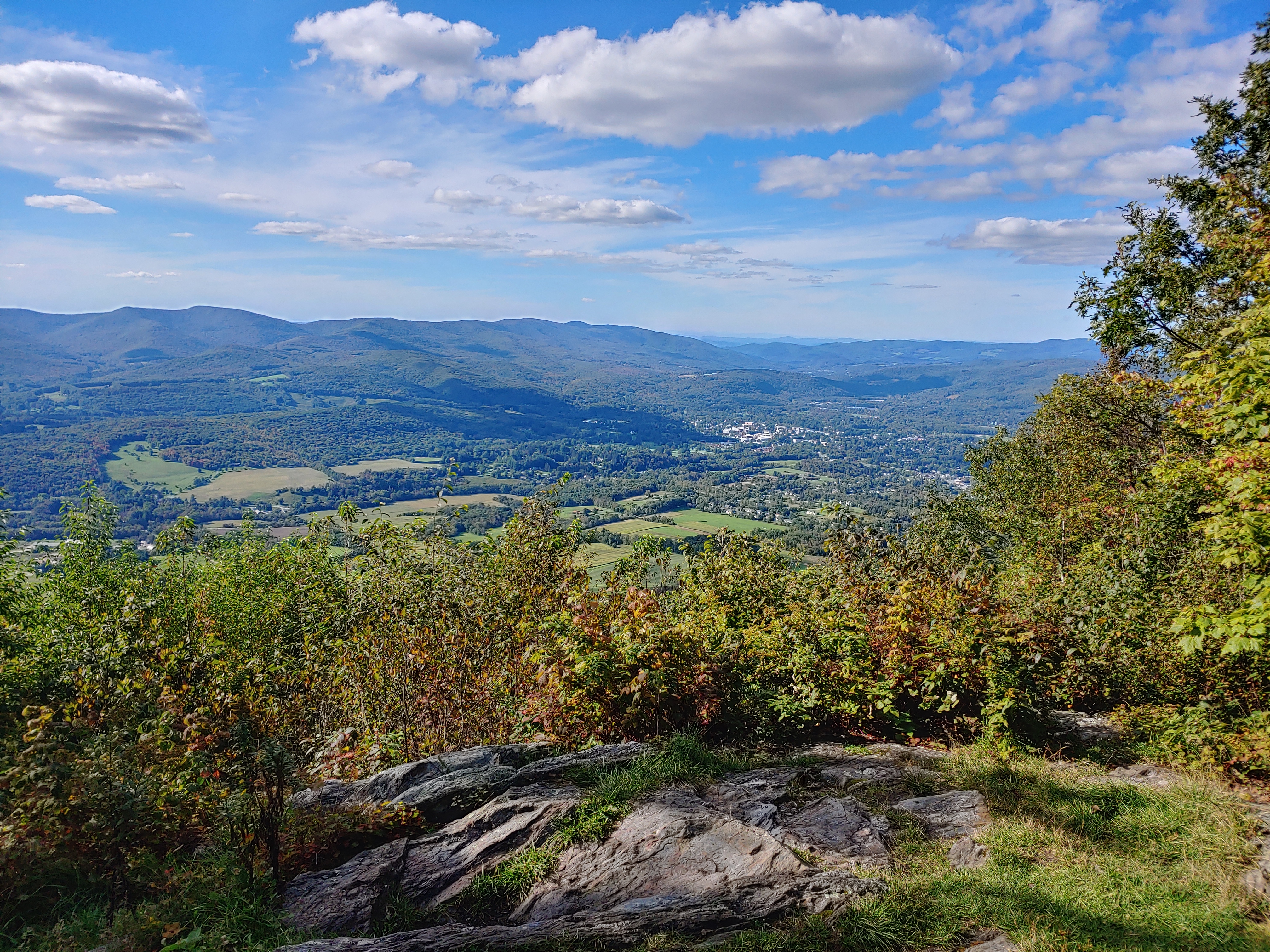
Standing 3500 feet above sea level, Mt. Greylock provided a steep but rewarding climb that first day back on trail. A large building similar to a coastal lighthouse stood atop the peak and offered views in every direction. This was going to be the last big mountain for the next few hundred miles so I took some time at the summit to survey the surrounding area. Pressing on I reached the shelter around 6:45 and made my usual dehydrated dinner accompanied by a giant crusty baguette I had packed out with me from town.
Eager to make progress and carbo-loaded, up the following morning I set out for what would be my highest mileage day so far. Passing through two towns, Cheshire and Dalton, I stopped at the latter around noon to eat lunch and take advantage of the public showers offered in the community recreation center. Knowing the famous Cookie Lady was closed for the season, I grabbed some Gatorade and snacks at the local Cumby’s before leaving town. After 25.5 miles of moderate hiking, I reached the October Mountain Shelter and was greeted by a group of section hikers who offered me some wine upon my arrival. Graciously I indulged on the fermented grape juice while chatting with them about my southbound east coast adventure and listened to their experiences on the Pacific Crest Trail out west.
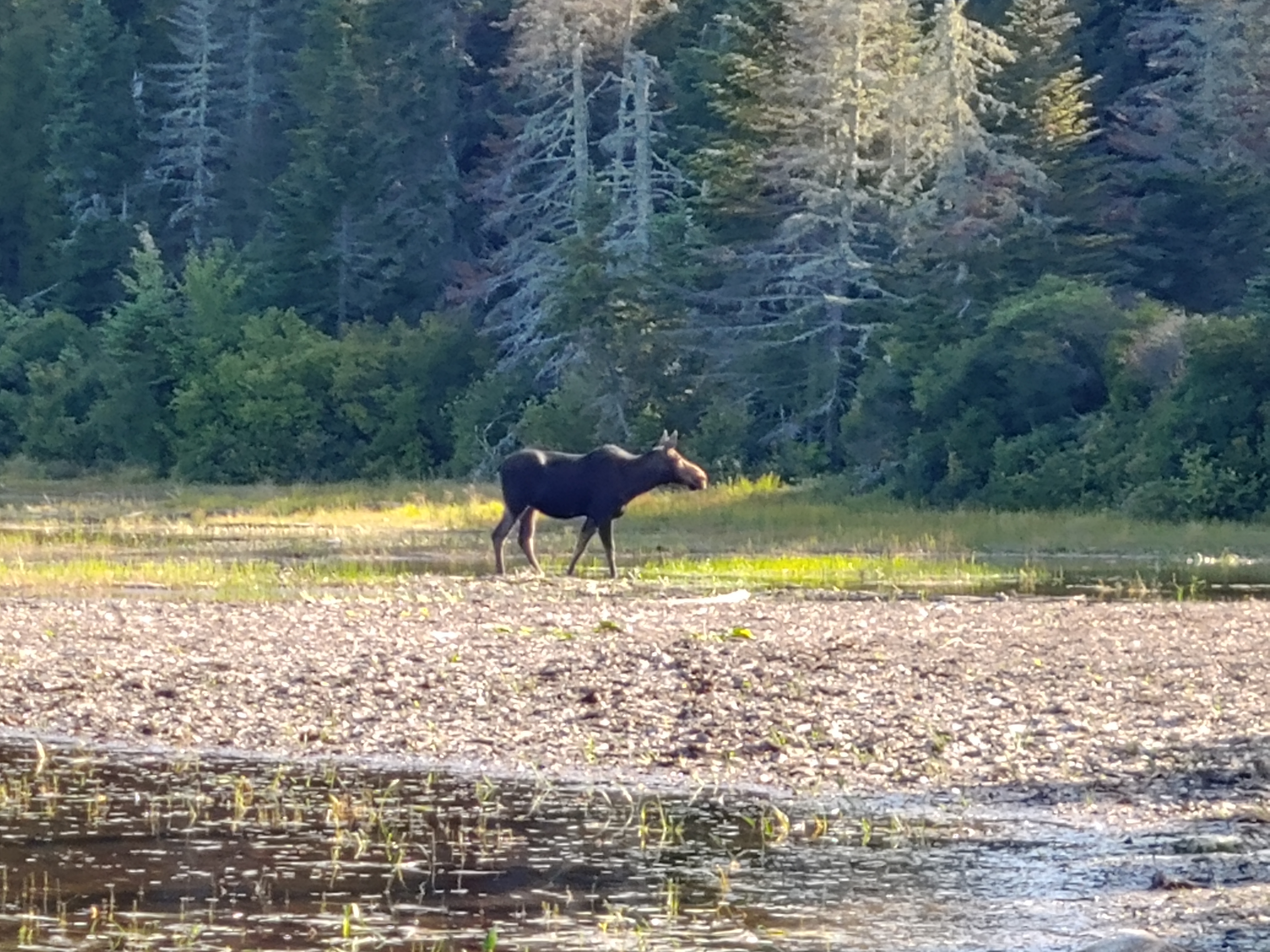
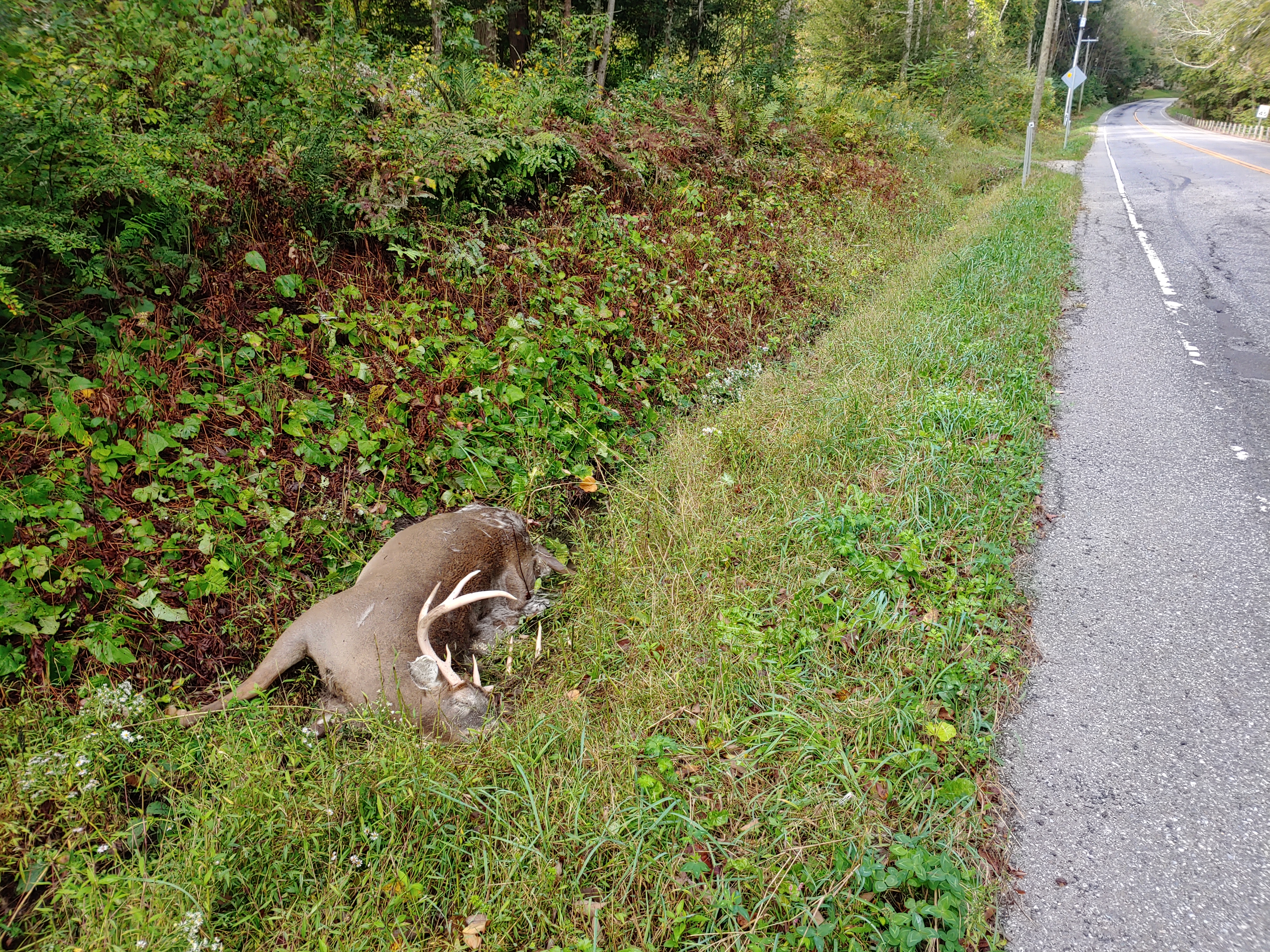
The next day on my hike I passed a guy walking his dog off leash. We exchanged hellos and went on our separate ways. Further down the trail I noticed what appeared to be another dog off leash aimlessly meandering along. Something about this large dark furry animal gave me pause, so I stopped and watched. I waited as it emerged from around a fallen tree and, to my surprise, it was a large adolescent black bear. Stunned, I reached for my camera to capture the moment but as I slowly unzipped my hip belt pocket the bear looked up and at once darted off into the woods. The brief run-in with nature elevated my heart rate but luckily resulted in no injuries.

Although I continued on unscathed from my bear encounter, my hastened pace eventually caught up to me in the form of foot pain that started to slowly develop throughout the afternoon. I began noticing my left ankle was getting irritated with each progressive step. As I hiked, on the relentless pounding also migrated up my leg causing bothersome shin splints. With a resupply box and heavy overnight rain in the forecast, I pushed through the pain to reach the next town to recoup.
Emerging from the woods into farmland, I was soon swarmed and surrounded by mosquitoes. The few miles leading up to Great Barrington are bordered by massive corn fields and the highly toxic Housatonic River which make a perfect breeding ground for the blood sucking pests. Even at a slight jog the buzzing bastards left me with dozens of itchy bites as I reached the road leading into town. Thumbing my way to the hotel was a pretty quick process and I spent the night eating a plethora of microwaved meals in my quaint motel room, a scene that would have made my overweight younger self very proud.


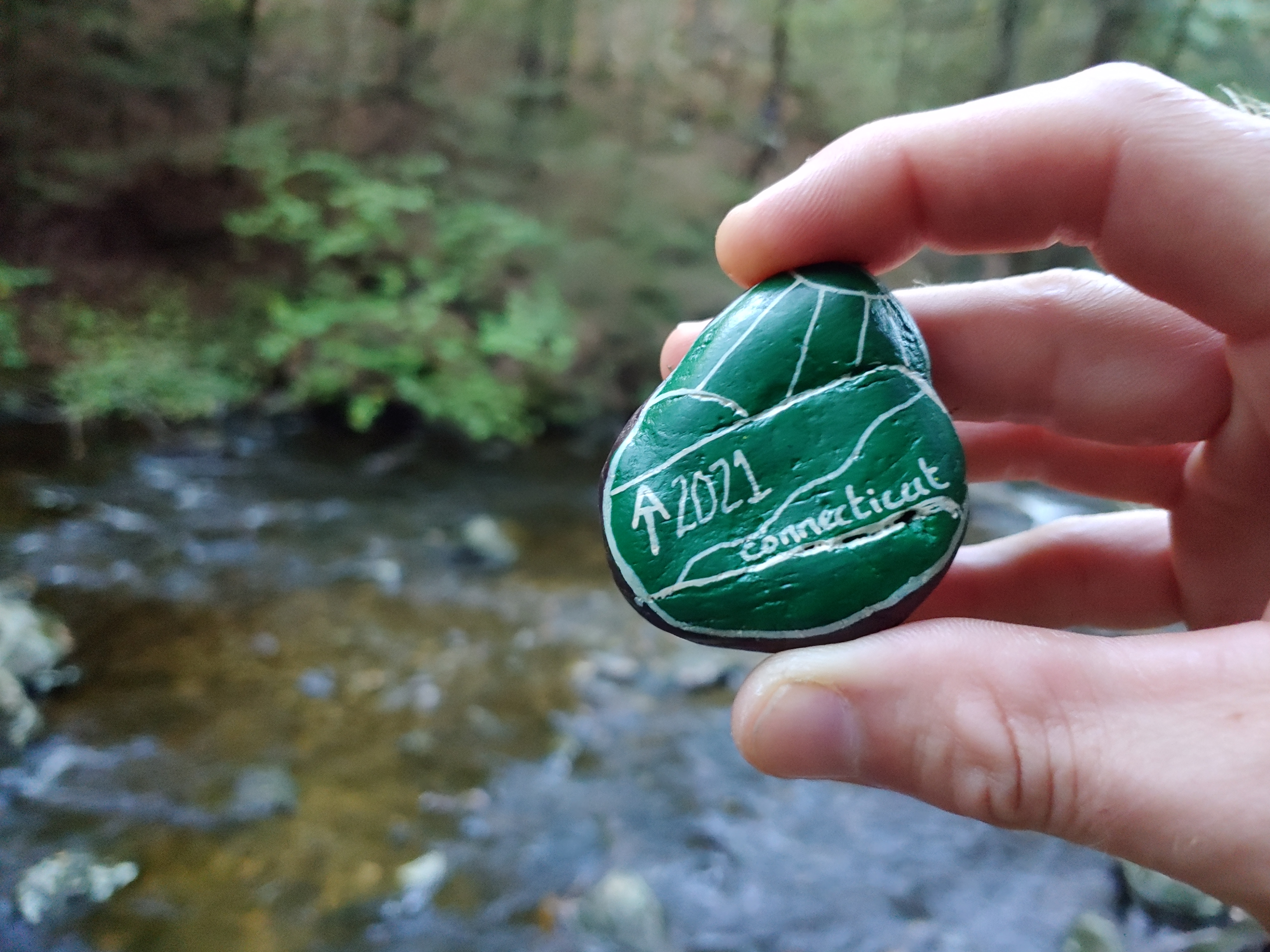
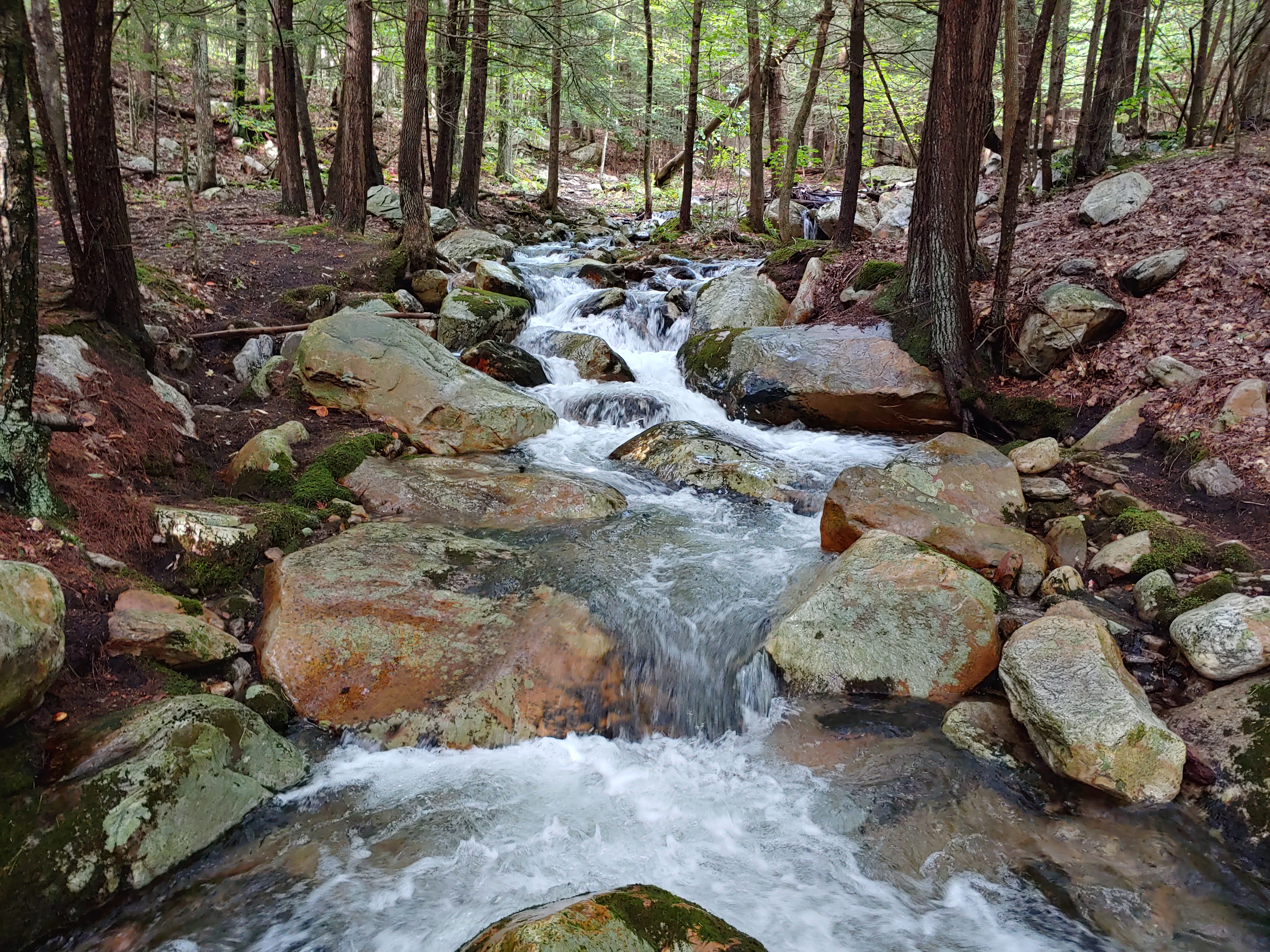
While I slept and into the next morning, over two inches of rain soaked the earth and I restarted my hike through puddle filled fields. The warm sun high in the sky heralded me further south and towards the edge of Massachusetts. By late afternoon, wading past the recharged stream in Sages Ravine, a wooden sign announced my arrival in the fifth state on this journey, Connecticut. I stopped for celebratory selfies before continuing up Bear Mountain where a lone rabbit greeted me at the summit. Saying goodbye to my new fluffy friend, I watched the setting sun paint the sky with pink hues and eventually arrived at camp well after dark, aided by the light from my headlamp.

Water, food and shelter are important when spending many days alone in the woods and that night, after pitching my tent, I retrieved water from the nearby Brassie Brook to start my dinner preparations. As soon as I began to filter my water, two holes burst open causing the majority of the collected liquid to spill out on to the ground. Luckily a fellow hiker at the shelter named Captain Crust offered me chlorine tablets to sterilize the remaining water I had to get through the night. In the morning, I searched to see what stores might have a replacement, but finding none I reached out to social media for advice and then started hiking.
Trail angels came to my rescue when a thoughtful stranger named Bridget responded to my post and we arranged to meet up later that day. With help on the way and little time to get there, I picked up my pace to reach a parking area which was over six miles ahead in under two hours. I arrived around noon and was greeted by Bridget and her friend Janet who drove an hour from their homes in New York just to help out. They brought me an entirely brand new filter kit along with freshly picked apples, and a combination of healthy snacks. I chomped away as we all chatted for close to an hour. While talking to them, I found out that Janet’s son attends college in my hometown back in Maine. I marveled at what a small but generous world we all live in.

Saying goodbye and after many appreciative thank you-s I marched on another twelve miles to complete the 23 mile day. The combination of a long day and faster than normal pace caused my shin bone and ankle to become swollen again. I awoke the next morning knowing that I had overexerted myself and hiked with an aching limp for the better part of the day. Running low on Advil and seeing a town coming up on the map I decided to make a detour in hopes of finding anti-inflammatories and ice to help quell my pain. The local pizza shop provided me a bag of ice and I laid down in the town park to elevate my leg on a bench for awhile.

Laying there as my swelling subsided, I met another hiker named Don who was utilizing the warm sun to dry out some wet gear. We struck up a conversation about our thru hiking adventures and he offered to give me a ride back to the trailhead. It was near dinner time and my new friend put on his trail angel wings and suggested we get supper together..his treat. I gladly accepted and we proceeded to munch down some spicy chicken wings and greasy pepperoni pizza. With leftovers in hand, I hiked the remaining mile to the shelter from the trailhead and settled in for the night where I ran into Captain Crust and Mountain Doctor.
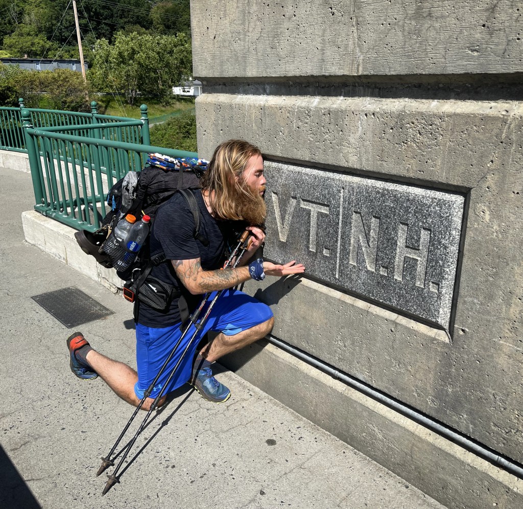
Shortly after ten o’clock the next day, I crossed over the state line, saying so long to Connecticut and hello to New York. Entering the sixth state on my journey filled me with joy and added to my sense of accomplishment. It’s hard to describe how good it feels to step over an invisible line that denotes how far you have gone. Each time it adds to my self-confidence and reaffirms my decision to walk away from my normal everyday routine back home and devote a large chunk of life to pursuing a childhood dream of hiking the Appalachian Trail.


AT Week 5-6_Vermont

Having completed the undisputedly toughest states on the AT (Maine and New Hampshire), I eagerly looked forward to the more gentle terrain of the 12 remaining southern states. After a few days of rest and relaxation in Hanover, I stepped back into the woods on a late Wednesday afternoon with a fully loaded pack ready for new adventures in the Green Mountain State of Vermont.

Crossing into Vermont, the trail took on an obvious departure from the more familiar long rocky stair-stepping climbs of the previous weeks and transitioned to smoother gradually inclined packed dirt surfaces, ripe with plenty of switchbacks and void of the treacherously slick roots and jagged rocks. Although the terrain was slightly easier, the hiking also targeted different muscles, taxing more of my hamstrings and calves to walk up the ramp-like inclines.
Spending the first two nights camping by myself in empty shelters, it became evident that the bubble of northbound hikers was dwindling, and a new realization that the trail would be a more solitary experience started to sink in. It was an ironically eerie feeling to arrive at the Happy Hill shelter late that Wednesday afternoon without seeing another hiker in passing. As the night wore on, it was clear that I would have the place to myself and, since the weather called for rain storms, I decided to stay in the stacked stone structure reminiscent of an old church or schoolhouse. Sleeping alone in the old stone shelter during a night filled with thunder, lightning, and heavy downpours, I had little sense of comfort with a mind filled by scenes from countless scary movies. But the pitter patter of raindrops on the metal roof slowly but reassuringly lulled me to sleep.

Unscathed, I awoke in the morning to a fully saturated forest floor all around me. The streambed behind the shelter which was bone dry the night before when I arrived was now a flowing path of gushing liquid freshly fallen from the heavens. This new moisture rich earth foreshadowed the soggy and muddy terrain that lie ahead.
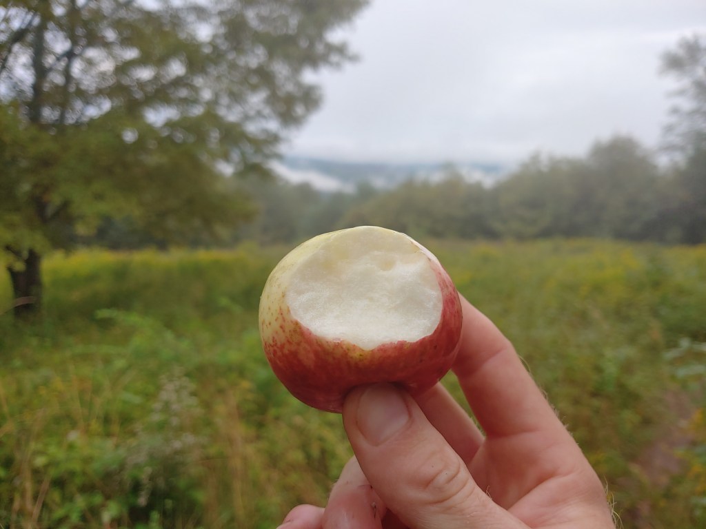
Another change was the abundance of fields bisected by the trail. Without many high peaks, a bulk of the views in the state were located atop these cleared pastures randomly speckled throughout the countryside. Popping out of the trees briefly to pass through grassy open areas, I took advantage of the newest form of trail candy I had come across…wild apples. One spot in particular had two inscribed benches where I stopped to indulge in a few tart yet tasty treats while resting for a bit. The inscriptions were a reminder to relax and enjoy while also welcoming each visitor to the green mountain state.
The Appalachian trail in Vermont is a dual personality pathway in the woods. Upon reaching Mt Killington, the presence of other hikers greatly increased since the AT and the slightly older Long Trail share roughly 100 miles through the southern part of the state. Even though they carried large backpacks stuffed with gear separating them from the usual day hiker crowd, it was quite easy to discern who was an LT hiker vs an AT hiker. The type of equipment and comfort items brought on trail were the clear giveaways and, as I headed further south, the cleanliness along with the pleasing aromas of fresh laundry helped to set them apart even with my eyes closed.
Trail magic was limited but fittingly “when it rains it pours”. It worked out one day where my normal mileage got me near Gifford State Park which is a state-run campground close to the base of Killington. Having researched the area, I knew there was an Irish pub close by with live music scheduled for that night. After pitching camp and getting cleaned up, I hitched a ride over to fill up on music, beer and food. At the bar, I sat next to a group of men chatting and laughing in the typical Friday night fashion. Focused on completing my previous blog post, I was glued to my phone when my idle ears eavesdropped on their dialogue and I offered up a quick joke.
The man to my immediate left turned and chuckled and then introduced himself, giving me a curious look up and down in assessment considering my odd choice of attire which was my cleanest and least smelly clothing at the time (long johns with a t-shirt and shorts worn over top). Explaining that I was hiking the AT he shifted in his barstool, his eyes brightened up, and we then began to talk about life and politics while sharing a few drinks. He was a retired local and avid skier, pointing to his hat signifying that he skied over 100 days last winter and told me of his plans to do the same again this year.

Having the opportunity to indulge on non-dehydrated foods, I quickly ordered loaded nachos, a burger with fries, and homemade bread pudding a la mode, all washed down with some cold local brews. After a few hours of pleasant conversation, it was bill time and my new companion Denny graciously offered to cover my check, which I hesitantly accepted knowing how much I had just eaten. He gave me his number with the invitation to call when I was finished hiking to join him by hitting the slopes once the snow flies.

After reaching the rocky summit of Killington the following morning, the trail began to resemble the phrase I had heard used many times before to describe this state. Vermud. Increasingly for the next few days, I encountered some of the slowest moving and annoyingly muddy sections of hiking I have yet to navigate. My pace was stuttered, having to tip toe around massive puddles of watery dirt and mud seemingly everywhere I went. Eventually I perfected a technique of using my trekking poles to form a human bridge over the ponds of muck while gingerly walking around the outer edge of the muddy pools scattered at my feet.

On day eight of nine in Vermont, the weather was warm and dry as I made good time hiking with a fellow SOBO’er and Mainer I joined up with named Pete. We spent a couple hours together chatting and hopping from dry spot to dry spot. He was getting a ride into town that afternoon and we parted ways near a parking lot. No sooner did I start uphill again when the winds intensified and the sky darkened. We had been hearing thunder off in the distance earlier but now it was right on top of me.
Pausing to put on my poncho, I attempted to wait out the storm as it passed but, after 20 minutes of heavy rain, I decided to march on and finish the remaining 3.5 miles to reach the spot I had planned to camp for the night. Each step was carefully calculated so as to not get my shoes wet, knowing I still had another long day before getting off trail to clean up and resupply. It started raining around 3:30 and by 5:30 I hadn’t yet reached my destination. With the sudden deluge of rain, the trail transitioned into a fast-flowing river, at which point I gave up on keeping my feet dry as the daylight slowly vanished. Trudging through ankle deep water, I finally reached camp around 6:30, fully soaked and quite aggravated.
It continued to rain all night and I awoke to pools of water everywhere. The stream I slept next to was raging and the trail was even more of a river than the evening before. Begrudgingly I got dressed by climbing into my cold wet clothing, slapping on my soggy shoes and setting out to wrap up this water-logged state. With knowledge of an upcoming three day vacation from the trail raising my spirits, I abandoned all concerns about my footwear and splashed straight through the middle of every mud puddle I came across while loudly bitching to myself about the lack of proper trail maintenance that led to this situation.
As I crested a small hill, a sign fell into view marking the end of the Long Trail and the entrance into Massachusetts. Quite fittingly the thirty or so feet separating the two signs consisted again of ankle deep mud water, which I sarcastically stomped in like a delighted child after a rain storm. My frustration was quelled with the satisfaction of finishing another state and (as the YouTuber Darwin onthetrail always says) the experience of embracing the suck. I continued a few miles further on to the town of North Adams to meet up with Hannah where she and I ate dinner before heading home to Maine to attend a weekend music festival put on by one of my favorite bands, Skyfoot.
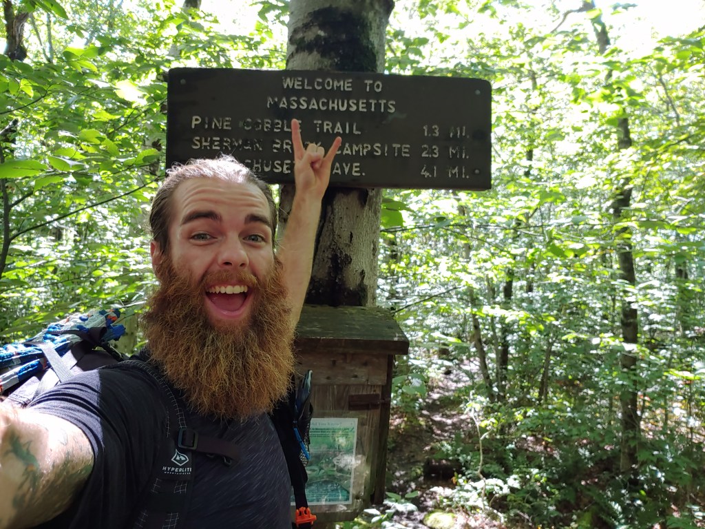
Each state so far has contained new challenges that make for memorable experiences which set each apart from the other. Nine long days on trail allowed me to conquer Vermont and taught me some good lessons in determination and solidarity that I carried with me into the next state on my southward journey, Massachusetts.


AT Week 4-5_New Hampshire
Everyone said the Whites would be hard and slow hiking but, in just 10 days, I had walked from one edge of New Hampshire to the other, feeling better than ever. Having spent countless hours over the past year checking off high peaks from my NH48 list, I had a sense of comfort and familiarity with this region.
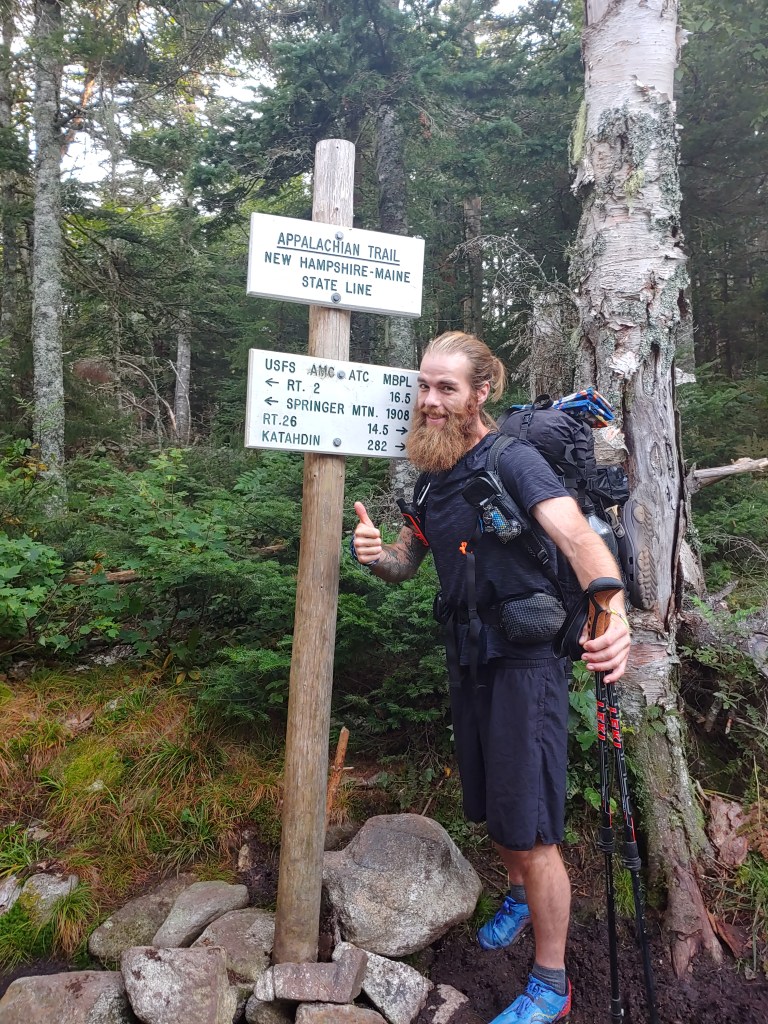
After celebrating my morning exit from Maine last Friday, it was fitting to next summit Mt. Success. I had thrown myself through the ringer navigating the 282 miles across my home state. My mind was so focused each day on pushing past the suck and racking up mileage that, once in NH, I had to take some time with a map to chart out my course and arrange the next resupply locations.
Later on that night, I was joined by my girlfriend Hannah at the Rattle River Shelter where we shopped for supplies at the nearest Walmart and later dined at the local pub. My hiker hunger and gentle charm sparked the bartender to wager a food challenge that I easily won. She clearly underestimated how much of a bottomless pit my stomach has become. Tasked with finishing the entire chicken prosciutto pizza and lamb burger with fries I ordered for my dinner and also eating a big slice of homemade strawberry cake with all the fixings without assistance, I easily won us free beers and dessert. It was quite literally a piece of cake 😉
The following morning, Hannah accompanied me on the trek up to Mt. Moriah. On top of the 4000 footer’s summit we ate lunch, tried feeding the numerous Gray Jays that greeted us, and then said our goodbyes as I continued on south down the AT. I then summited three more 4000 footers that day before setting up camp at a tentsite near the Carter Notch hut.
Realizing that within a few days I would be hitting the Presidential Range including Mt. Washington, my excitement and anxiety levels grew. I had wanted to hike the entire presi-traverse in one day since camping anywhere above treeline along the 15-mile stretch is strictly prohibited and confined only to very pricey mountain huts. Having hiked this section on an eleven-hour day hike last fall, I was aware of the challenge ahead of me.
The next day, after bagging two more 4000 footers (the Wildcats), I stopped at the Pinkham Notch center to recharge my electronics and fill up on some thru-hiker discounted but still heaping full bowls of chili served with fresh wheat bread. While digesting my second helping, I checked the weather, packed up, and then left for the Osgood tentsite. The following day’s forecast called for strong afternoon thunderstorms which complicated my plans for a one-day trek across the Presidential Range. I decided to chance it and left camp at 5:45 the next morning in hopes of ducking for cover in the Mt Washington visitor center while the worst of the storm past overhead.

Hiking up Madison, I caught a brief glimpse of a late sunrise before being engulfed in blowing mist (what I have termed “slow-rain”). After taking a painful slip, I slowed my pace to stay upright and on two feet. Stopping only for a quick coffee break at the Madison hut, I stepped out and back into the soggy chilly air to venture southward since time was of the essence.
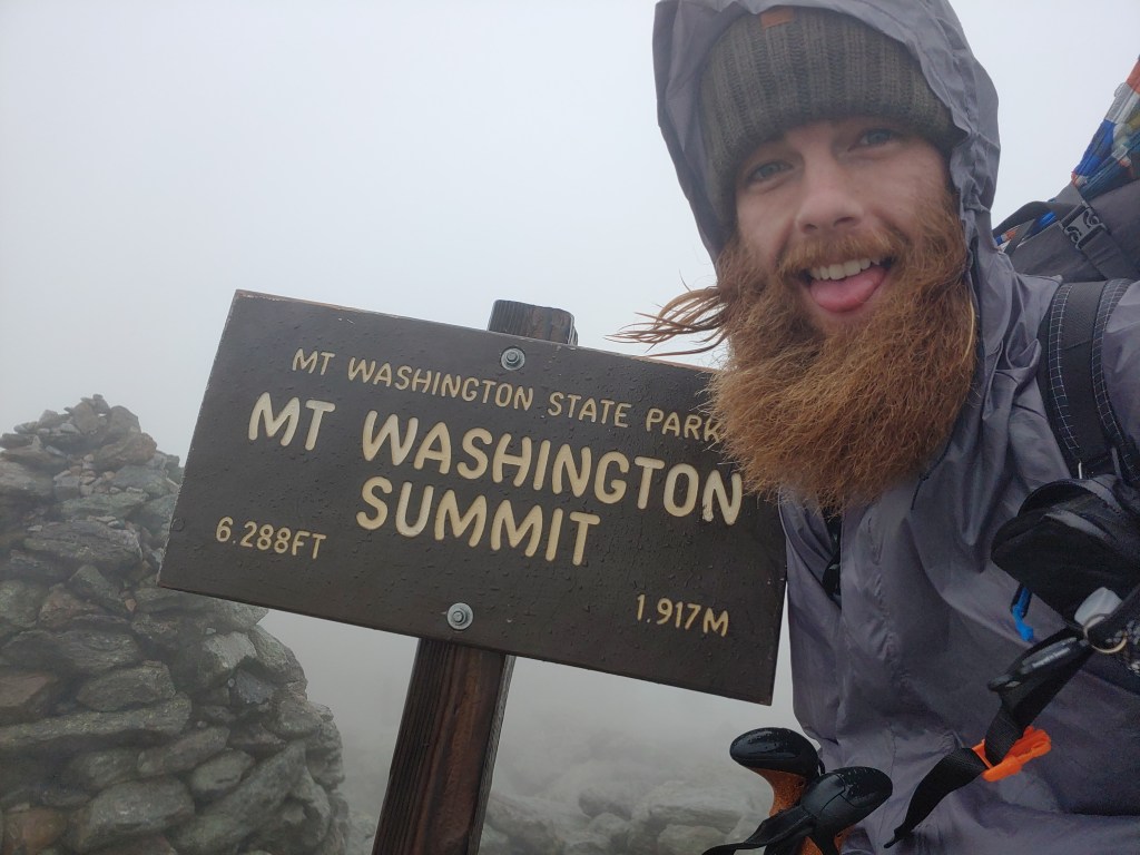
In the last mile to Washington, two loaded Cog Railroad cars passed by just as the rain began to intensify. In the low visibility, I pinballed up the mountain from cairn to cairn finally reaching the summit around 11 o’clock to take refuge from the weather. Feasting on cafeteria pizza, chips and soda, I dried off as best I could when I noticed a couple stroll in who I had passed earlier. Noticing they were dripping wet from head to toe, I gave a head nod of acknowledgement as one of them said, “Looks like you missed the hail.!?” Patting myself on the back for my predawn start, I packed up and headed back out into the howling fog. I arrived at the Nauman tentsite a few hours later in high spirits. Completing my traverse right as the clouds broke I laid out my gear in the sun to dry and munched on some fruit snacks with a smile on my face.

Even with this section behind me, I still had ten 4000 footers to summit before leaving New Hampshire. Next up was a gorgeous and sunny trek to Mt Zealand, stopping at Thoreau Falls for a scenic break and spending some time in the Zealand Notch chatting with a local day hiker. The next day tackling South Twin, Garfield, Lafayette, Lincoln and Liberty was a breeze, albeit more of a gusty cold wind than a breeze 😉 . As luck would have it, the internet plus trail magic landed me a free and calorie filled ride into town for a much needed resupply.
Knowing I had five more days before reaching the western edge of New Hampshire, I spent the night at the Notch Hostel to clean up and pig out. Given the lack of shuttle options and my economic efficiency (I’m cheap) I decided to take a loaner bike into town. Six pedaled miles later I returned to my place of lodging with food in hand and a nagging concern. I wondered if, since I had the energy to ride a bike after a day spent hiking 17 miles, maybe I have some weird form of restless leg syndrome? I never did get around to checking WebMD on that…oh well.
Trail Angels were in abundance the following days. I was joined by my good friend Kris and her son Ronin at the summit of Mt. Moosilauke on Friday for some snacks, trail talk and of course laughter. Then on Saturday, my Aunt’s family met me at a road crossing for a huge bacon cheeseburger lunch that I polished off with chocolate milk, beer and hard boiled eggs. Leaving feeling stuffed, I hiked south together with my aunt and uncle for awhile. Sharing my time on the trail with people I know and love adds a layer of support that helps me get through the harder days when it is just me and the miles ahead.
Moosilauke marks the end of the White Mountains and the shift in terrain was noticeable to say the least. Wider less mountainous trail combined with soft forest floor meant the next two days were more easily accomplished than anything from the month prior. So by Monday morning around 11am, I leisurely waltzed through downtown Hanover with pep in my step, smiling brightly back at the curious and confused faces of the crowds enjoying their Labor Day holiday along Main Street because I knew that just down the block I would be entering the third state on my southbound AT hike.
Stepping over an imaginary invisible line dividing the two New England neighbors felt amazing. Suspended high above the river, a polished granite plaque signified the end of one state and beginning of another. I had proven to myself that I can “walk the walk” as the saying goes. Joy filled my being as once again Hannah’s cheerful gaze caught my eye. With celebratory photos and sweaty hugs out of the way, we proceeded to enjoy the rest of our day together in Hanover. I zeroed the next day to sight-see and recoup before heading out on the trail to take on Vermont.


AT Week 3_Southern Maine

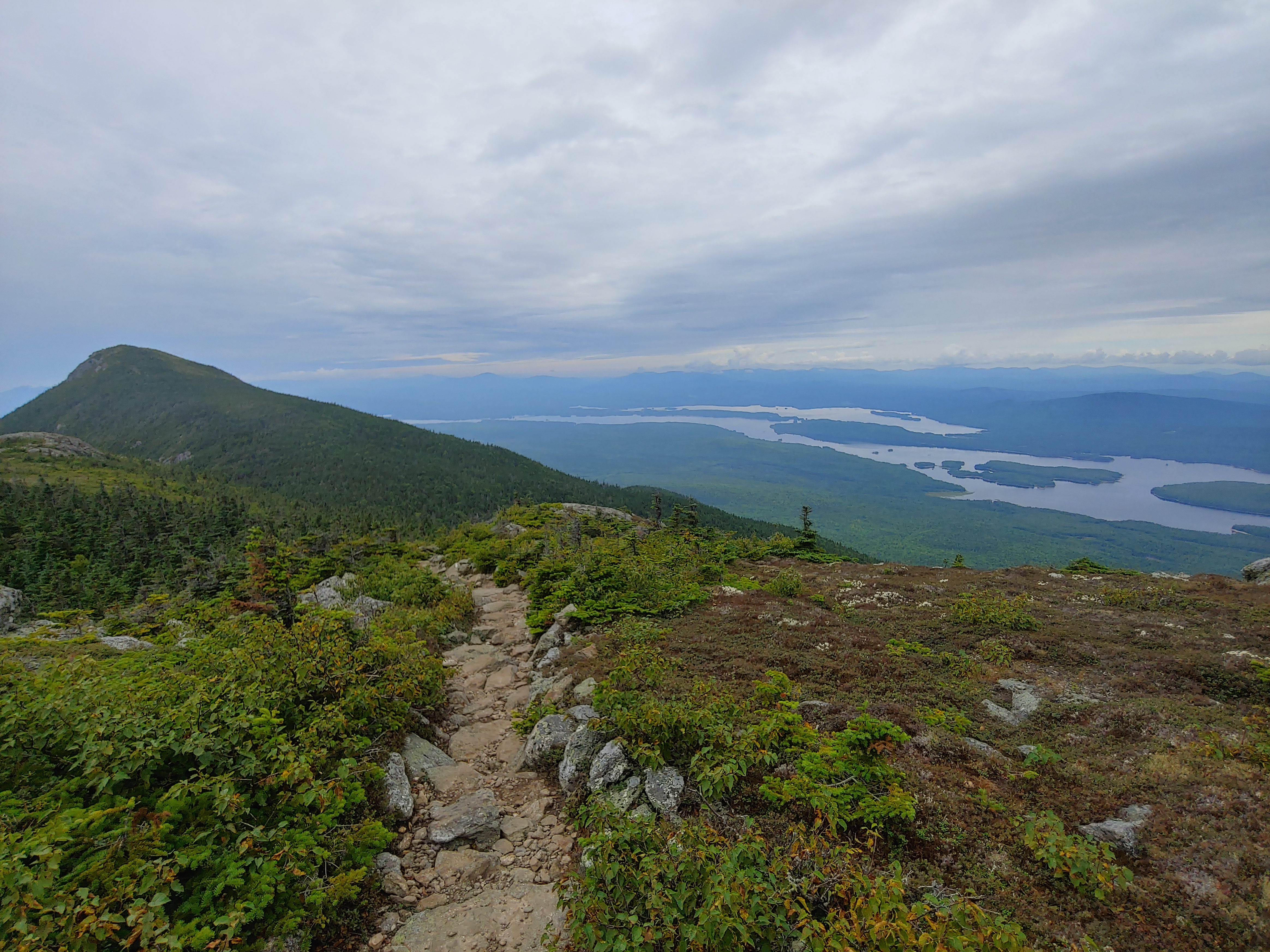
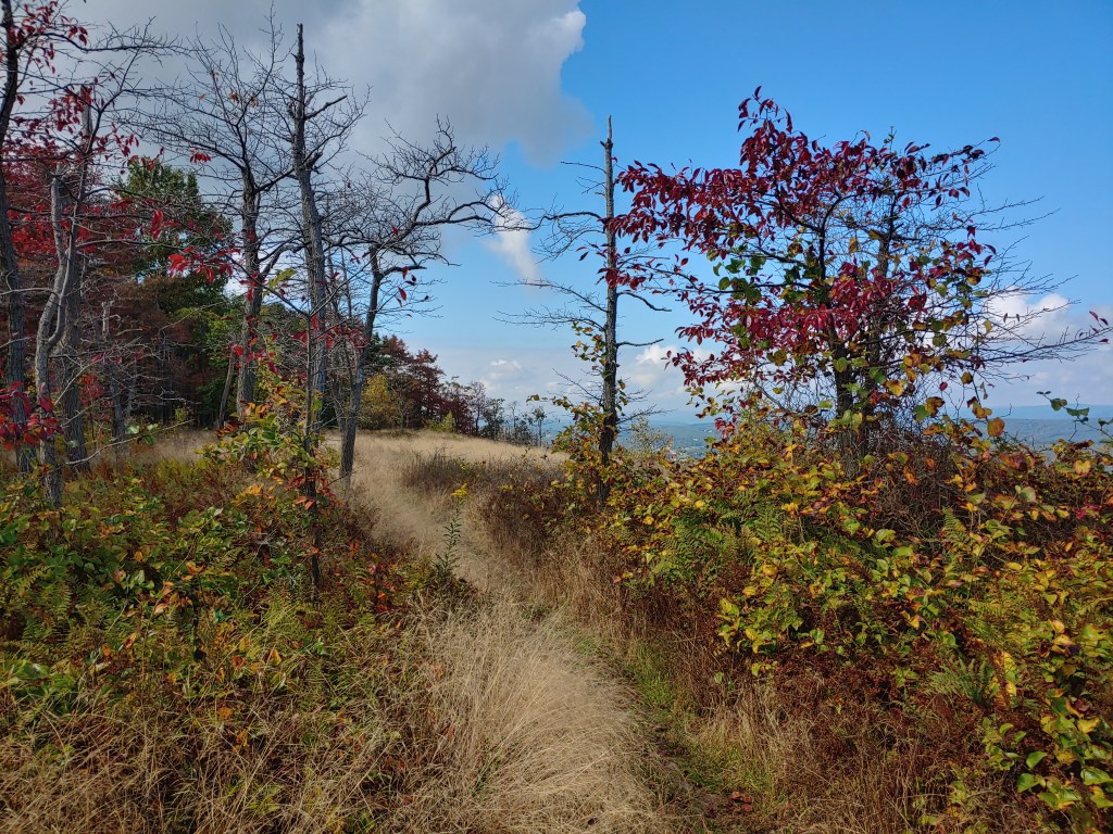
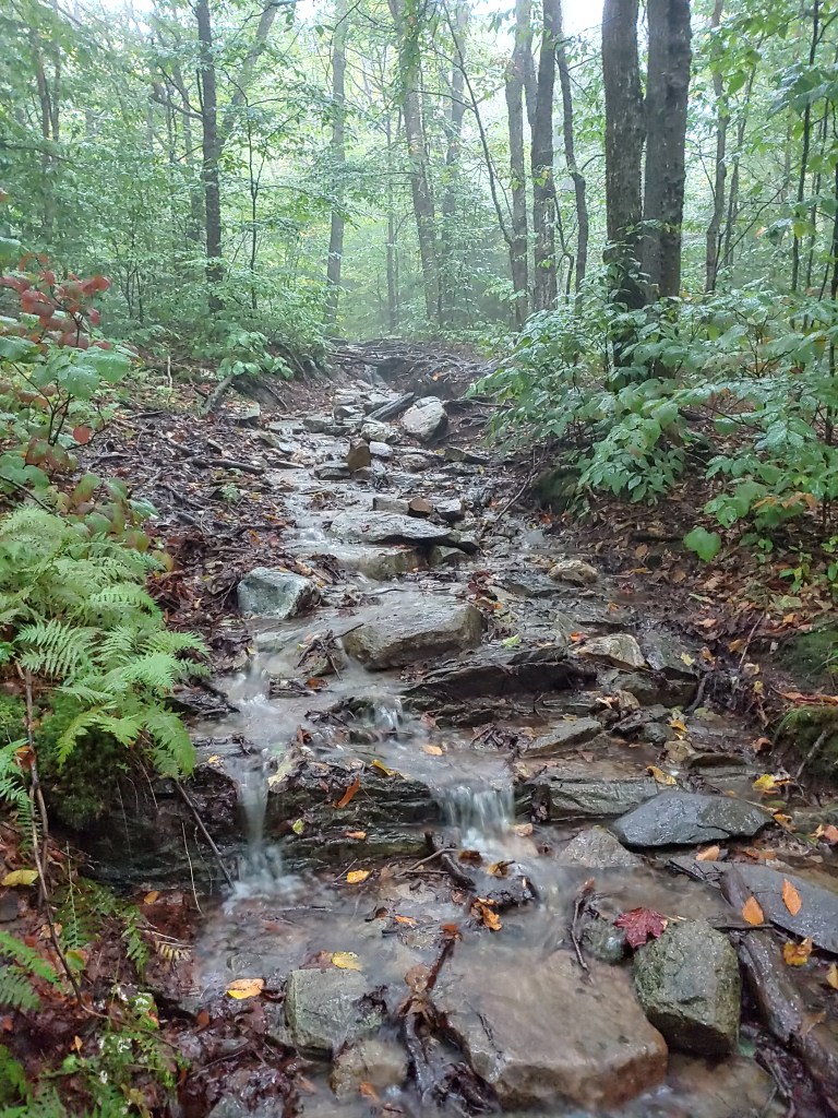
Navigating the notoriously difficult southern Maine section of the Appalachian Trail proved to be a slow but steady challenge this week. Wet, rocky and rooty footing coupled with soggy misty days made for more tedious terrain to travel.
Cautiously advancing through the muddy miles, I still racked up plenty of scrapes and bruises. One morning after slipping and falling I rose to collect myself and immediately was stung by a bee. “Great!” Slowing my pace improved my confidence but didnt prevent further scuffs and dings. Gravity plus mud make for a constant struggle to stay vertical.

Dryness adds to the overall comfort we feel when starting a morning (or anytime for that matter). Climbing into damp, cold sweat-soured clothing first thing is not a pleasant task and something I have not yet gotten used to. Knowing that your day will be spent hiking in wet shoes can suck the motivation out of you quickly but the trail beckons and I am here to answer the call.
Mid-way through the week the weather turned drier as the heat returned again. Even though there wasn’t rain from the sky, my excess sweat precipitation still managed to leave me dripping wet from head to toe. My shoes in particular took a smelly beating as the perspired droplets trickled down my torso and legs, funneling nicely into my trail runners. I was quite pleased to swap them out for a new pair when my mom met me for a resupply at Grafton Notch and brought a local favorite (George’s Italians) for some trail magic lunch.
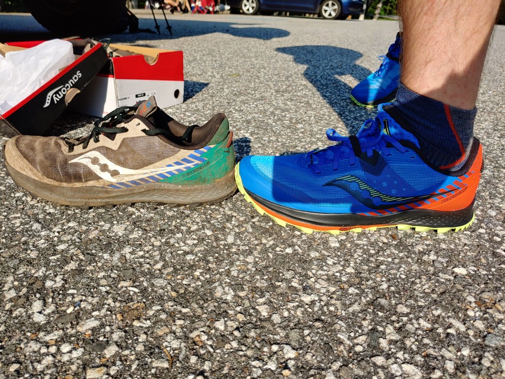
Well fed, cleaned up and laundered, I restarted my hike that evening at 5:30 heading up to Speck Pond campsite. Driving to the trailhead from town and noticing the dashboard thermometer reading of 83 degrees, I quickly dreaded the thought of a late evening hike up a 4000 footer. Taking my time, I gingerly climbed the 4.6 miles. As I rose in elevation, the sun dropped behind the mountain while a cooling breeze eased my concerns and dried my sweat covered brow. Reaching the summit as the sunset, I was rewarded with beautiful sky colors and strolled into the campsite after dark, guided by the light of my headlamp.

The next morning’s hike through the infamous Mahoosuc Notch, “the most difficult mile of the AT”, actually was a fun experience. At times it was akin to bouldering at a rock gym. Trekking poles tucked away in my bag, I was hoisting myself up and over pickup truck sized rocks. Points where I had to remove my pack and required a fellow hiker Gandalf to help pass my bag through an opening no larger than a manhole cover and down into a crevice in order to proceed further along the trail.
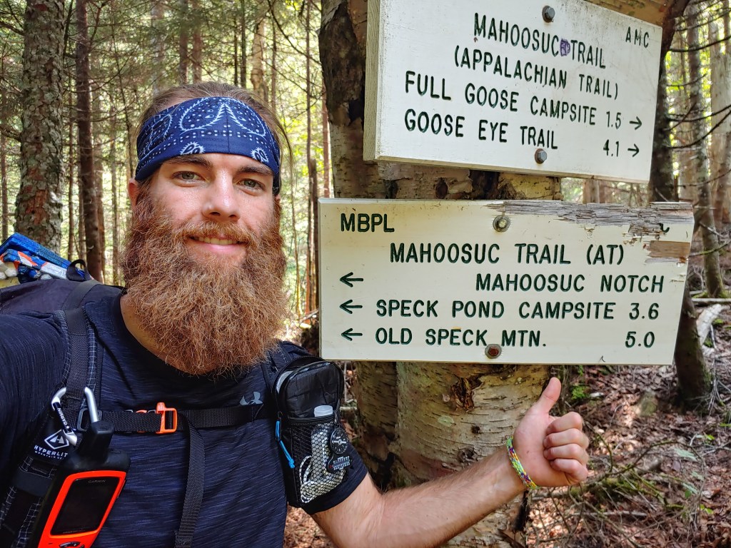
Although the air was hot and humid that day, the shape and position of the notch in relation to the sun means that the water running underneath your feet remains ice cold all year. Fog was actually rising from the rocky ground and blasts of cold air made for a refreshing reprieve from the normal summer heat. The sensation felt like driving with the AC on but with the windows down on a hot day.
Camping at Carlo Col that night, I rested easy knowing that I was a half mile from the New Hampshire border. The Southern Maine section lived up to its reputation as a tough part of the trail leaving many more miles to still explore.
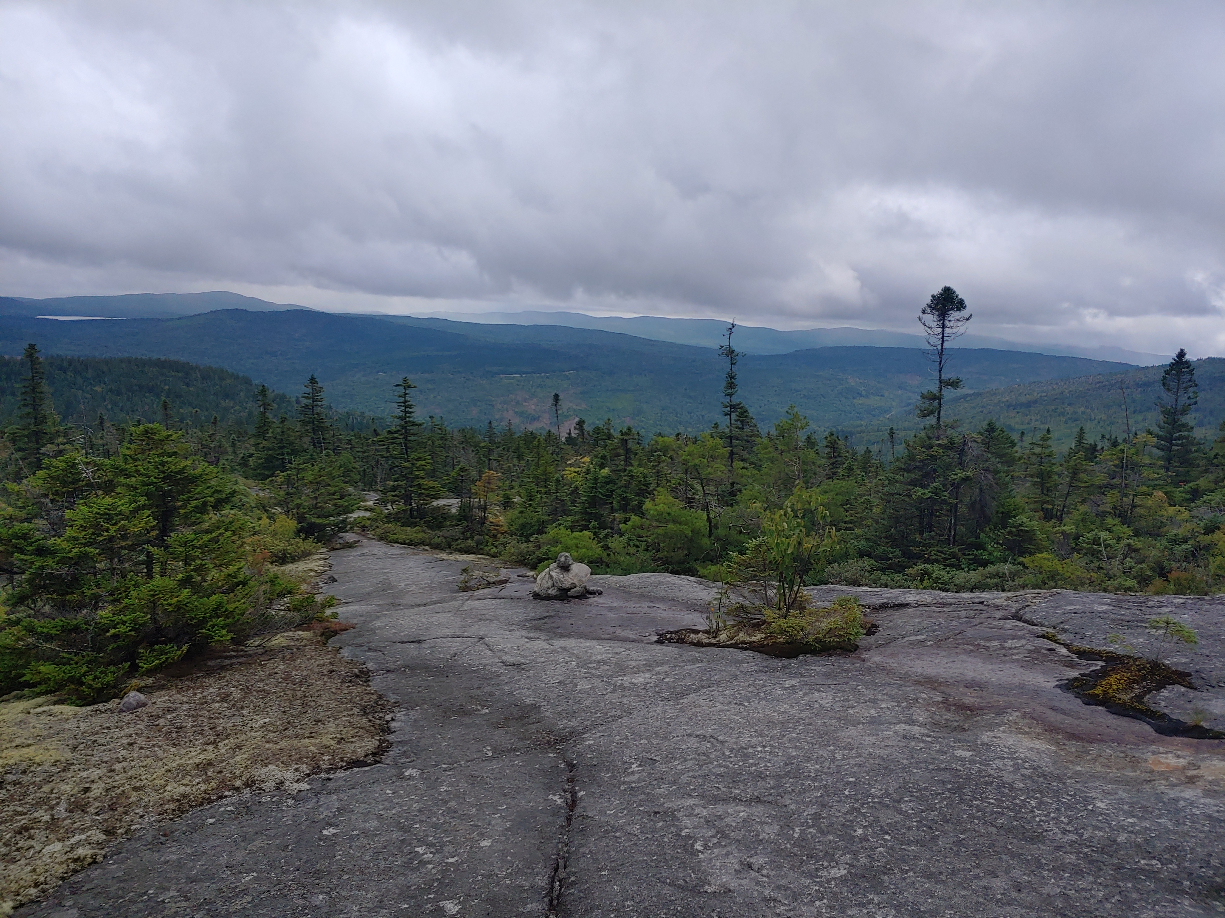

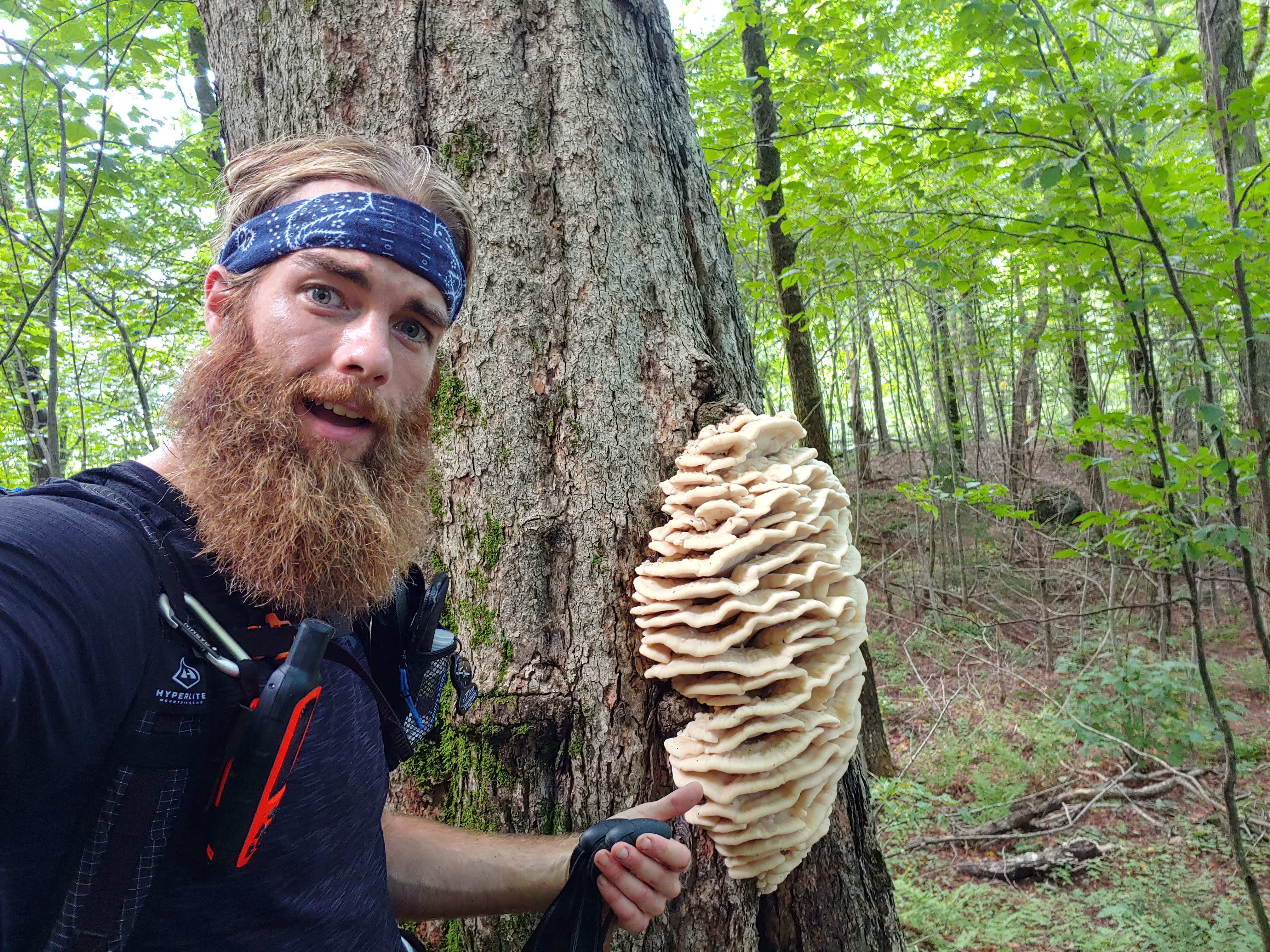


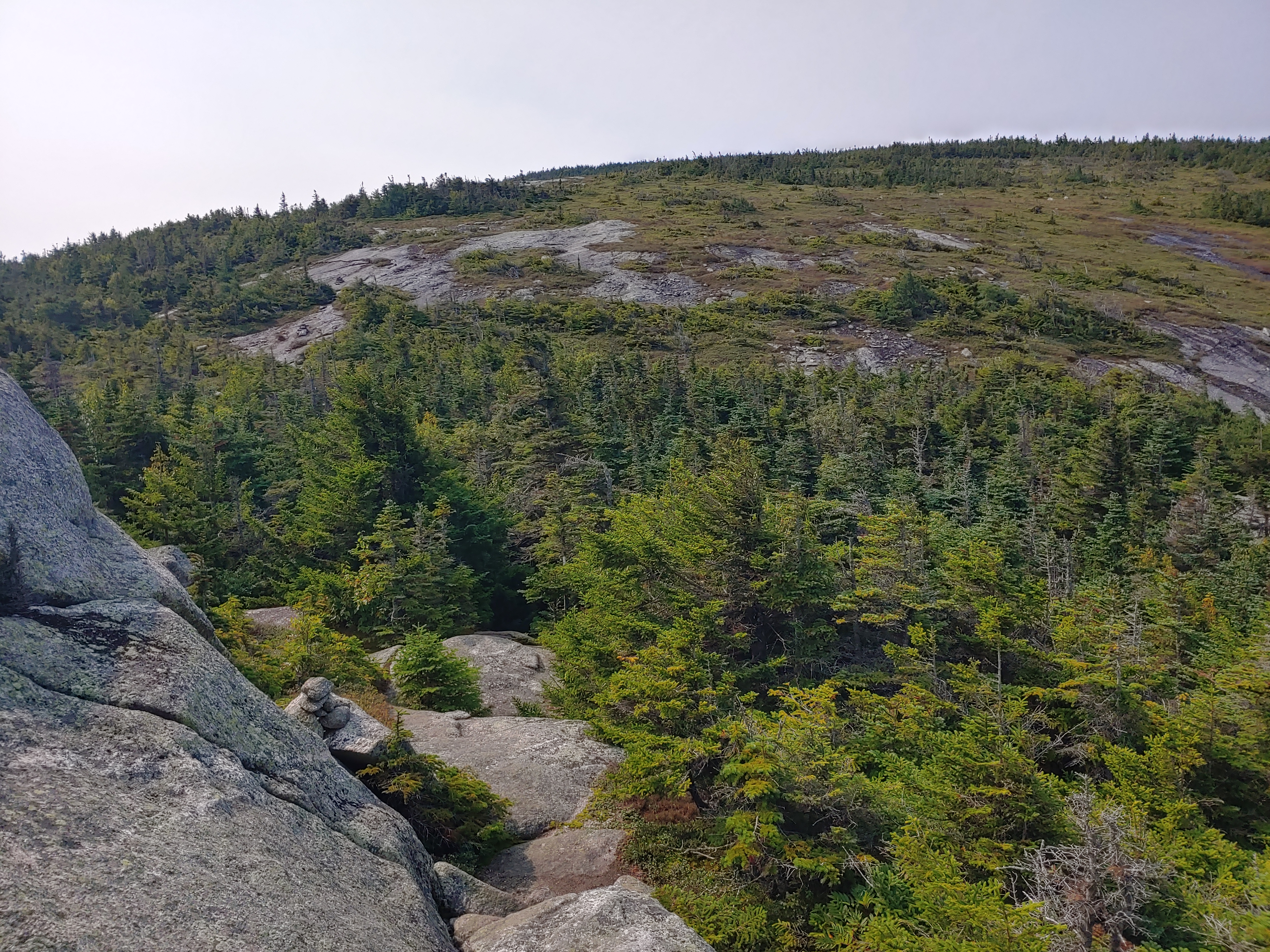


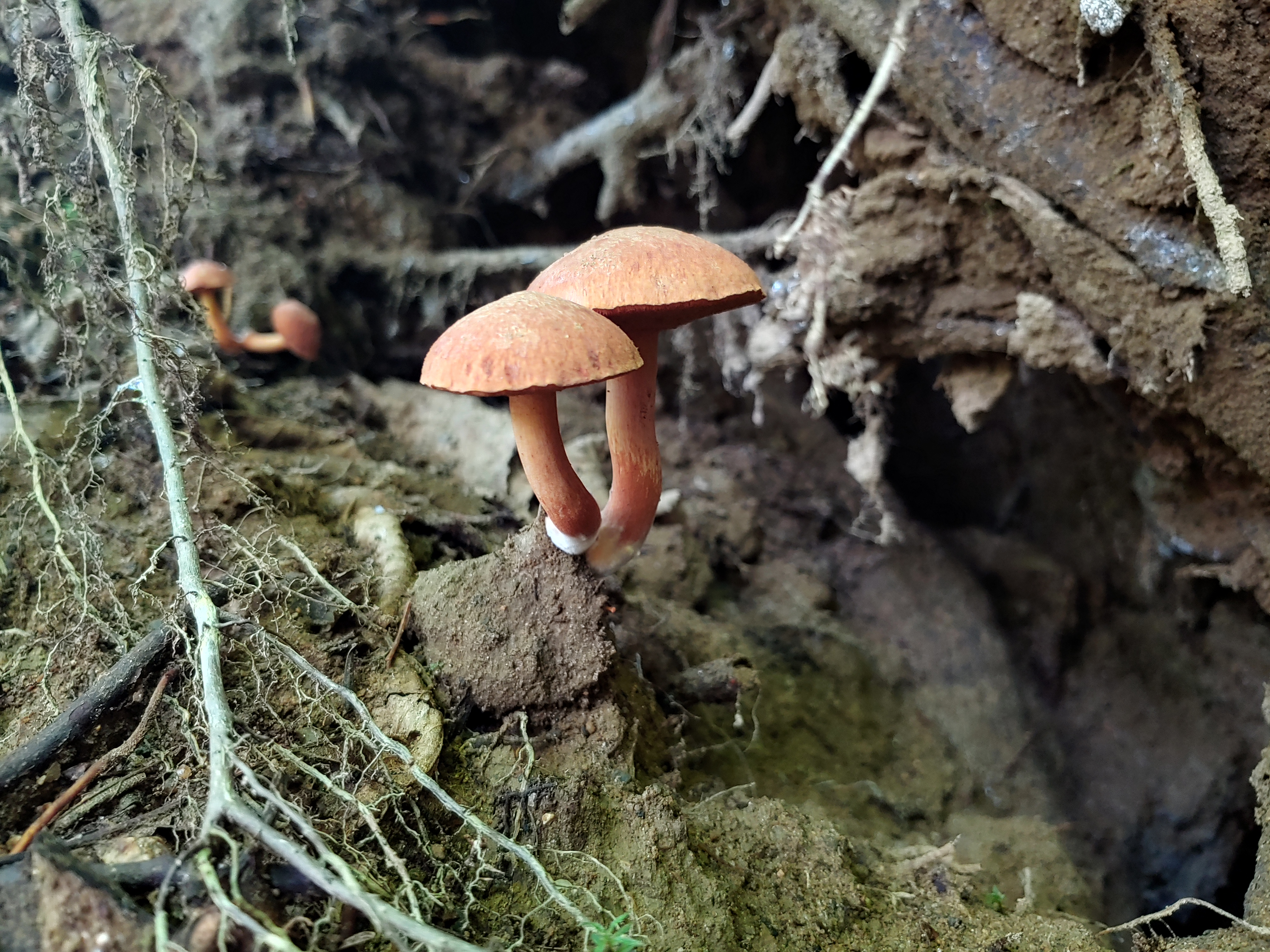
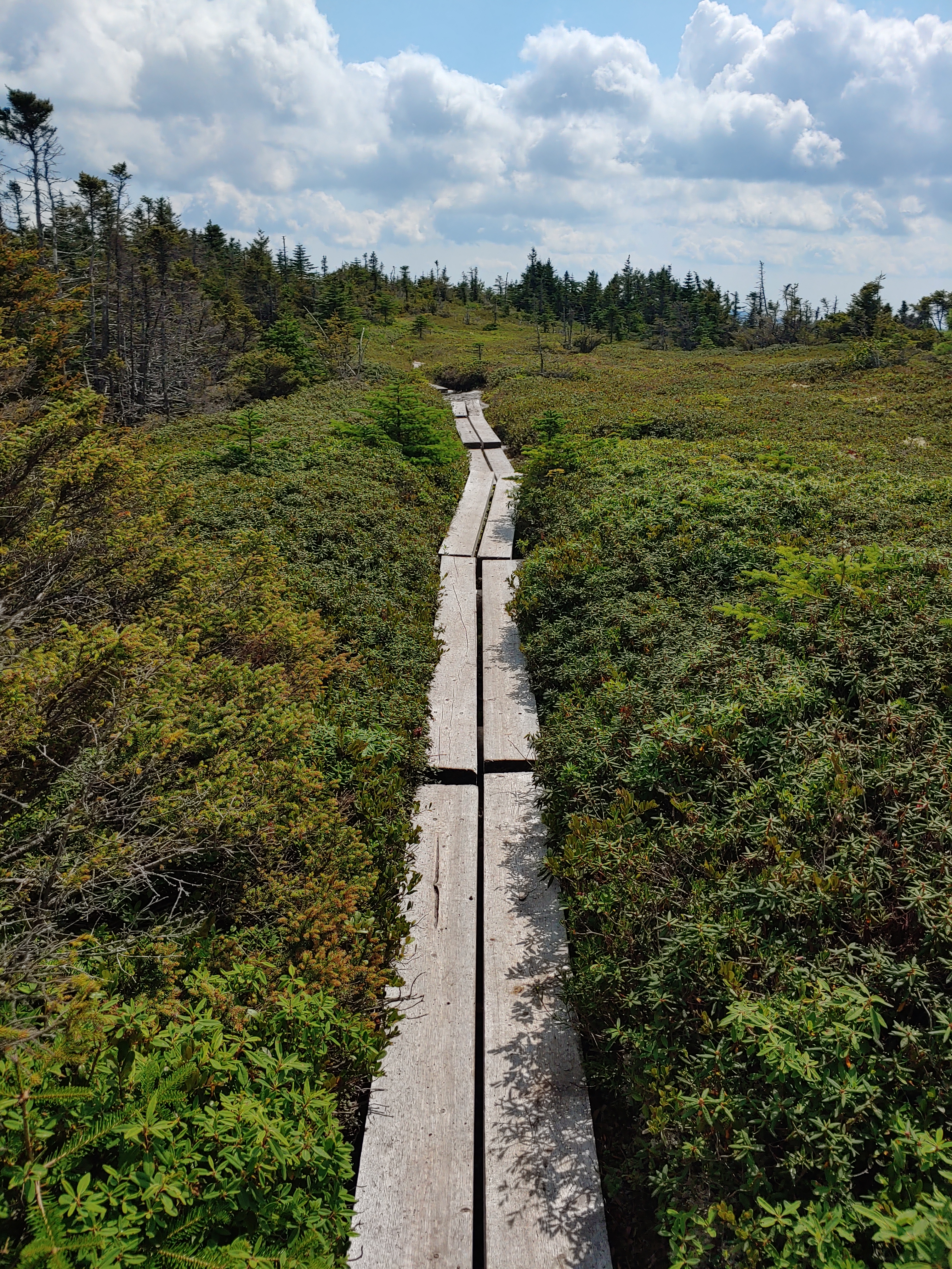
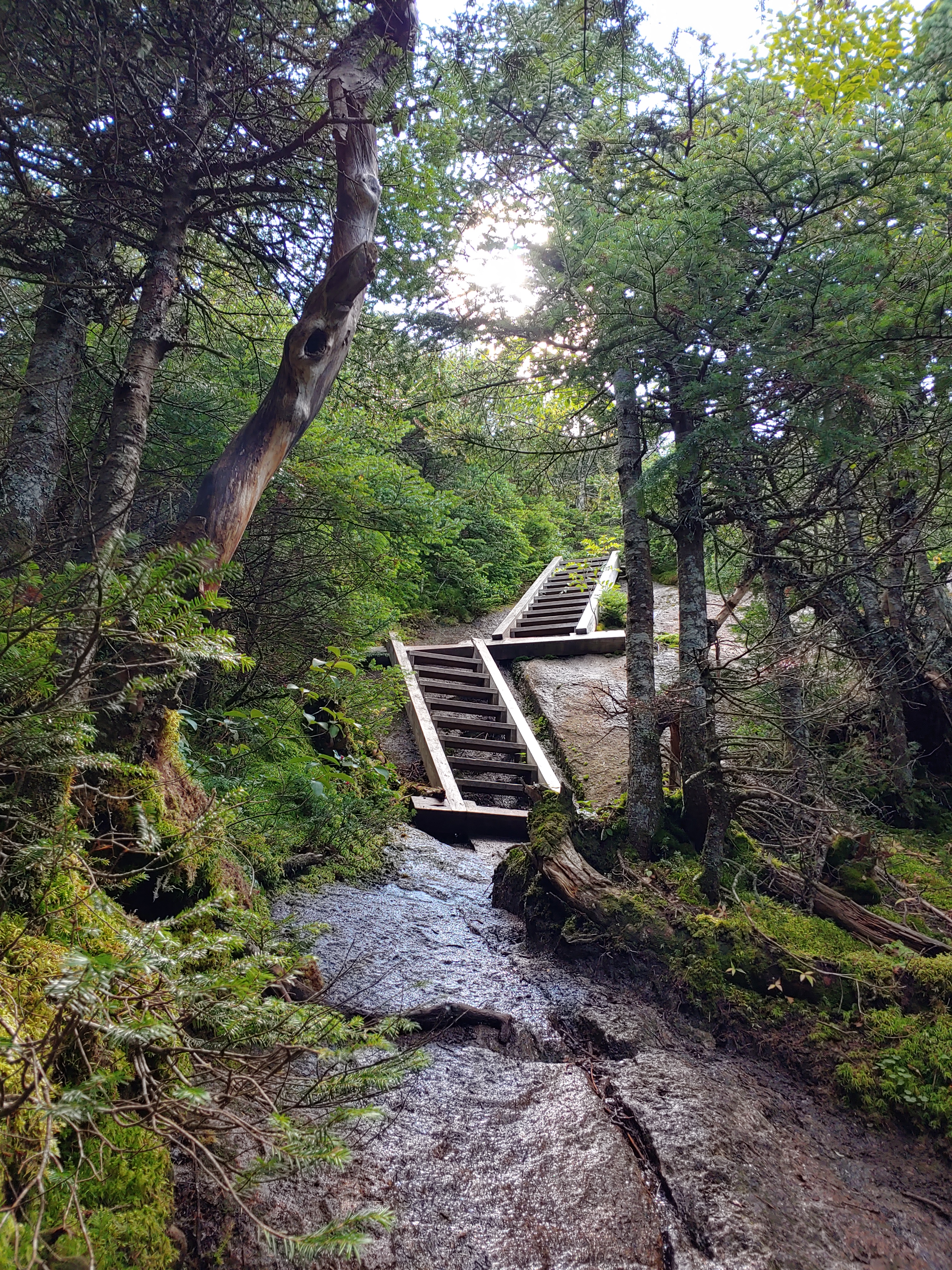


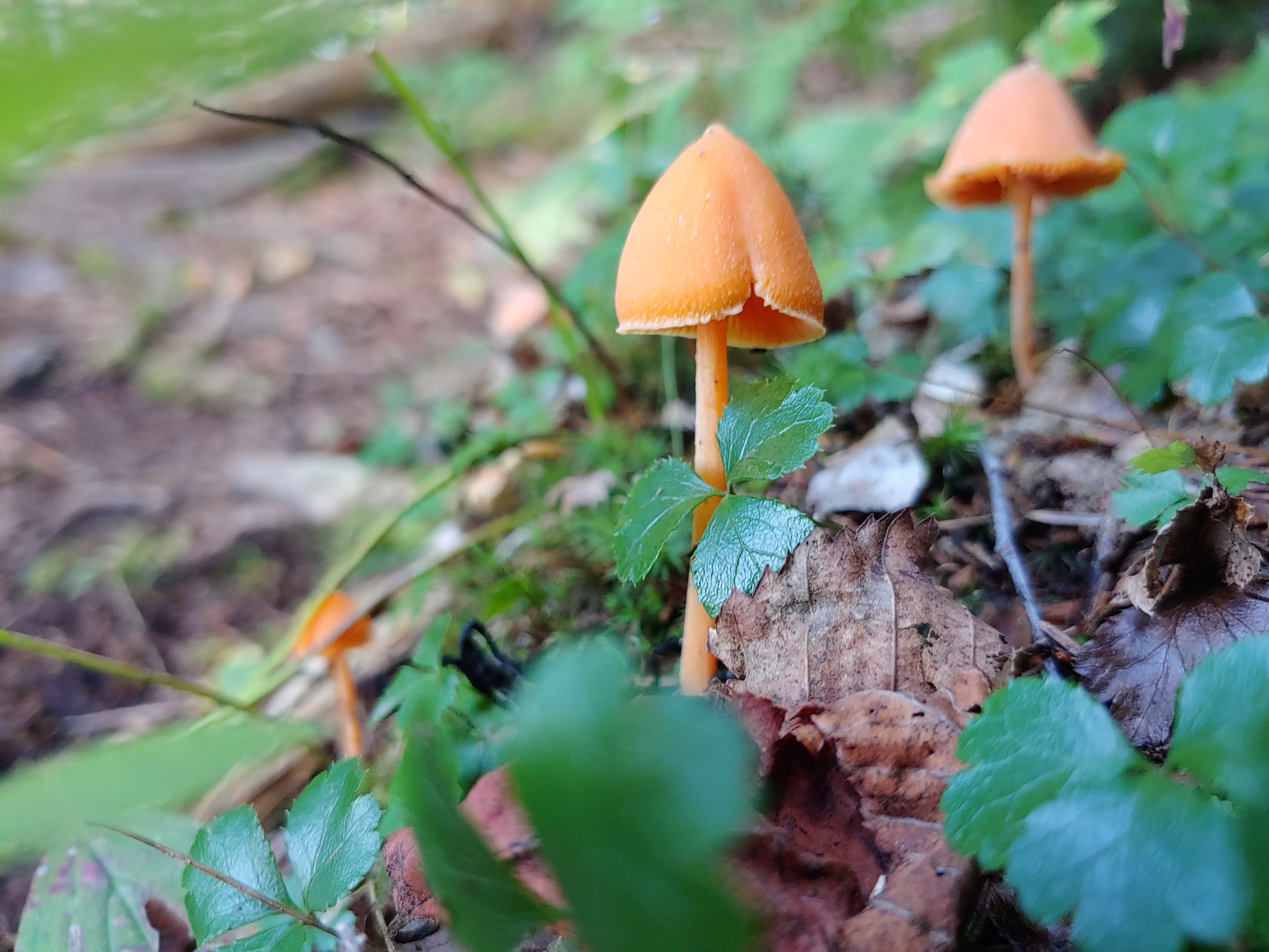

AT Week 2_Rangeley to Monson
Finding time to sit and write has been a challenge. This past week was filled with high mileage days broken up by town visits to gorge on calories. Because you know, “Treat Yourself!”
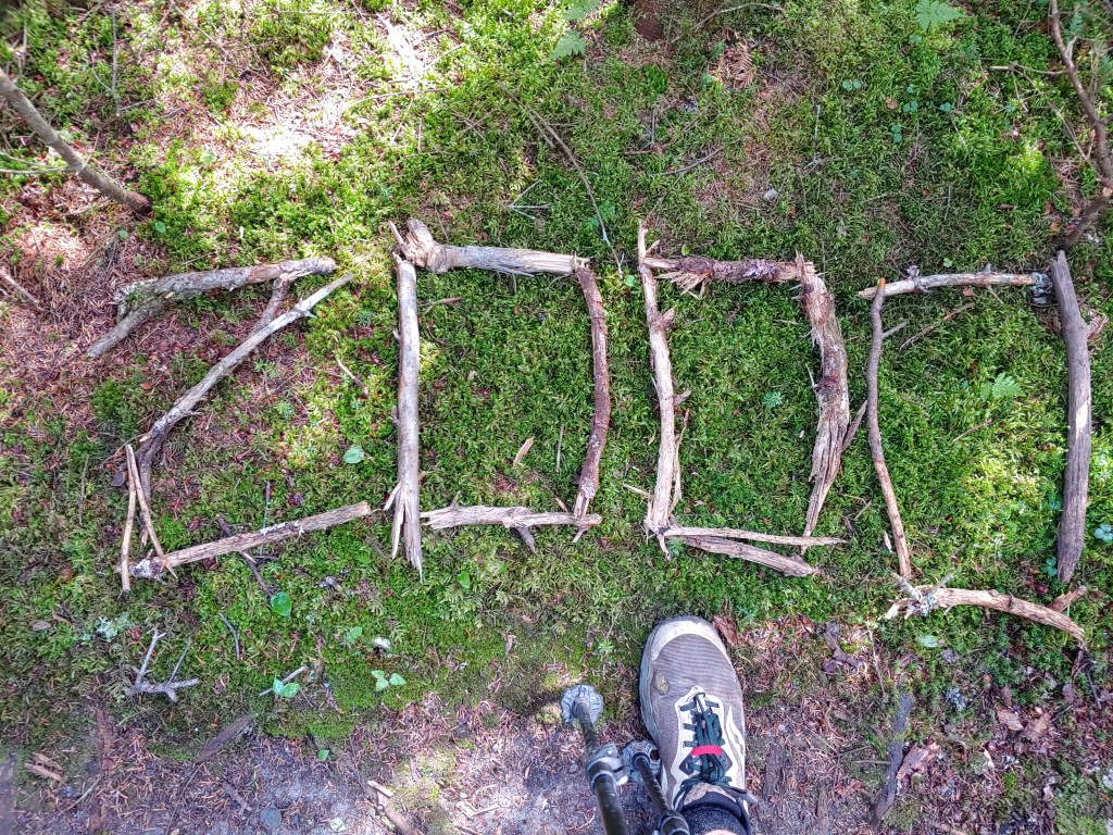
After my first week hiking through the 100 Mile Wilderness, I stepped on to the scale at Shaw’s Hiker Hostel in Monson and was shocked to see I had lost 12 pounds. That night I ate anything I could get my hands on to help replenish my body. Many how-to guides I read before this trip warned of men in particular losing large amounts of body weight when doing long distance thru hiking like the AT.
Until now my experience on trail is best described as a passionate day hiker. I was used to only having a protein shake and coffee in the morning during a drive to the trailhead, snacking lightly at the summit, and then stopping at the closest Mickey D’s on the return trip home as a reward for the days effort. But this routine hasn’t served me well on the trail.
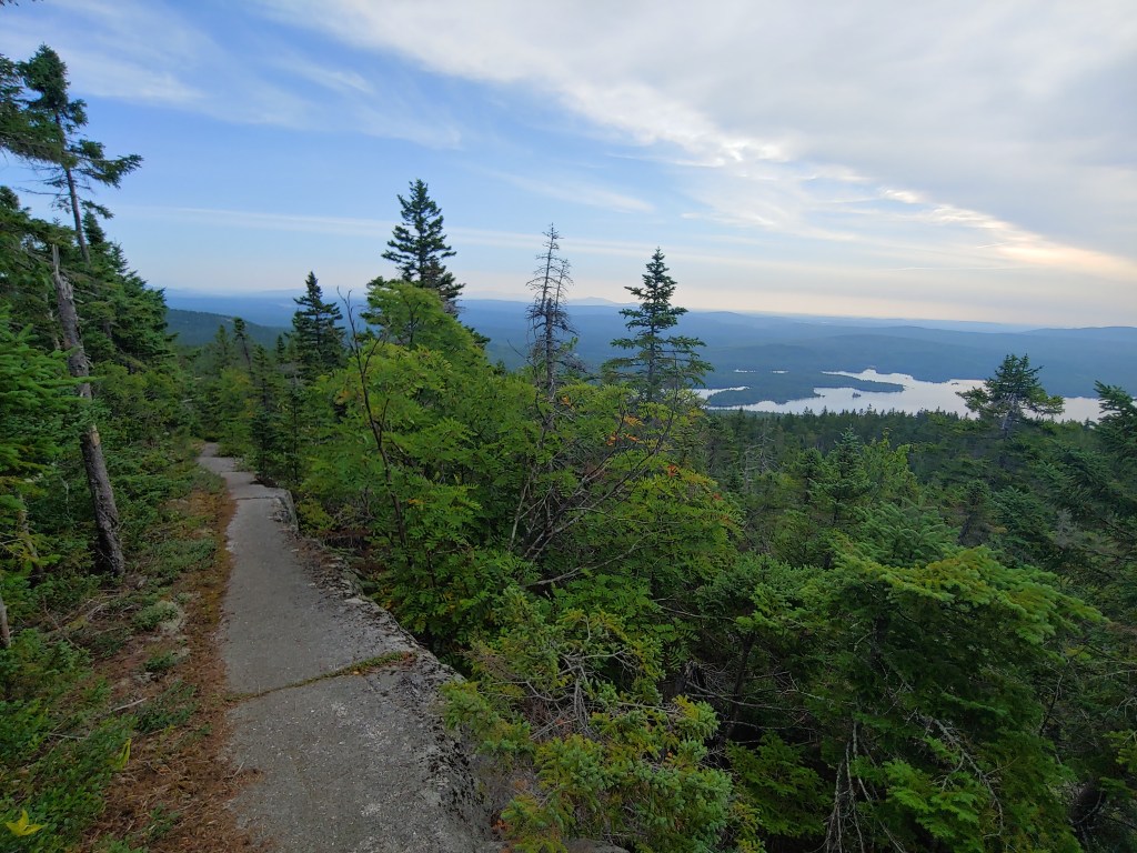
Like the cars we drive, each day I have to remember that I am a machine of sorts and require water to keep from overheating and also need fuel in the tank to reach the next destination. Lacking a dashboard filled with gauges and warning lights, I’m slowly becoming attuned to the signs of dehydration and the feeling of “zonk”. There were a few times after a long hot day to reach camp when, leaning over to setup my tent, I almost passed out due to low blood sugar and lack of water.
Establishing a new cycle of water and snack breaks has helped to increase my daily mileage and prevented nights rolling into camp completely wiped. With this new regimen, I hiked the roughly 110 miles from Monson to Rangeley in six days, spending two nights in hostels to reload on calories.

Caloric deficits and a supercharged metabolism are no match for mere pub food…trust me. My new “hiker hunger” was put to the test in Caratunk at the Kennebec River Pub where I ate a salad, an order of fried pickles, and a 2lb double bacon cheeseburger, and then had room for Ben and Jerry’s later at the inn. I slept like a baby that night.
With the New Hampshire border fast approaching, I am eager to enter the Granite State and bid farewell to my homeland of Maine. New skills in hand and a growing appetite for more, I keep on my course heading south to Georgia.